Schächentaler Windgällen
2,764 m9,068 ft
Mountain · Schwyzer Voralpen · Switzerland
The Schächentaler Windgällen is a mountain massif in the Schwyzer Alps, overlooking Unterschächen in the canton of Uri. The two named peaks are Höch Windgällen and Läged Windgällen. The mountain massif lies between the valley of Muotathal (north) and Schächental (south).
From Wikipedia, CC BY-SA · Read the article
At the summit · forecast for 7:00 PM
0 °CClear · wind 1 km/h from the NE
 See it in 3D
Weather at the summit of Schächentaler Windgällen, 2,764 m
- 7:00 PM0 °CNE 1 km/h–
- 10:00 PM-2 °CSE 2 km/h–
- 1:00 AM-3 °CE 3 km/h–
- 4:00 AM-4 °CSE 4 km/h0.1 mm
- 7:00 AM-2 °CNW 2 km/h0.2 mm
- 10:00 AM-2 °CNW 6 km/h0.6 mm
- 1:00 PM-2 °CNW 5 km/h0.1 mm
- 4:00 PM-2 °CNW 4 km/h–
| Day | Sky | High / low | Rain | Wind up to |
|---|---|---|---|---|
| Wed, Oct 28 | Light snow | -2 °C / -4 °C | 1 mm | 6 km/h |
| Thu, Oct 29 | Mostly clear | 2 °C / -7 °C | – | 8 km/h |
| Fri, Oct 30 | Mostly clear | 1 °C / -7 °C | – | 6 km/h |
| Sat, Oct 31 | Mostly clear | 2 °C / -8 °C | – | 4 km/h |
| Sun, Nov 1 | Mostly clear | 1 °C / -8 °C | – | 5 km/h |
| Mon, Nov 2 | Partly cloudy | -2 °C / -7 °C | – | 6 km/h |
| Tue, Nov 3 | Partly cloudy | -2 °C / -10 °C | – | 6 km/h |
Forecast by MET Norway (CC BY 4.0), updated 02:17 PM GMT+1. Times are local.
Facts
- What it is
- Mountain
- Height above sea level
- 2,764 m (9,068 ft)
- Prominence
- 691 m (2,267 ft)
- Range
- Schwyzer Voralpen
- Parent peak
- Glärnisch
- Country
- Switzerland
- Coordinates
- 46.888°N 8.792°E
- Source
- Wikidata, CC0
Schächentaler Windgällen
Mountain in Switzerland
The Schächentaler Windgällen is a mountain massif in the Schwyzer Alps, overlooking Unterschächen in the canton of Uri. The two named peaks are Höch Windgällen and Läged Windgällen. The mountain massif lies between the valley of Muotathal (north) and Schächental (south). The Schächentaler Windgällen are located a few kilometres west of Klausen Pass.
From Wikipedia, CC BY-SA · Read the article
Peaks near Schächentaler Windgällen
- Clariden3,267 m · 7.9 km awayOn the map
- Düssi3,256 m · 11 km awayOn the map
- Tödi3,612 m · 13 km awayOn the map
- Bifertenstock3,421 m · 16 km awayOn the map
- Oberalpstock3,328 m · 16 km awayOn the map
- Gross Spannort3,198 m · 23 km awayOn the map
- Rigi1,797 m · 30 km awayOn the map
- Titlis3,238 m · 30 km awayOn the map
- Piz Medel3,210 m · 31 km awayOn the map
- Bürgenstock1,128 m · 32 km awayOn the map
Parent peak
The nearest higher peak its prominence is measured to.
- Glärnisch2,915 mOn the map
Peaks below Schächentaler Windgällen
- Ortstock2,717 mOn the map
- Alpler Torstock2,622 mOn the map
- Chaiserstock2,515 mOn the map
- Alpler Horn2,380 mOn the map
- Wasserbergfirst2,341 mOn the map
Highest in the Schwyzer Voralpen
- Schächentaler Windgällen2,764 mOn the map
- Chaiserstock2,515 mOn the map
- Fulen2,491 mOn the map
- Wasserbergfirst2,341 mOn the map
- Mutteristock2,294 mOn the map
- Rautispitz2,283 mOn the map
- Druesberg2,282 mOn the map
- Piet1,965 mOn the map
- Chlingenstock1,935 mOn the map
Highest mountains in Switzerland
- Dufourspitze4,634 mOn the map
- Dom4,546 mOn the map
- Lyskamm4,532 mOn the map
- Weisshorn4,505 mOn the map
- Matterhorn4,478 mOn the map
- Dent Blanche4,357 mOn the map
- Grand Combin4,309 mOn the map
- Finsteraarhorn4,274 mOn the map
- Zinalrothorn4,221 mOn the map
- Alphubel4,206 mOn the map
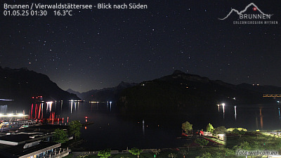
Webcams near Schächentaler Windgällen



History around Schächentaler Windgällen
Towns near Schächentaler Windgällen
- Schwyz18 km away
- Einsiedeln27 km away
- Rapperswil38 km away
- Zug38 km away
- Jona38 km away
- Baar40 km away