Schächentaler Windgällen
2764 m9068 ft
Montaña · Schwyzer Voralpen · Suiza
The Schächentaler Windgällen is a mountain massif in the Schwyzer Alps, overlooking Unterschächen in the canton of Uri. The two named peaks are Höch Windgällen and Läged Windgällen. The mountain massif lies between the valley of Muotathal (north) and Schächental (south).
De Wikipedia, CC BY-SA · Leer el artículo
En la cumbre · pronóstico para las 7:00
-3 °CNiebla · viento de 3 km/h del SE
 Verla en 3D
Clima en la cumbre de Schächentaler Windgällen, 2764 m
- 7:00-3 °CSE 3 km/h–
- 10:00-0 °CNO 5 km/h0,7 mm
- 13:00-1 °CNO 7 km/h0,5 mm
- 16:00-2 °CN 4 km/h–
- 19:00-3 °CN 4 km/h–
- 22:00-2 °CNE 4 km/h–
- 1:00-4 °CSE 4 km/h–
- 4:00-6 °CSE 4 km/h–
| Día | Cielo | Máx. / mín. | Lluvia | Viento hasta |
|---|---|---|---|---|
| Hoy | Nieve | -0 °C / -3 °C | 1,2 mm | 7 km/h |
| jue, 29 oct | Despejado | 2 °C / -7 °C | – | 8 km/h |
| vie, 30 oct | Mayormente despejado | 1 °C / -9 °C | – | 6 km/h |
| sáb, 31 oct | Mayormente despejado | 1 °C / -8 °C | – | 4 km/h |
| dom, 1 nov | Mayormente despejado | -1 °C / -8 °C | – | 6 km/h |
| lun, 2 nov | Nublado | -5 °C / -9 °C | 2 mm | 6 km/h |
| mar, 3 nov | Parcialmente nublado | -5 °C / -10 °C | 0,1 mm | 6 km/h |
Pronóstico de MET Norway (CC BY 4.0), actualizado a las 00:18 CET. Horas locales.
Ficha técnica
- Tipo
- Montaña
- Altitud sobre el nivel del mar
- 2764 m (9068 ft)
- Prominencia
- 691 m (2267 ft)
- Cordillera
- Schwyzer Voralpen
- Pico padre
- Glärnisch
- País
- Suiza
- Coordenadas
- 46.888°N 8.792°E
- Fuente
- Wikidata, CC0
Schächentaler Windgällen
Mountain in Switzerland
The Schächentaler Windgällen is a mountain massif in the Schwyzer Alps, overlooking Unterschächen in the canton of Uri. The two named peaks are Höch Windgällen and Läged Windgällen. The mountain massif lies between the valley of Muotathal (north) and Schächental (south). The Schächentaler Windgällen are located a few kilometres west of Klausen Pass.
De Wikipedia, CC BY-SA · Leer el artículo
Picos cerca de Schächentaler Windgällen
- Clariden3267 m · a 7,9 kmEn el mapa
- Düssi3256 m · a 11 kmEn el mapa
- Tödi3612 m · a 13 kmEn el mapa
- Bifertenstock3421 m · a 16 kmEn el mapa
- Oberalpstock3328 m · a 16 kmEn el mapa
- Gross Spannort3198 m · a 23 kmEn el mapa
- Rigi1797 m · a 30 kmEn el mapa
- Titlis3238 m · a 30 kmEn el mapa
- Piz Medel3210 m · a 31 kmEn el mapa
- Bürgenstock1128 m · a 32 kmEn el mapa
Pico padre
El pico más alto más cercano respecto al que se mide su prominencia.
- Glärnisch2915 mEn el mapa
Picos por debajo de Schächentaler Windgällen
- Ortstock2717 mEn el mapa
- Alpler Torstock2622 mEn el mapa
- Chaiserstock2515 mEn el mapa
- Alpler Horn2380 mEn el mapa
- Wasserbergfirst2341 mEn el mapa
Los más altos de Schwyzer Voralpen
- Schächentaler Windgällen2764 mEn el mapa
- Chaiserstock2515 mEn el mapa
- Fulen2491 mEn el mapa
- Wasserbergfirst2341 mEn el mapa
- Mutteristock2294 mEn el mapa
- Rautispitz2283 mEn el mapa
- Druesberg2282 mEn el mapa
- Piet1965 mEn el mapa
- Chlingenstock1935 mEn el mapa
Montañas más altas de Suiza
- Pico Dufour4634 mEn el mapa
- Dom4546 mEn el mapa
- Liskamm4532 mEn el mapa
- Weisshorn4505 mEn el mapa
- Cervino4478 mEn el mapa
- Dent Blanche4357 mEn el mapa
- Grand Combin4309 mEn el mapa
- Finsteraarhorn4274 mEn el mapa
- Zinalrothorn4221 mEn el mapa
- Alphubel4206 mEn el mapa
Cámaras web cerca de Schächentaler Windgällen


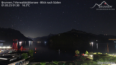

Historia alrededor de Schächentaler Windgällen
Ciudades cerca de Schächentaler Windgällen
- Schwyza 18 km
- Einsiedelna 27 km
- Rapperswila 38 km
- Zuga 38 km
- Jonaa 38 km
- Baara 40 km