Schächentaler Windgällen
2.764 m9.068 pés
Montanha · Pré-Alpes de Schwyz e de Uri · Suíça
The Schächentaler Windgällen is a mountain massif in the Schwyzer Alps, overlooking Unterschächen in the canton of Uri. The two named peaks are Höch Windgällen and Läged Windgällen. The mountain massif lies between the valley of Muotathal (north) and Schächental (south).
Da Wikipedia, CC BY-SA · Ler o artigo
No cume · previsão para 21:00
-1 °CCéu limpo · vento de 2 km/h de SE
 Ver em 3D
Clima no cume de Schächentaler Windgällen, 2.764 m
- 21:00-1 °CSE 2 km/h–
- 0:00-2 °CL 2 km/h–
- 3:00-4 °CSE 3 km/h0,1 mm
- 6:00-3 °CSE 2 km/h–
- 9:00-2 °CNO 4 km/h0,6 mm
- 12:00-2 °CNO 6 km/h0,3 mm
- 15:00-2 °CNO 4 km/h–
- 18:00-3 °CN 4 km/h–
| Dia | Céu | Máx. / mín. | Chuva | Vento até |
|---|---|---|---|---|
| qua., 28 de out. | Neve fraca | -2 °C / -4 °C | 1 mm | 6 km/h |
| qui., 29 de out. | Poucas nuvens | 2 °C / -7 °C | – | 8 km/h |
| sex., 30 de out. | Poucas nuvens | 1 °C / -7 °C | – | 6 km/h |
| sáb., 31 de out. | Poucas nuvens | 2 °C / -8 °C | – | 4 km/h |
| dom., 1 de nov. | Poucas nuvens | 1 °C / -8 °C | – | 5 km/h |
| seg., 2 de nov. | Parcialmente nublado | -2 °C / -7 °C | – | 6 km/h |
| ter., 3 de nov. | Parcialmente nublado | -2 °C / -10 °C | – | 6 km/h |
Previsão: MET Norway (CC BY 4.0), atualizada às 14:17 GMT+1. Horários locais.
Ficha técnica
- Tipo
- Montanha
- Altitude acima do nível do mar
- 2.764 m (9.068 pés)
- Proeminência
- 691 m (2.267 pés)
- Cordilheira
- Pré-Alpes de Schwyz e de Uri
- Pico pai
- Glärnisch
- País
- Suíça
- Coordenadas
- 46.888°N 8.792°E
- Fonte
- Wikidata, CC0
Schächentaler Windgällen
Mountain in Switzerland
The Schächentaler Windgällen is a mountain massif in the Schwyzer Alps, overlooking Unterschächen in the canton of Uri. The two named peaks are Höch Windgällen and Läged Windgällen. The mountain massif lies between the valley of Muotathal (north) and Schächental (south). The Schächentaler Windgällen are located a few kilometres west of Klausen Pass.
Da Wikipedia, CC BY-SA · Ler o artigo
Picos perto de Schächentaler Windgällen
- Clariden3.267 m · a 7,9 kmNo mapa
- Düssi3.256 m · a 11 kmNo mapa
- Tödi3.612 m · a 13 kmNo mapa
- Bifertenstock3.421 m · a 16 kmNo mapa
- Oberalpstock3.328 m · a 16 kmNo mapa
- Gross Spannort3.198 m · a 23 kmNo mapa
- Rigi1.797 m · a 30 kmNo mapa
- Monte Titlis3.238 m · a 30 kmNo mapa
- Piz Medel3.210 m · a 31 kmNo mapa
- Bürgenstock1.128 m · a 32 kmNo mapa
Pico pai
Picos abaixo de Schächentaler Windgällen
- Ortstock2.717 mNo mapa
- Alpler Torstock2.622 mNo mapa
- Chaiserstock2.515 mNo mapa
- Alpler Horn2.380 mNo mapa
- Wasserbergfirst2.341 mNo mapa
Os mais altos de Pré-Alpes de Schwyz e de Uri
- Schächentaler Windgällen2.764 mNo mapa
- Chaiserstock2.515 mNo mapa
- Fulen2.491 mNo mapa
- Wasserbergfirst2.341 mNo mapa
- Mutteristock2.294 mNo mapa
- Rautispitz2.283 mNo mapa
- Druesberg2.282 mNo mapa
- Piet1.965 mNo mapa
- Chlingenstock1.935 mNo mapa
Montanhas mais altas de Suíça
- Pico Dufour4.634 mNo mapa
- Dom de Mischabel4.546 mNo mapa
- Liskamm4.532 mNo mapa
- Weisshorn4.505 mNo mapa
- Matterhorn4.478 mNo mapa
- Dente Branco4.357 mNo mapa
- Grand Combin4.309 mNo mapa
- Finsteraarhorn4.274 mNo mapa
- Zinalrothorn4.221 mNo mapa
- Alphubel4.206 mNo mapa
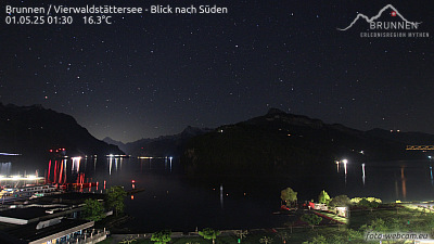
Webcams perto de Schächentaler Windgällen



História ao redor de Schächentaler Windgällen
Cidades perto de Schächentaler Windgällen
- Schwyza 18 km
- Einsiedelna 27 km
- Rapperswila 38 km
- Zuga 38 km
- Jonaa 38 km
- Baara 40 km