Mount Horrible
Montagne · États-Unis
Mount Horrible is a summit of the Blue Mountains in Asotin County, Washington, in the United States. With an elevation of 5,804 feet (1,769 m), Mount Horrible is the 906th highest summit in the state of Washington.
Source : Wikipedia, CC BY-SA · Lire l’article
Au sommet · prévision pour 21:00
31 °FPartiellement nuageux · vent 11 mph du SO
Prévisions météo à Mount Horrible
- 21:0031 °FSO 11 mph–
- 0:0031 °FS 8 mph0,01 po
- 3:0029 °FSO 12 mph–
- 6:0028 °FSO 10 mph0,01 po
- 9:0031 °FSO 10 mph0,07 po
- 12:0033 °FS 9 mph0,06 po
- 15:0034 °FSO 8 mph0,05 po
- 18:0030 °FSO 6 mph0,1 po
| Jour | Ciel | Max. / min. | Pluie | Vent jusqu’à |
|---|---|---|---|---|
| mer. 28 oct. | Pluie | 36 °F / 26 °F | 0,29 po | 12 mph |
| jeu. 29 oct. | Partiellement nuageux | 42 °F / 25 °F | 0,04 po | 6 mph |
| ven. 30 oct. | Nuageux | 43 °F / 31 °F | 0,02 po | 6 mph |
| sam. 31 oct. | Nuageux | 40 °F / 30 °F | 0,08 po | 2 mph |
| dim. 1 nov. | Dégagé | 37 °F / 26 °F | 0,01 po | 5 mph |
| lun. 2 nov. | Nuageux | 41 °F / 27 °F | – | 2 mph |
| mar. 3 nov. | Plutôt dégagé | 46 °F / 35 °F | – | 4 mph |
Prévisions de MET Norway (CC BY 4.0), mises à jour à 18:17 UTC−7. Heures locales.
Fiche technique
- Type
- Montagne
- Pays
- États-Unis
- Coordonnées
- 46.100°N 117.448°W
- Source
- Wikidata, CC0
Mount Horrible
Mountain in Washington (state), United States
Mount Horrible is a summit of the Blue Mountains in Asotin County, Washington, in the United States. With an elevation of 5,804 feet (1,769 m), Mount Horrible is the 906th highest summit in the state of Washington. Along with neighboring Mount Misery, it was named by 19th century pioneers for the difficult conditions they experienced on the Grouse Flat.
Source : Wikipedia, CC BY-SA · Lire l’article
Sommets près de Mount Horrible
- Milk ShakesMontagne · à 37 kmSur la carte
Plus hautes montagnes : États-Unis
- Denali20 308 ftSur la carte
- mont Saint-Élie18 009 ftSur la carte
- mont Foraker17 402 ftSur la carte
- mont Bona16 535 ftSur la carte
- mont Blackburn16 390 ftSur la carte
- mont Sanford16 237 ftSur la carte
- mont Vancouver15 787 ftSur la carte
- mont Churchill15 636 ftSur la carte
- mont Fairweather15 325 ftSur la carte
- mont Hubbard14 951 ftSur la carte
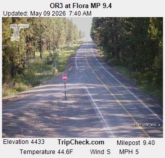
Webcams près de Mount Horrible
Histoire autour de Mount Horrible
- Lick Creek Fire2021
Villes près de Mount Horrible
- Lewiston Orchardsà 48 km
- Lewistonà 48 km
- Walla Wallaà 69 km
- College Placeà 73 km
- Pullmanà 73 km
- Moscowà 78 km