Te Ahumairangi Hill
Colline · Nouvelle-Zélande
Te Ahumairangi Hill is a hill running for over 100 hectares through the Town Belt of Wellington, New Zealand. It was renamed Te Ahumairangi Hill as part of the Port Nicholson Block Claims Settlement Act 2009. The suburb of Wadestown lies to the north, with Wilton, and Northland to the west and south-west.
Source : Wikipedia, CC BY-SA · Lire l’article
Au sommet · prévision pour 4:00
12 °CPlutôt dégagé · vent 52 km/h du NO
 Voir en 3D
Prévisions météo à Te Ahumairangi Hill
- 4:0012 °CNO 52 km/h–
- 7:0013 °CNO 53 km/h–
- 10:0015 °CNO 52 km/h0,5 mm
- 13:0014 °CNO 46 km/h–
- 16:0015 °CNO 46 km/h–
- 19:0013 °CO 36 km/h–
- 22:0012 °CNO 44 km/h–
- 1:0010 °CNO 37 km/h–
| Jour | Ciel | Max. / min. | Pluie | Vent jusqu’à |
|---|---|---|---|---|
| Aujourd’hui | Nuageux | 16 °C / 11 °C | 0,5 mm | 59 km/h |
| ven. 30 oct. | Pluie | 15 °C / 10 °C | 2 mm | 51 km/h |
| sam. 31 oct. | Dégagé | 13 °C / 8 °C | 0,4 mm | 44 km/h |
| dim. 1 nov. | Partiellement nuageux | 14 °C / 11 °C | – | 41 km/h |
| lun. 2 nov. | Partiellement nuageux | 16 °C / 13 °C | 2 mm | 41 km/h |
| mar. 3 nov. | Nuageux | 16 °C / 14 °C | 1 mm | 33 km/h |
| mer. 4 nov. | Partiellement nuageux | 18 °C / 14 °C | – | 20 km/h |
Prévisions de MET Norway (CC BY 4.0), mises à jour à 02:17 UTC+13. Heures locales.
Fiche technique
- Type
- Colline
- Pays
- Nouvelle-Zélande
- Coordonnées
- 41.267°S 174.770°E
- Source
- Wikidata, CC0
Te Ahumairangi Hill
Hill located in Wellington, New Zealand
Te Ahumairangi Hill is a hill running for over 100 hectares through the Town Belt of Wellington, New Zealand. It was renamed Te Ahumairangi Hill as part of the Port Nicholson Block Claims Settlement Act 2009. The suburb of Wadestown lies to the north, with Wilton, and Northland to the west and south-west. Te Ahumairangi lies within Thorndon which continues to its south-east.
Source : Wikipedia, CC BY-SA · Lire l’article
Sommets près de Te Ahumairangi Hill
- Mont Victoria (Wellington)196 m · à 3,9 kmSur la carte
- Mount Kaukau445 m · à 4 kmSur la carte
- Rangituhi / Colonial Knob459 m · à 13 kmSur la carte
- Mount Matthews941 m · à 22 kmSur la carte
- Mount Hector1 529 m · à 55 kmSur la carte
- Mount CrawfordColline · à 5,7 kmSur la carte
- mont Stokes1 203 m · à 59 kmSur la carte
Plus hautes montagnes : Nouvelle-Zélande
- Aoraki/Mont Cook3 724 mSur la carte
- mont Tasman3 497 mSur la carte
- Malte-Brun3 199 mSur la carte
- Mount Sefton3 151 mSur la carte
- Mount Elie De Beaumont3 109 mSur la carte
- La Perouse3 078 mSur la carte
- Douglas Peak3 077 mSur la carte
- The Minarets3 040 mSur la carte
- mont Aspiring3 033 mSur la carte
- Mount Hamilton3 025 mSur la carte
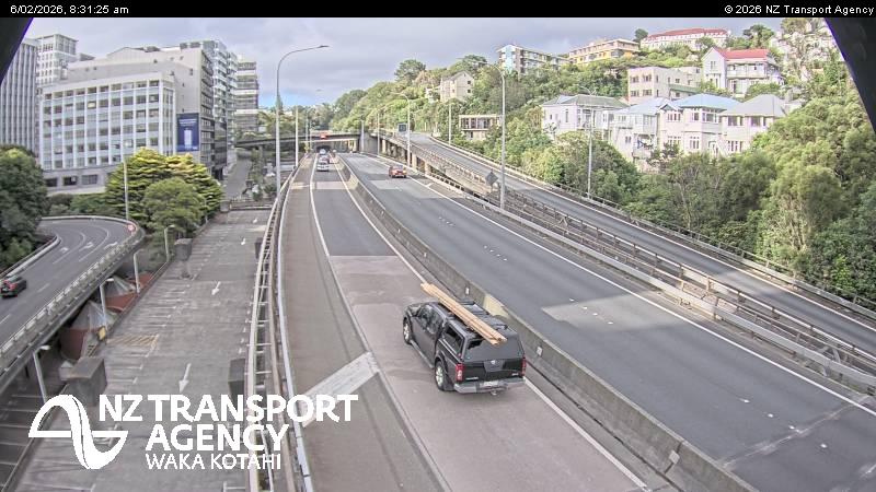
Webcams près de Te Ahumairangi Hill



Histoire autour de Te Ahumairangi Hill
- Trans-Pacific Partnership2016
- Battle of Huamachuco1883
- Earthquake — New Zealand: Wellington,Waiouru,Wanganui,Otaki1855
- Battle of Manners Street1943
- Protests in Wellington start outside Parliament, and develop into an "occupation", which lasts until 2 March when police moved in2022
- Wellington Convention1989
- The New Zealand Industrial Exhibition opens in Wellington1885
Villes près de Te Ahumairangi Hill
- Wellingtonà 2,2 km
- Karorià 3 km
- Lower Huttà 13 km
- Wainuiomataà 15 km
- Poriruaà 16 km
- Upper Huttà 27 km