Gundkopf
2,062 m6,765 ft
山 · Allgäu Alps · ドイツ
Gundkopf is a mountain in Bavaria, Germany. Located 2,063 m (6,768 ft) above sea level, Gundkopf is a subsidiary peak of the Western Wengenkopf in the mountain range that extends from the Nebelhorn to the Rubihorn.
出典: Wikipedia、CC BY-SA · 記事を読む
山頂 · 20:00 の予報
4 °C晴れ · 南の風 4 km/h
 3D で見る
Gundkopf 山頂の天気(2,062 m)
- 20:004 °C南 4 km/h–
- 23:001 °C南 7 km/h–
- 2:001 °C南 6 km/h–
- 5:00-0 °C南 6 km/h–
- 8:002 °C南 5 km/h–
- 11:004 °C北西 8 km/h1.5 mm
- 14:001 °C北西 6 km/h0.1 mm
- 17:001 °C北西 4 km/h–
| 日付 | 天気 | 最高 / 最低 | 雨 | 最大風速 |
|---|---|---|---|---|
| 10月28日(水) | みぞれ | 4 °C / -0 °C | 1.6 mm | 9 km/h |
| 10月29日(木) | 快晴 | 6 °C / -5 °C | – | 9 km/h |
| 10月30日(金) | 快晴 | 6 °C / -6 °C | – | 7 km/h |
| 10月31日(土) | 快晴 | 6 °C / -5 °C | – | 6 km/h |
| 11月1日(日) | 快晴 | 4 °C / -5 °C | – | 6 km/h |
| 11月2日(月) | 快晴 | 1 °C / -5 °C | – | 6 km/h |
| 11月3日(火) | 晴れ時々曇り | 0 °C / -7 °C | 2.3 mm | 6 km/h |
MET Norway(CC BY 4.0)による予報。18:17 GMT+1 更新。時刻は現地時間です。
基本データ
Gundkopf
Mountain in Bavaria, Germany
Gundkopf is a mountain in Bavaria, Germany. Located 2,063 m (6,768 ft) above sea level, Gundkopf is a subsidiary peak of the Western Wengenkopf in the mountain range that extends from the Nebelhorn to the Rubihorn. The mountain is located 7.1 km (4.4 mi) from the Germany-Austria border and 4.1 km (2.5 mi) east of the town of Oberstdorf.
出典: Wikipedia、CC BY-SA · 記事を読む
Gundkopf周辺の山
- Nebelhorn2,224 m · 0.8 km先地図上
- Großer Daumen2,280 m · 4 km先地図上
- Schneck2,268 m · 5.3 km先地図上
- Glasfelderkopf2,270 m · 7.6 km先地図上
- Hochvogel2,592 m · 8.9 km先地図上
- Schänzlekopf2,070 m · 9 km先地図上
- Schänzlespitz2,052 m · 9.3 km先地図上
- Lahnerkopf2,121 m · 9.8 km先地図上
- Kugelhorn2,125 m · 11 km先地図上
- Rauhhorn2,241 m · 11 km先地図上
親ピーク
Gundkopfの下位の山
Allgäu Alpsの最高峰
- Krottenkopf2,656 m地図上
- Hohes Licht2,651 m地図上
- Biberkopf2,599 m地図上
- Hochvogel2,592 m地図上
- Widderstein2,533 m地図上
- Gundkopf2,062 m地図上
ドイツの高い山
- ツークシュピッツェ2,962 m地図上
- Hochwanner2,744 m地図上
- Dreitorspitze2,682 m地図上
- ホッホカルター2,607 m地図上
- Biberkopf2,599 m地図上
- Großer Hundstod2,594 m地図上
- Hochvogel2,592 m地図上
- Östliche Karwendelspitze2,538 m地図上
- Hocheisspitze2,523 m地図上
- Hoher Göll2,522 m地図上
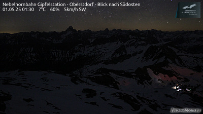
Gundkopf周辺のライブカメラ



Gundkopf周辺の町
- Sonthofen12 km先
- Füssen32 km先
- Kempten (Allgäu)34 km先
- Dornbirn44 km先
- Bregenz45 km先
- Marktoberdorf45 km先