Gundkopf
2062 m6765 ft
Montaña · Alpes de Allgäu · Alemania
Gundkopf is a mountain in Bavaria, Germany. Located 2,063 m (6,768 ft) above sea level, Gundkopf is a subsidiary peak of the Western Wengenkopf in the mountain range that extends from the Nebelhorn to the Rubihorn.
De Wikipedia, CC BY-SA · Leer el artículo
En la cumbre · pronóstico para las 21:00
3 °CParcialmente nublado · viento de 5 km/h del S
 Verla en 3D
Clima en la cumbre de Gundkopf, 2062 m
- 21:003 °CS 5 km/h–
- 0:001 °CS 7 km/h–
- 3:001 °CS 5 km/h–
- 6:000 °CS 6 km/h–
- 9:004 °CO 6 km/h0,6 mm
- 12:003 °CNO 9 km/h1 mm
- 15:001 °CNO 5 km/h–
- 18:000 °CN 4 km/h–
| Día | Cielo | Máx. / mín. | Lluvia | Viento hasta |
|---|---|---|---|---|
| mié, 28 oct | Aguanieve | 4 °C / -0 °C | 1,6 mm | 9 km/h |
| jue, 29 oct | Despejado | 6 °C / -5 °C | – | 9 km/h |
| vie, 30 oct | Despejado | 6 °C / -6 °C | – | 7 km/h |
| sáb, 31 oct | Despejado | 6 °C / -5 °C | – | 6 km/h |
| dom, 1 nov | Despejado | 4 °C / -5 °C | – | 6 km/h |
| lun, 2 nov | Despejado | 1 °C / -5 °C | – | 6 km/h |
| mar, 3 nov | Parcialmente nublado | 0 °C / -7 °C | 2,3 mm | 6 km/h |
Pronóstico de MET Norway (CC BY 4.0), actualizado a las 18:17 CET. Horas locales.
Ficha técnica
- Tipo
- Montaña
- Altitud sobre el nivel del mar
- 2062 m (6765 ft)
- Prominencia
- 24 m (79 ft)
- Aislamiento
- a 0,2 km de un terreno más alto
- Cordillera
- Alpes de Allgäu
- Pico padre
- Nebelhorn
- País
- Alemania
- Coordenadas
- 47.419°N 10.333°E
- Fuente
- Wikidata, CC0
Gundkopf
Mountain in Bavaria, Germany
Gundkopf is a mountain in Bavaria, Germany. Located 2,063 m (6,768 ft) above sea level, Gundkopf is a subsidiary peak of the Western Wengenkopf in the mountain range that extends from the Nebelhorn to the Rubihorn. The mountain is located 7.1 km (4.4 mi) from the Germany-Austria border and 4.1 km (2.5 mi) east of the town of Oberstdorf.
De Wikipedia, CC BY-SA · Leer el artículo
Picos cerca de Gundkopf
- Nebelhorn2224 m · a 0,8 kmEn el mapa
- Großer Daumen2280 m · a 4 kmEn el mapa
- Schneck (montaña)2268 m · a 5,3 kmEn el mapa
- Glasfelderkopf2270 m · a 7,6 kmEn el mapa
- Hochvogel2592 m · a 8,9 kmEn el mapa
- Schänzlekopf2070 m · a 9 kmEn el mapa
- Schänzlespitz2052 m · a 9,3 kmEn el mapa
- Lahnerkopf2121 m · a 9,8 kmEn el mapa
- Kugelhorn2125 m · a 11 kmEn el mapa
- Rauhhorn2241 m · a 11 kmEn el mapa
Pico padre
El pico más alto más cercano respecto al que se mide su prominencia.
- Nebelhorn2224 mEn el mapa
Picos por debajo de Gundkopf
- Geißfuß1981 mEn el mapa
Los más altos de Alpes de Allgäu
- Großer Krottenkopf2656 mEn el mapa
- Hohes Licht2651 mEn el mapa
- Biberkopf2599 mEn el mapa
- Hochvogel2592 mEn el mapa
- Widderstein2533 mEn el mapa
- Gundkopf2062 mEn el mapa
Montañas más altas de Alemania
- Zugspitze2962 mEn el mapa
- Hochwanner2744 mEn el mapa
- Dreitorspitze2682 mEn el mapa
- Hochkalter2607 mEn el mapa
- Biberkopf2599 mEn el mapa
- Großer Hundstod2594 mEn el mapa
- Hochvogel2592 mEn el mapa
- Östliche Karwendelspitze2538 mEn el mapa
- Hocheisspitze2523 mEn el mapa
- Hoher Göll2522 mEn el mapa
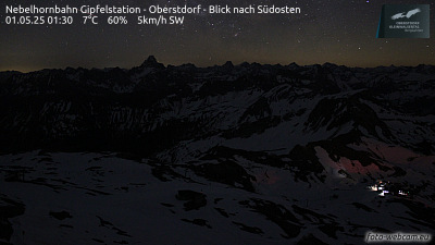
Cámaras web cerca de Gundkopf



Ciudades cerca de Gundkopf
- Sonthofena 12 km
- Füssena 32 km
- Kempten (Allgäu)a 34 km
- Dornbirna 44 km
- Bregenza 45 km
- Marktoberdorfa 45 km