Mountains in Germany
Benediktenwand
1,801 m5,909 ft
Mountain · Eastern Wallgau Alps · Germany
The Benediktenwand is a 1,800-metre-high (5,900 ft) mountain ridge in the Bavarian Prealps between the rivers Loisach and Isar and the Jachenau in the south and Benediktbeuern Abbey, from which it derives its name, in the north. Immediately below the North Face of the Benediktenwand is the Tutzinger Hut.
From Wikipedia, CC BY-SA · Read the article
The highest point of Eastern Wallgau Alps
At the summit · forecast for 4:00 PM
9 °CClear · wind 8 km/h from the NE
 See it in 3D
Weather at the summit of Benediktenwand, 1,801 m
- 4:00 PM9 °CNE 8 km/h–
- 7:00 PM4 °CS 3 km/h–
- 10:00 PM3 °CS 8 km/h–
- 1:00 AM3 °CS 6 km/h–
- 4:00 AM1 °CSW 9 km/h–
- 7:00 AM1 °CS 7 km/h2.1 mm
- 10:00 AM4 °CSW 10 km/h4.3 mm
- 1:00 PM3 °CNW 14 km/h3.9 mm
| Day | Sky | High / low | Rain | Wind up to |
|---|---|---|---|---|
| Wed, Oct 28 | Heavy rain | 4 °C / 1 °C | 11.9 mm | 14 km/h |
| Thu, Oct 29 | Mostly clear | 5 °C / -3 °C | – | 16 km/h |
| Fri, Oct 30 | Clear | 4 °C / -3 °C | – | 9 km/h |
| Sat, Oct 31 | Mostly clear | 3 °C / -6 °C | – | 8 km/h |
| Sun, Nov 1 | Mostly clear | 2 °C / -6 °C | – | 8 km/h |
| Mon, Nov 2 | Partly cloudy | 1 °C / -5 °C | 2 mm | 5 km/h |
| Tue, Nov 3 | Light snow | 0 °C / -4 °C | 4.3 mm | 12 km/h |
Forecast by MET Norway (CC BY 4.0), updated 02:17 PM GMT+1. Times are local.
Facts
- What it is
- Mountain
- Height above sea level
- 1,801 m (5,909 ft)
- Prominence
- 943 m (3,094 ft)
- Isolation
- 14 km to higher ground
- Range
- Eastern Wallgau Alps
- Country
- Germany
- Highest point of
- Eastern Wallgau Alps
- Coordinates
- 47.653°N 11.466°E
- Source
- Wikidata, CC0
Peaks near Benediktenwand
- Jochberg1,565 m · 7.7 km awayOn the map
- Herzogstand1,731 m · 13 km awayOn the map
- Osterseen591 m · 19 km awayOn the map
- Mondscheinspitze2,106 m · 24 km awayOn the map
- Krottenkopf2,086 m · 24 km awayOn the map
- Wörner2,474 m · 25 km awayOn the map
- Wallberg1,722 m · 25 km awayOn the map
- Birkkarspitze2,749 m · 27 km awayOn the map
- Kaltwasserkarspitze2,733 m · 28 km awayOn the map
- Sonnjoch2,457 m · 29 km awayOn the map
Highest in the Eastern Wallgau Alps
- Benediktenwand1,801 mOn the map
- Brauneck1,555 mOn the map
- Hoher Zwiesler1,376 mOn the map
Highest mountains in Germany
- Zugspitze2,962 mOn the map
- Hochwanner2,744 mOn the map
- Dreitorspitze2,682 mOn the map
- Hochkalter2,607 mOn the map
- Biberkopf2,599 mOn the map
- Großer Hundstod2,594 mOn the map
- Hochvogel2,592 mOn the map
- Östliche Karwendelspitze2,538 mOn the map
- Hocheisspitze2,523 mOn the map
- Hoher Göll2,522 mOn the map
Webcams near Benediktenwand


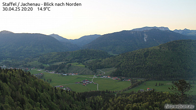
History around Benediktenwand
Towns near Benediktenwand
- Penzberg13 km away
- Bad Tölz14 km away
- Geretsried23 km away
- Wolfratshausen29 km away
- Holzkirchen30 km away
- Weilheim31 km away