Mountains in Switzerland
Cima dei Cogn
3,063 m10,049 ft
Mountain · Adula Group · Switzerland
Cima dei Cogn is a mountain in the Lepontine Alps, located on the border between the cantons of Ticino and Graubünden. It lies south of the higher Cima Rossa.
From Wikipedia, CC BY-SA · Read the article
At the summit · forecast for 12:00 AM
-3 °CPartly cloudy · wind 5 km/h from the NE
 See it in 3D
Weather at the summit of Cima dei Cogn, 3,063 m
- 12:00 AM-3 °CNE 5 km/h–
- 3:00 AM-5 °CNE 6 km/h–
- 6:00 AM-4 °CN 7 km/h–
- 9:00 AM-0 °CN 8 km/h–
- 12:00 PM3 °CN 8 km/h–
- 3:00 PM3 °CN 10 km/h–
- 6:00 PM-3 °CN 6 km/h–
- 9:00 PM-5 °CN 8 km/h–
| Day | Sky | High / low | Rain | Wind up to |
|---|---|---|---|---|
| Today | Clear | 3 °C / -5 °C | – | 10 km/h |
| Thu, Oct 29 | Clear | 2 °C / -10 °C | – | 6 km/h |
| Fri, Oct 30 | Partly cloudy | -1 °C / -8 °C | – | 6 km/h |
| Sat, Oct 31 | Mostly clear | -0 °C / -9 °C | – | 5 km/h |
| Sun, Nov 1 | Clear | 3 °C / -8 °C | – | 4 km/h |
| Mon, Nov 2 | Clear | 1 °C / -8 °C | – | 9 km/h |
| Tue, Nov 3 | Partly cloudy | -0 °C / -10 °C | – | 8 km/h |
Forecast by MET Norway (CC BY 4.0), updated 08:17 PM GMT+1. Times are local.
Facts
- What it is
- Mountain
- Height above sea level
- 3,063 m (10,049 ft)
- Prominence
- 177 m (581 ft)
- Range
- Adula Group
- Parent peak
- Rheinwaldhorn
- Country
- Switzerland
- Coordinates
- 46.432°N 9.089°E
- Source
- Wikidata, CC0
Peaks near Cima dei Cogn
- Rheinwaldhorn3,402 m · 7.8 km awayOn the map
- Güferhorn3,379 m · 9.1 km awayOn the map
- Pizzo di Claro2,727 m · 15 km awayOn the map
- Alperschällihorn3,036 m · 24 km awayOn the map
- Piz Medel3,210 m · 25 km awayOn the map
- Scopi3,190 m · 25 km awayOn the map
- Bruschghorn3,056 m · 28 km awayOn the map
- Pizzo Campo Tencia3,072 m · 28 km awayOn the map
- Piz Beverin2,998 m · 32 km awayOn the map
- Camoghè2,226 m · 33 km awayOn the map
Parent peak
The nearest higher peak its prominence is measured to.
- Rheinwaldhorn3,402 mOn the map
Highest in the Adula Group
- Rheinwaldhorn3,402 mOn the map
- Güferhorn3,379 mOn the map
- Vogelberg3,218 mOn the map
- Fanellhorn3,124 mOn the map
- Cima dei Cogn3,063 mOn the map
- Torent Alto2,952 mOn the map
- Pizzo del Ramulazz2,939 mOn the map
- Cima di Gana Bianca2,842 mOn the map
- Cima de Gagela2,805 mOn the map
Highest mountains in Switzerland
- Dufourspitze4,634 mOn the map
- Dom4,546 mOn the map
- Lyskamm4,532 mOn the map
- Weisshorn4,505 mOn the map
- Matterhorn4,478 mOn the map
- Dent Blanche4,357 mOn the map
- Grand Combin4,309 mOn the map
- Finsteraarhorn4,274 mOn the map
- Zinalrothorn4,221 mOn the map
- Alphubel4,206 mOn the map
Webcams near Cima dei Cogn
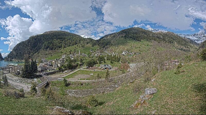



History around Cima dei Cogn
Towns near Cima dei Cogn
- Bellinzona27 km away
- Locarno37 km away
- Lugano48 km away
- Chur58 km away
- Sondrio67 km away
- Pallanza-Intra-Suna68 km away