Cowrock Mountain
3,852 ft1,174 m
Mountain · Blue Ridge Mountains · United States
Cowrock Mountain is a mountain that is located in Lumpkin and White counties in Georgia, United States. The mountain forms a north–south ridge. Its northern peak, Cowrock, has an elevation of 3,852 feet (1,174 m) and its southern peak, Cowrock Flat, has an elevation of 3,502 feet (1,067 m).
From Wikipedia, CC BY-SA · Read the article
At the summit · forecast for 4:00 PM
65 °FClear · wind 6 mph from the SE
 See it in 3D
Weather at the summit of Cowrock Mountain, 3,852 ft
- 4:00 PM65 °FSE 6 mph–
- 7:00 PM54 °FSE 5 mph–
- 10:00 PM48 °FE 7 mph–
- 1:00 AM47 °FE 8 mph–
- 4:00 AM46 °FE 8 mph–
- 7:00 AM45 °FNE 8 mph–
- 10:00 AM54 °FE 9 mph–
- 1:00 PM62 °FE 9 mph–
| Day | Sky | High / low | Rain | Wind up to |
|---|---|---|---|---|
| Wed, Oct 28 | Partly cloudy | 63 °F / 44 °F | – | 10 mph |
| Thu, Oct 29 | Clear | 66 °F / 45 °F | – | 8 mph |
| Fri, Oct 30 | Cloudy | 71 °F / 45 °F | – | 6 mph |
| Sat, Oct 31 | Cloudy | 61 °F / 53 °F | – | 13 mph |
| Sun, Nov 1 | Rain | 51 °F / 49 °F | 0.14 in | 11 mph |
| Mon, Nov 2 | Cloudy | 53 °F / 50 °F | 0.11 in | 9 mph |
| Tue, Nov 3 | Light rain | 59 °F / 51 °F | 0.05 in | 12 mph |
Forecast by MET Norway (CC BY 4.0), updated 03:17 PM EDT. Times are local.
Facts
- What it is
- Mountain
- Height above sea level
- 3,852 ft (1,174 m)
- Range
- Blue Ridge Mountains
- Country
- United States
- Coordinates
- 34.722°N 83.857°W
- Source
- Wikidata, CC0
Cowrock Mountain
Mountain in Georgia, U.S.
Cowrock Mountain is a mountain that is located in Lumpkin and White counties in Georgia, United States. The mountain forms a north–south ridge. Its northern peak, Cowrock, has an elevation of 3,852 feet (1,174 m) and its southern peak, Cowrock Flat, has an elevation of 3,502 feet (1,067 m). The boundary line between Lumpkin and White counties follows the ridge formed by Cowrock Mountain.
From Wikipedia, CC BY-SA · Read the article
Peaks near Cowrock Mountain
- Wildcat Mountain3,760 ft · 1.6 km awayOn the map
- Blood Mountain4,458 ft · 7.7 km awayOn the map
- Slaughter Mountain4,338 ft · 9 km awayOn the map
- Coosa Bald4,280 ft · 12 km awayOn the map
- Jacks Knob3,813 ft · 13 km awayOn the map
- Yonah Mountain3,166 ft · 16 km awayOn the map
- Three Sisters2,131 ft · 16 km awayOn the map
- Wolfpen Ridge4,561 ft · 16 km awayOn the map
- Brasstown Bald4,783 ft · 17 km awayOn the map
- Tray Mountain4,430 ft · 18 km awayOn the map
Highest in the Blue Ridge Mountains
- Mount Rogers5,988 ftOn the map
- Grandfather Mountain5,965 ftOn the map
- Mount Pisgah5,721 ftOn the map
- Devil's Courthouse5,720 ftOn the map
- Snake Mountain (North Carolina)5,564 ftOn the map
- Elk Knob5,538 ftOn the map
- Whitetop Mountain5,518 ftOn the map
- Beech Mountain5,506 ftOn the map
- Cowrock Mountain3,852 ftOn the map
Highest mountains in United States
- Denali20,308 ftOn the map
- Mount Saint Elias18,009 ftOn the map
- Mount Foraker17,402 ftOn the map
- Mount Bona16,535 ftOn the map
- Mount Blackburn16,390 ftOn the map
- Mount Sanford16,237 ftOn the map
- Mount Vancouver15,787 ftOn the map
- Mount Churchill15,636 ftOn the map
- Mount Fairweather15,325 ftOn the map
- Mount Hubbard14,951 ftOn the map
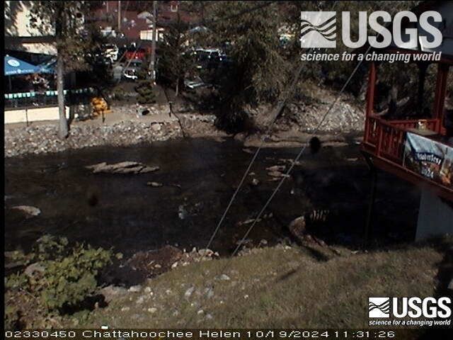
Webcams near Cowrock Mountain
Towns near Cowrock Mountain
- Helen12 km away
- Young Harris24 km away
- Dahlonega24 km away
- Hiawassee27 km away
- Clarkesville33 km away
- Cornelia37 km away