Mountains in Germany
See it in 3DEmmeringer Leite
561 m1,841 ft
Mountain · Germany
Emmeringer Leite is a mountain of Bavaria in the district of Fürstenfeldbruck, Germany.
From Wikipedia, CC BY-SA · Read the article
At the summit · forecast for 10:00 PM
8 °CPartly cloudy · wind 9 km/h from the SW
Weather at the summit of Emmeringer Leite, 561 m
- 10:00 PM8 °CSW 9 km/h–
- 1:00 AM9 °CW 11 km/h–
- 4:00 AM8 °CW 13 km/h–
- 7:00 AM9 °CW 12 km/h0.2 mm
- 10:00 AM11 °CW 15 km/h2.1 mm
- 1:00 PM10 °CNW 14 km/h–
- 4:00 PM10 °CW 11 km/h–
- 7:00 PM7 °CNW 9 km/h–
| Day | Sky | High / low | Rain | Wind up to |
|---|---|---|---|---|
| Wed, Oct 28 | Cloudy | 11 °C / 5 °C | 2.3 mm | 15 km/h |
| Thu, Oct 29 | Cloudy | 10 °C / 3 °C | – | 13 km/h |
| Fri, Oct 30 | Clear | 10 °C / 2 °C | – | 14 km/h |
| Sat, Oct 31 | Mostly clear | 9 °C / 2 °C | – | 14 km/h |
| Sun, Nov 1 | Mostly clear | 8 °C / 1 °C | – | 9 km/h |
| Mon, Nov 2 | Cloudy | 8 °C / -0 °C | 0.2 mm | 8 km/h |
| Tue, Nov 3 | Light rain | 7 °C / 3 °C | 2.7 mm | 15 km/h |
Forecast by MET Norway (CC BY 4.0), updated 02:17 PM GMT+1. Times are local.
Facts
- What it is
- Mountain
- Height above sea level
- 561 m (1,841 ft)
- Country
- Germany
- Coordinates
- 48.174°N 11.294°E
- Source
- Wikidata, CC0
Peaks near Emmeringer Leite
- Parsberg569 m · 5.1 km awayOn the map
- Ilkahöhe726 m · 30 km awayOn the map
- Osterseen591 m · 43 km awayOn the map
- Hoher Peißenberg988 m · 46 km awayOn the map
- Blomberg1,248 m · 51 km awayOn the map
- Zwiesel1,348 m · 52 km awayOn the map
- Heiglkopf1,205 m · 52 km awayOn the map
- Stauffersberg574 m · 52 km awayOn the map
- Vogel Kopf1,210 m · 56 km awayOn the map
- Rechelkopf1,330 m · 56 km awayOn the map
Highest mountains in Germany
- Zugspitze2,962 mOn the map
- Hochwanner2,744 mOn the map
- Dreitorspitze2,682 mOn the map
- Hochkalter2,607 mOn the map
- Biberkopf2,599 mOn the map
- Großer Hundstod2,594 mOn the map
- Hochvogel2,592 mOn the map
- Östliche Karwendelspitze2,538 mOn the map
- Hocheisspitze2,523 mOn the map
- Hoher Göll2,522 mOn the map
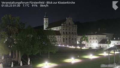
Webcams near Emmeringer Leite
History around Emmeringer Leite
- Munich massacre: Eleven Israeli athletes at the 1972 Summer Olympics in Munich are murdered after eight members of the Arab terrorist group Black September…1972
- 2025 Munich car attack2025
- 2016 Munich shooting2016
- Representing Luxembourg, Corinne Hermès wins the Eurovision Song Contest 1983 with the song Si la vie est cadeau1983
- Oktoberfest bombing: 13 people are killed and 211 injured in a right-wing terror attack in Munich (West Germany)1980
- 1960 Munich Convair 340 crash1960
- Dachau liberation reprisals1945
- First Oktoberfest: Bavarian royalty invites the citizens of Munich to join the celebration of the marriage of Crown Prince Ludwig of Bavaria1810
Towns near Emmeringer Leite
- Fürstenfeldbruck3 km away
- Olching4.1 km away
- Puchheim4.9 km away
- Gröbenzell6.1 km away
- Gilching7.4 km away
- Germering7.5 km away