Mountains in Switzerland
Federispitz
1,865 m6,119 ft
Mountain · Appenzell Alps · Switzerland
The Federispitz is a mountain of the Appenzell Alps, situated in the canton of St. Gallen, with an elevation of 1,865 metres (6,119 ft). It lies south of the Speer and above the municipality of Schänis, overlooking the Walensee, the Linth Plain, and Lake Zurich.
From Wikipedia, CC BY-SA · Read the article
At the summit · forecast for 12:00 AM
2 °CMostly clear · wind 4 km/h from the SE
 See it in 3D
Weather at the summit of Federispitz, 1,865 m
- 12:00 AM2 °CSE 4 km/h–
- 3:00 AM2 °CSE 3 km/h–
- 6:00 AM1 °CE 4 km/h–
- 9:00 AM6 °CE 5 km/h–
- 12:00 PM11 °CNW 4 km/h–
- 3:00 PM11 °CW 4 km/h–
- 6:00 PM5 °CSE 5 km/h–
- 9:00 PM3 °CSE 4 km/h–
| Day | Sky | High / low | Rain | Wind up to |
|---|---|---|---|---|
| Tue, Oct 27 | Mostly clear | 11 °C / 0 °C | – | 6 km/h |
| Wed, Oct 28 | Rain | 3 °C / 1 °C | 2.6 mm | 8 km/h |
| Thu, Oct 29 | Clear | 6 °C / -2 °C | – | 10 km/h |
| Fri, Oct 30 | Mostly clear | 5 °C / -3 °C | – | 5 km/h |
| Sat, Oct 31 | Mostly clear | 6 °C / -5 °C | – | 5 km/h |
| Sun, Nov 1 | Mostly clear | 4 °C / -4 °C | – | 5 km/h |
| Mon, Nov 2 | Clear | 4 °C / -2 °C | – | 6 km/h |
Forecast by MET Norway (CC BY 4.0), updated 08:16 PM GMT+1. Times are local.
Facts
- What it is
- Mountain
- Height above sea level
- 1,865 m (6,119 ft)
- Prominence
- 194 m (636 ft)
- Isolation
- 2.9 km to higher ground
- Range
- Appenzell Alps
- Parent peak
- Speer
- Country
- Switzerland
- Coordinates
- 47.167°N 9.090°E
- Source
- Wikidata, CC0
Peaks near Federispitz
- Glärnisch2,915 m · 20 km awayOn the map
- Säntis2,501 m · 21 km awayOn the map
- Altmann2,435 m · 23 km awayOn the map
- Piz Sardona3,056 m · 30 km awayOn the map
- Piz Segnas3,098 m · 31 km awayOn the map
- Pizol2,844 m · 32 km awayOn the map
- Hausstock3,158 m · 33 km awayOn the map
- Hoher Kasten1,794 m · 33 km awayOn the map
- Vorab3,028 m · 33 km awayOn the map
- Grosser Mythen1,898 m · 34 km awayOn the map
Parent peak
The nearest higher peak its prominence is measured to.
- Speer1,951 mOn the map
Highest in the Appenzell Alps
- Säntis2,501 mOn the map
- Gamsberg2,385 mOn the map
- Furgglenfirst1,951 mOn the map
- Speer1,951 mOn the map
- Mattstock1,937 mOn the map
- Federispitz1,865 mOn the map
- Stockberg1,782 mOn the map
- Kronberg1,663 mOn the map
- Tweralpspitz1,331 mOn the map
Highest mountains in Switzerland
- Dufourspitze4,634 mOn the map
- Dom4,546 mOn the map
- Lyskamm4,532 mOn the map
- Weisshorn4,505 mOn the map
- Matterhorn4,478 mOn the map
- Dent Blanche4,357 mOn the map
- Grand Combin4,309 mOn the map
- Finsteraarhorn4,274 mOn the map
- Zinalrothorn4,221 mOn the map
- Alphubel4,206 mOn the map
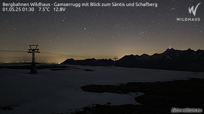
Webcams near Federispitz



History around Federispitz
Towns near Federispitz
- Jona20 km away
- Rapperswil21 km away
- Einsiedeln26 km away
- Wetzikon28 km away
- Herisau28 km away
- Gossau30 km away