 See it in 3D
Facts
- What it is
- Mountain
- Height above sea level
- 2,092 m (6,864 ft)
- Prominence
- 268 m (879 ft)
- Isolation
- 3.8 km to higher ground
- Range
- Schwyzer Voralpen
- Parent peak
- Druesberg
- Country
- Switzerland
- Coordinates
- 47.062°N 8.883°E
- Source
- Wikidata, CC0
Peaks near Fluebrig
- Clariden3,267 m · 24 km awayOn the map
- Hausstock3,158 m · 25 km awayOn the map
- Gross Schärhorn3,294 m · 26 km awayOn the map
- Tödi3,612 m · 28 km awayOn the map
- Bifertenstock3,421 m · 29 km awayOn the map
- Rigi1,797 m · 30 km awayOn the map
- Pfannenstiel853 m · 30 km awayOn the map
- Düssi3,256 m · 30 km awayOn the map
- Gross Windgällen3,187 m · 31 km awayOn the map
- Piz Sardona3,056 m · 32 km awayOn the map
Parent peak
The nearest higher peak its prominence is measured to.
- Druesberg2,282 mOn the map
Highest in the Schwyzer Voralpen
- Schächentaler Windgällen2,764 mOn the map
- Chaiserstock2,515 mOn the map
- Fulen2,491 mOn the map
- Wasserbergfirst2,341 mOn the map
- Mutteristock2,294 mOn the map
- Rautispitz2,283 mOn the map
- Druesberg2,282 mOn the map
- Fluebrig2,092 mOn the map
- Piet1,965 mOn the map
Highest mountains in Switzerland
- Dufourspitze4,634 mOn the map
- Dom4,546 mOn the map
- Lyskamm4,532 mOn the map
- Weisshorn4,505 mOn the map
- Matterhorn4,478 mOn the map
- Dent Blanche4,357 mOn the map
- Grand Combin4,309 mOn the map
- Finsteraarhorn4,274 mOn the map
- Zinalrothorn4,221 mOn the map
- Alphubel4,206 mOn the map
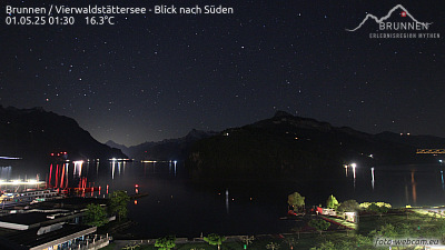
Webcams near Fluebrig




History around Fluebrig
Towns near Fluebrig
- Einsiedeln13 km away
- Schwyz18 km away
- Rapperswil19 km away
- Jona19 km away
- Wetzikon30 km away
- Zug30 km away