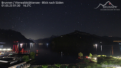
Mountains in Switzerland
Gottschalkenberg Pass
1,186 m3,891 ft
Mountain · Schwyzer Voralpen · Switzerland
Gottschalkenberg Pass is a high mountain pass in the canton of Zug in Switzerland.
From Wikipedia, CC BY-SA · Read the article
At the summit · forecast for 6:00 AM
6 °CClear · wind 1 km/h from the SE
 See it in 3D
Weather at the summit of Gottschalkenberg Pass, 1,186 m
- 6:00 AM6 °CSE 1 km/h–
- 9:00 AM8 °CN 2 km/h–
- 12:00 PM12 °CNW 3 km/h–
- 3:00 PM13 °CNW 4 km/h–
- 6:00 PM9 °CS 3 km/h–
- 9:00 PM8 °CS 4 km/h–
- 12:00 AM7 °CSW 4 km/h–
- 3:00 AM7 °CSW 4 km/h–
| Day | Sky | High / low | Rain | Wind up to |
|---|---|---|---|---|
| Today | Clear | 13 °C / 5 °C | – | 5 km/h |
| Wed, Oct 28 | Light rain | 8 °C / 4 °C | 4 mm | 8 km/h |
| Thu, Oct 29 | Cloudy | 7 °C / 2 °C | – | 12 km/h |
| Fri, Oct 30 | Partly cloudy | 5 °C / 2 °C | – | 6 km/h |
| Sat, Oct 31 | Cloudy | 5 °C / 1 °C | – | 5 km/h |
| Sun, Nov 1 | Mostly clear | 7 °C / 2 °C | – | 3 km/h |
| Mon, Nov 2 | Partly cloudy | 5 °C / 1 °C | – | 14 km/h |
Forecast by MET Norway (CC BY 4.0), updated 02:17 AM GMT+1. Times are local.
Facts
- What it is
- Mountain
- Height above sea level
- 1,186 m (3,891 ft)
- Range
- Schwyzer Voralpen
- Country
- Switzerland
- Coordinates
- 47.154°N 8.648°E
- Source
- Wikidata, CC0
Peaks near Gottschalkenberg Pass
- Grosser Mythen1,898 m · 14 km awayOn the map
- Pfannenstiel853 m · 15 km awayOn the map
- Rigi1,797 m · 16 km awayOn the map
- Albis915 m · 18 km awayOn the map
- Üetliberg869 m · 25 km awayOn the map
- Bürgenstock1,128 m · 25 km awayOn the map
- Zürichberg676 m · 26 km awayOn the map
- Glärnisch2,915 m · 32 km awayOn the map
- Stanserhorn1,898 m · 34 km awayOn the map
- Mount Pilatus2,128 m · 37 km awayOn the map
Highest in the Schwyzer Voralpen
- Schächentaler Windgällen2,764 mOn the map
- Chaiserstock2,515 mOn the map
- Fulen2,491 mOn the map
- Wasserbergfirst2,341 mOn the map
- Mutteristock2,294 mOn the map
- Rautispitz2,283 mOn the map
- Druesberg2,282 mOn the map
- Piet1,965 mOn the map
- Gottschalkenberg Pass1,186 mOn the map
Highest mountains in Switzerland
- Dufourspitze4,634 mOn the map
- Dom4,546 mOn the map
- Lyskamm4,532 mOn the map
- Weisshorn4,505 mOn the map
- Matterhorn4,478 mOn the map
- Dent Blanche4,357 mOn the map
- Grand Combin4,309 mOn the map
- Finsteraarhorn4,274 mOn the map
- Zinalrothorn4,221 mOn the map
- Alphubel4,206 mOn the map