Griffin Butte
8,411 ft2,564 m
Mountain · Smoky Mountains · United States
Griffin Butte, at 8,411 feet (2,564 m) above sea level is a peak in the Smoky Mountains of Idaho. The peak is located in Sawtooth National Forest in Blaine County northwest of Ketchum. It is located in the watershed of the Big Wood River.
From Wikipedia, CC BY-SA · Read the article
At the summit · forecast for 5:00 AM
24 °FPartly cloudy · wind 4 mph from the W
Weather at the summit of Griffin Butte, 8,411 ft
- 5:00 AM24 °FW 4 mph–
- 8:00 AM23 °FNW 3 mph–
- 11:00 AM30 °FSW 5 mph–
- 2:00 PM34 °FSW 8 mph–
- 5:00 PM32 °FSW 7 mph–
- 8:00 PM25 °FN 3 mph–
- 11:00 PM19 °FN 5 mph–
- 2:00 AM19 °FNW 6 mph–
| Day | Sky | High / low | Rain | Wind up to |
|---|---|---|---|---|
| Today | Cloudy | 34 °F / 19 °F | – | 8 mph |
| Wed, Oct 28 | Partly cloudy | 35 °F / 18 °F | – | 10 mph |
| Thu, Oct 29 | Partly cloudy | 40 °F / 17 °F | 0.09 in | 8 mph |
| Fri, Oct 30 | Snow | 32 °F / 27 °F | 0.36 in | 3 mph |
| Sat, Oct 31 | Snow | 35 °F / 13 °F | 0.22 in | 5 mph |
| Sun, Nov 1 | Clear | 26 °F / 4 °F | 0.08 in | 6 mph |
| Mon, Nov 2 | Clear | 30 °F / -1 °F | – | 4 mph |
Forecast by MET Norway (CC BY 4.0), updated 03:22 AM MDT. Times are local.
Facts
- What it is
- Mountain
- Height above sea level
- 8,411 ft (2,564 m)
- Prominence
- 871 ft (266 m)
- Range
- Smoky Mountains
- Country
- United States
- Coordinates
- 43.730°N 114.420°W
- Source
- Wikidata, CC0
Griffin Butte
Mountain in the state of Idaho
Griffin Butte, at 8,411 feet (2,564 m) above sea level is a peak in the Smoky Mountains of Idaho. The peak is located in Sawtooth National Forest in Blaine County northwest of Ketchum. It is located in the watershed of the Big Wood River. It is about 1.75 mi (2.82 km) west of Idaho State Highway 75. No roads or trails go to the summit.
From Wikipedia, CC BY-SA · Read the article
Peaks near Griffin Butte
- Bald Mountain9,150 ft · 8.4 km awayOn the map
- Ryan Peak11,714 ft · 19 km awayOn the map
- Glassford Peak11,602 ft · 21 km awayOn the map
- Hyndman Peak12,009 ft · 23 km awayOn the map
- Saviers Peak10,441 ft · 26 km awayOn the map
- Big Peak10,047 ft · 26 km awayOn the map
- Camas County Highpoint10,337 ft · 26 km awayOn the map
- Titus Peak10,110 ft · 26 km awayOn the map
- Bromaghin Peak10,225 ft · 26 km awayOn the map
- Buttercup Mountain9,079 ft · 27 km awayOn the map
Highest in the Smoky Mountains
- Saviers Peak10,441 ftOn the map
- Norton Peak10,336 ftOn the map
- Baker Peak10,174 ftOn the map
- Big Peak10,047 ftOn the map
- Kelly Mountain8,826 ftOn the map
- Griffin Butte8,411 ftOn the map
Highest mountains in United States
- Denali20,308 ftOn the map
- Mount Saint Elias18,009 ftOn the map
- Mount Foraker17,402 ftOn the map
- Mount Bona16,535 ftOn the map
- Mount Blackburn16,390 ftOn the map
- Mount Sanford16,237 ftOn the map
- Mount Vancouver15,787 ftOn the map
- Mount Churchill15,636 ftOn the map
- Mount Fairweather15,325 ftOn the map
- Mount Hubbard14,951 ftOn the map
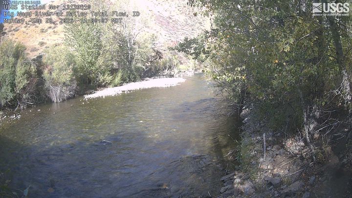
Webcams near Griffin Butte
Towns near Griffin Butte
- Sun Valley8.6 km away
- Hailey26 km away
- Bellevue32 km away
- Carey60 km away