Mountains in Austria
Gschrappkogel
3,194 m10,479 ft
Mountain · Ötztal Alps · Austria
Der Gschrappkogel ist ein 3194 m ü. A. hoher Gipfel im Geigenkamm in den Ötztaler Alpen in Tirol. Bei Begehung des Mainzer Höhenwegs, eines hochalpinen Steigs von der Rüsselsheimer Hütte zur Braunschweiger Hütte, wird der Gschrappkogel überschritten.
From German Wikipedia, CC BY-SA · Read the article
At the summit · forecast for 5:00 AM
-5 °CPartly cloudy · wind 4 km/h from the SW
 See it in 3D
Weather at the summit of Gschrappkogel, 3,194 m
- 5:00 AM-5 °CSW 4 km/h–
- 8:00 AM-4 °CSW 4 km/h–
- 11:00 AM-1 °CNW 7 km/h0.3 mm
- 2:00 PM-2 °CNW 8 km/h1.1 mm
- 5:00 PM-4 °CNW 5 km/h0.4 mm
- 8:00 PM-5 °CNW 6 km/h–
- 11:00 PM-7 °CS 4 km/h–
- 2:00 AM-10 °CS 4 km/h–
| Day | Sky | High / low | Rain | Wind up to |
|---|---|---|---|---|
| Today | Snow | -0 °C / -7 °C | 1.8 mm | 8 km/h |
| Thu, Oct 29 | Clear | -1 °C / -10 °C | – | 6 km/h |
| Fri, Oct 30 | Clear | -1 °C / -8 °C | – | 6 km/h |
| Sat, Oct 31 | Clear | 0 °C / -9 °C | – | 4 km/h |
| Sun, Nov 1 | Clear | -1 °C / -9 °C | – | 6 km/h |
| Mon, Nov 2 | Clear | -4 °C / -10 °C | 0.2 mm | 10 km/h |
| Tue, Nov 3 | Mostly clear | -5 °C / -12 °C | 1.6 mm | 10 km/h |
Forecast by MET Norway (CC BY 4.0), updated 08:17 PM GMT+1. Times are local.
Facts
- What it is
- Mountain
- Height above sea level
- 3,194 m (10,479 ft)
- Isolation
- 0.7 km to higher ground
- Range
- Ötztal Alps
- Country
- Austria
- First ascent
- 1878
- Coordinates
- 46.961°N 10.907°E
- Source
- Wikidata, CC0
Peaks near Gschrappkogel
- Wildspitze3,768 m · 9 km awayOn the map
- Similaun3,597 m · 22 km awayOn the map
- Weißkugel3,738 m · 23 km awayOn the map
- Parseierspitze3,036 m · 40 km awayOn the map
- Vorderseespitze2,889 m · 48 km awayOn the map
- Feuerspitze2,851 m · 49 km awayOn the map
- Wetterspitze2,895 m · 49 km awayOn the map
- Bergisel746 m · 49 km awayOn the map
- Hochwanner2,744 m · 50 km awayOn the map
- Nordkette2,637 m · 50 km awayOn the map
Highest in the Ötztal Alps
- Bliggspitze3,453 mOn the map
- Verpeilspitze3,425 mOn the map
- Gschrappkogel3,194 mOn the map
Highest mountains in Austria
- Grossglockner3,798 mOn the map
- Wildspitze3,768 mOn the map
- Weißkugel3,738 mOn the map
- Großvenediger3,657 mOn the map
- Hintere Schwärze3,624 mOn the map
- Großes Wiesbachhorn3,564 mOn the map
- Ramolkogel3,549 mOn the map
- Schalfkogel3,537 mOn the map
- Watzespitze3,532 mOn the map
- Fineilspitze3,514 mOn the map
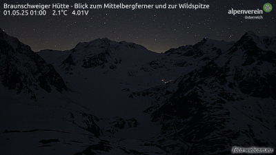
Webcams near Gschrappkogel



Towns near Gschrappkogel
- Merano38 km away
- Telfs40 km away
- Innsbruck50 km away
- Garmisch-Partenkirchen61 km away
- Bolzano62 km away
- Bressanone63 km away