Mountains in Germany
See it in 3DHirschberg
1,039 m3,409 ft
Mountain · Bavarian Forest · Germany
Hirschberg (Niederbayern) is a mountain of Bavaria, Germany. It is located in the district government of Lower Bavaria and the federal state of Bavaria, in the southeastern part of the country, 400 km south of the state capital Berlin.
From Wikipedia, CC BY-SA · Read the article
At the summit · forecast for 12:00 PM
10 °CCloudy · wind 6 km/h from the W
Weather at the summit of Hirschberg, 1,039 m
- 12:00 PM10 °CW 6 km/h1.7 mm
- 3:00 PM8 °CNW 7 km/h0.8 mm
- 6:00 PM7 °CN 10 km/h–
- 9:00 PM6 °CN 10 km/h0.5 mm
- 12:00 AM6 °CN 9 km/h0.1 mm
- 3:00 AM5 °CN 8 km/h–
- 6:00 AM4 °CNE 6 km/h–
- 9:00 AM5 °CNE 8 km/h–
| Day | Sky | High / low | Rain | Wind up to |
|---|---|---|---|---|
| Thu, Oct 29 | Clear | 10 °C / -0 °C | 0.1 mm | 12 km/h |
| Fri, Oct 30 | Clear | 8 °C / -1 °C | – | 13 km/h |
| Sat, Oct 31 | Clear | 9 °C / 1 °C | 0.3 mm | 11 km/h |
| Sun, Nov 1 | Cloudy | 3 °C / 1 °C | 1.5 mm | 10 km/h |
| Mon, Nov 2 | Rain | 3 °C / 1 °C | 5.2 mm | 13 km/h |
| Tue, Nov 3 | Cloudy | 3 °C / -1 °C | 2.6 mm | 12 km/h |
| Wed, Nov 4 | Cloudy | 2 °C / -2 °C | 0.2 mm | 10 km/h |
Forecast by MET Norway (CC BY 4.0), updated 12:17 AM GMT+1. Times are local.
Facts
- What it is
- Mountain
- Height above sea level
- 1,039 m (3,409 ft)
- Range
- Bavarian Forest
- Country
- Germany
- Coordinates
- 49.021°N 13.355°E
- Source
- Wikidata, CC0
Peaks near Hirschberg
- Hahnenbogen1,257 m · 2.9 km awayOn the map
- Kiesruck1,265 m · 3.6 km awayOn the map
- Kleiner Rachel1,399 m · 4.6 km awayOn the map
- Großer Rachel1,453 m · 5.4 km awayOn the map
- Scheuereckberg1,193 m · 5.5 km awayOn the map
- Großer Falkenstein1,315 m · 8.9 km awayOn the map
- Plattenhausenriegel1,376 m · 9.3 km awayOn the map
- Wagensonnriegel959 m · 9.5 km awayOn the map
- Kleiner Falkenstein1,190 m · 9.6 km awayOn the map
- Rukowitzberg1,269 m · 9.7 km awayOn the map
Highest in the Bavarian Forest
- Großer Rachel1,453 mOn the map
- Kleiner Arber1,384 mOn the map
- Bayerischer Plöckenstein1,362 mOn the map
- Großer Falkenstein1,315 mOn the map
- Enzian1,285 mOn the map
- Kiesruck1,265 mOn the map
- Hahnenbogen1,257 mOn the map
- Waldhäuserriegel1,151 mOn the map
- Hirschberg1,039 mOn the map
Highest mountains in Germany
- Zugspitze2,962 mOn the map
- Hochwanner2,744 mOn the map
- Dreitorspitze2,682 mOn the map
- Hochkalter2,607 mOn the map
- Biberkopf2,599 mOn the map
- Großer Hundstod2,594 mOn the map
- Hochvogel2,592 mOn the map
- Östliche Karwendelspitze2,538 mOn the map
- Hocheisspitze2,523 mOn the map
- Hoher Göll2,522 mOn the map
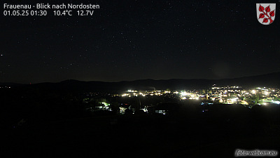
Webcams near Hirschberg


Towns near Hirschberg
- Deggendorf35 km away
- Klatovy42 km away
- Vilshofen45 km away
- Strakonice48 km away
- Passau51 km away
- Cham56 km away