Mountains in Austria
See it in 3DHohe Rehstatt
1,038 m3,406 ft
Mountain · Höllengebirge · Austria
上雷施塔特山,是奧地利的山峰,位於該國北部,由上奧地利州負責管轄,屬於赫倫格山的一部分,海拔高度906米,每年平均降雨量1,801毫米。
From Chinese Wikipedia, CC BY-SA · Read the article
At the summit · forecast for 7:00 PM
6 °CClear · wind 3 km/h from the SE
Weather at the summit of Hohe Rehstatt, 1,038 m
- 7:00 PM6 °CSE 3 km/h–
- 10:00 PM5 °CS 6 km/h–
- 1:00 AM4 °CS 5 km/h–
- 4:00 AM3 °CS 7 km/h–
- 7:00 AM3 °CS 7 km/h–
- 10:00 AM10 °CSW 12 km/h0.4 mm
- 1:00 PM10 °CW 13 km/h1.1 mm
- 4:00 PM8 °CNW 14 km/h5 mm
| Day | Sky | High / low | Rain | Wind up to |
|---|---|---|---|---|
| Wed, Oct 28 | Rain | 12 °C / 3 °C | 9.2 mm | 15 km/h |
| Thu, Oct 29 | Partly cloudy | 8 °C / 1 °C | 2.3 mm | 9 km/h |
| Fri, Oct 30 | Clear | 8 °C / -1 °C | – | 7 km/h |
| Sat, Oct 31 | Clear | 8 °C / -0 °C | – | 6 km/h |
| Sun, Nov 1 | Partly cloudy | 6 °C / 2 °C | 0.2 mm | 6 km/h |
| Mon, Nov 2 | Cloudy | 4 °C / 1 °C | 3.8 mm | 10 km/h |
| Tue, Nov 3 | Sleet | 2 °C / 0 °C | 14.4 mm | 10 km/h |
Forecast by MET Norway (CC BY 4.0), updated 06:17 PM GMT+1. Times are local.
Facts
- What it is
- Mountain
- Height above sea level
- 1,038 m (3,406 ft)
- Range
- Höllengebirge
- Country
- Austria
- Coordinates
- 47.792°N 13.617°E
- Source
- Wikidata, CC0
Peaks near Hohe Rehstatt
- Brunnkogel1,708 m · 4.1 km awayOn the map
- Schafberg1,782 m · 14 km awayOn the map
- Loser1,837 m · 19 km awayOn the map
- Traunstein1,691 m · 19 km awayOn the map
- Gamsfeld2,027 m · 21 km awayOn the map
- Rotgschirr2,270 m · 30 km awayOn the map
- Bischofsmütze2,458 m · 34 km awayOn the map
- Großer Priel2,515 m · 34 km awayOn the map
- Gjaidstein2,794 m · 35 km awayOn the map
- Spitzmauer2,446 m · 35 km awayOn the map
Highest in the Höllengebirge
- Großer Höllkogel1,862 mOn the map
- Wimmersberg1,243 mOn the map
- Goffeck1,101 mOn the map
- Hohe Rehstatt1,038 mOn the map
Highest mountains in Austria
- Grossglockner3,798 mOn the map
- Wildspitze3,768 mOn the map
- Weißkugel3,738 mOn the map
- Großvenediger3,657 mOn the map
- Hintere Schwärze3,624 mOn the map
- Großes Wiesbachhorn3,564 mOn the map
- Ramolkogel3,549 mOn the map
- Schalfkogel3,537 mOn the map
- Watzespitze3,532 mOn the map
- Fineilspitze3,514 mOn the map
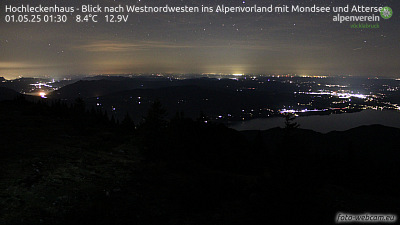
Webcams near Hohe Rehstatt



Towns near Hohe Rehstatt
- Salzburg43 km away
- Freilassing48 km away
- Wels52 km away
- Bad Reichenhall56 km away
- Steyr66 km away
- Traun66 km away