King Peak
11,036 ft3,364 m
Mountain · Ruby Mountains · United States
King Peak is the southernmost summit above 11,000 feet (3,400 m) in the Ruby Mountains of Elko County, in northeastern Nevada in the western United States. To the west is Rattlesnake Canyon, and to the east is Overland Creek Canyon, which drains into the Ruby Valley).
From Wikipedia, CC BY-SA · Read the article
At the summit · forecast for 8:00 AM
25 °FClear · wind 5 mph from the S
 See it in 3D
Weather at the summit of King Peak, 11,036 ft
- 8:00 AM25 °FS 5 mph–
- 11:00 AM31 °FSW 8 mph–
- 2:00 PM34 °FW 10 mph–
- 5:00 PM31 °FW 10 mph–
- 8:00 PM21 °FNW 7 mph–
- 11:00 PM19 °FN 4 mph–
- 2:00 AM19 °FN 3 mph–
- 5:00 AM21 °FSE 4 mph–
| Day | Sky | High / low | Rain | Wind up to |
|---|---|---|---|---|
| Today | Clear | 34 °F / 19 °F | – | 10 mph |
| Wed, Oct 28 | Clear | 33 °F / 19 °F | – | 9 mph |
| Thu, Oct 29 | Cloudy | 37 °F / 22 °F | 0.19 in | 10 mph |
| Fri, Oct 30 | Snow | 31 °F / 24 °F | 0.31 in | 3 mph |
| Sat, Oct 31 | Snow | 29 °F / 22 °F | 0.39 in | 8 mph |
| Sun, Nov 1 | Snow | 20 °F / 10 °F | 0.19 in | 4 mph |
| Mon, Nov 2 | Clear | 20 °F / 5 °F | – | 3 mph |
Forecast by MET Norway (CC BY 4.0), updated 06:17 AM PDT. Times are local.
Facts
- What it is
- Mountain
- Height above sea level
- 11,036 ft (3,364 m)
- Prominence
- 1,311 ft (400 m)
- Range
- Ruby Mountains
- Country
- United States
- Coordinates
- 40.477°N 115.471°W
- Source
- Wikidata, CC0
King Peak (Nevada)
Mountain in United States of America
King Peak is the southernmost summit above 11,000 feet (3,400 m) in the Ruby Mountains of Elko County, in northeastern Nevada in the western United States. To the west is Rattlesnake Canyon, and to the east is Overland Creek Canyon, which drains into the Ruby Valley). The Ruby Crest National Recreation Trail passes just to the east on its way north from Overland Lake.
From Wikipedia, CC BY-SA · Read the article
Peaks near King Peak
- Liberty Peak11,037 ft · 14 km awayOn the map
- Snow Lake Peak11,142 ft · 16 km awayOn the map
- Ruby Dome11,388 ft · 16 km awayOn the map
- Mount Gilbert11,125 ft · 17 km awayOn the map
- Thomas Peak11,321 ft · 18 km awayOn the map
- Verdi Peaks11,074 ft · 21 km awayOn the map
- Pearl Peak10,777 ft · 27 km awayOn the map
- Rattlesnake Mountain8,537 ft · 27 km awayOn the map
- Grindstone Mountain7,382 ft · 44 km awayOn the map
- Spruce Mountain10,233 ft · 56 km awayOn the map
Highest in the Ruby Mountains
- Ruby Dome11,388 ftOn the map
- Thomas Peak11,321 ftOn the map
- Mount Gilbert11,125 ftOn the map
- Verdi Peaks11,074 ftOn the map
- King Peak11,036 ftOn the map
- Pearl Peak10,777 ftOn the map
Highest mountains in United States
- Denali20,308 ftOn the map
- Mount Saint Elias18,009 ftOn the map
- Mount Foraker17,402 ftOn the map
- Mount Bona16,535 ftOn the map
- Mount Blackburn16,390 ftOn the map
- Mount Sanford16,237 ftOn the map
- Mount Vancouver15,787 ftOn the map
- Mount Churchill15,636 ftOn the map
- Mount Fairweather15,325 ftOn the map
- Mount Hubbard14,951 ftOn the map
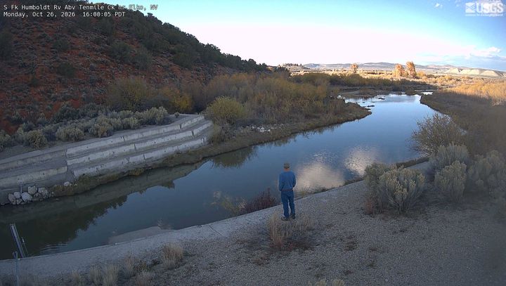
Webcams near King Peak
History around King Peak
Towns near King Peak
- Elko47 km away