Laber (Ammergauer Alpen)
1,686 m5,531 ft
Mountain · Ammergau Alps · Germany
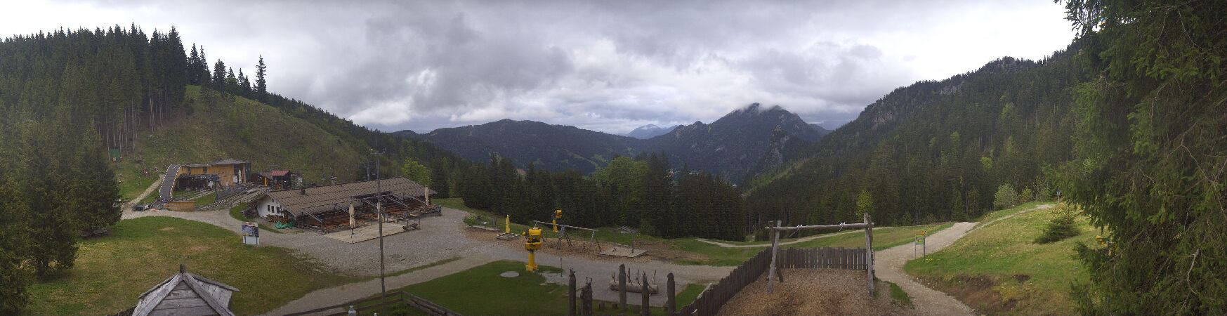
Der Laber ist ein Berg in den Ammergauer Alpen nördlich von Ettal und östlich von Oberammergau. Von Oberammergau führt auch die Laber Bergbahn auf den Laber.
From German Wikipedia, CC BY-SA · Read the article
At the summit · forecast for 9:00 AM
5 °CRain · wind 11 km/h from the SW
 See it in 3D
Weather at the summit of Laber (Ammergauer Alpen), 1,686 m
- 9:00 AM5 °CSW 11 km/h1 mm
- 12:00 PM5 °CNW 13 km/h4.4 mm
- 3:00 PM4 °CNW 9 km/h1.1 mm
- 6:00 PM3 °CNW 6 km/h1.7 mm
- 9:00 PM2 °CN 6 km/h0.6 mm
- 12:00 AM1 °CNE 4 km/h–
- 3:00 AM1 °CNE 4 km/h–
- 6:00 AM1 °CE 5 km/h–
| Day | Sky | High / low | Rain | Wind up to |
|---|---|---|---|---|
| Today | Heavy rain | 6 °C / 2 °C | 8.8 mm | 13 km/h |
| Thu, Oct 29 | Partly cloudy | 5 °C / -1 °C | – | 13 km/h |
| Fri, Oct 30 | Partly cloudy | 3 °C / -6 °C | – | 17 km/h |
| Sat, Oct 31 | Clear | 4 °C / -5 °C | – | 6 km/h |
| Sun, Nov 1 | Partly cloudy | 1 °C / -2 °C | 0.2 mm | 5 km/h |
| Mon, Nov 2 | Heavy snow | -1 °C / -3 °C | 12.9 mm | 5 km/h |
| Tue, Nov 3 | Snow | -2 °C / -3 °C | 7.5 mm | 6 km/h |
Forecast by MET Norway (CC BY 4.0), updated 08:17 AM GMT+1. Times are local.
Facts
- What it is
- Mountain
- Height above sea level
- 1,686 m (5,531 ft)
- Prominence
- 815 m (2,674 ft)
- Range
- Ammergau Alps
- Country
- Germany
- Coordinates
- 47.586°N 11.101°E
- Source
- Wikidata, CC0
Laber (Berg)
Berg in den Alpen
Der Laber ist ein Berg in den Ammergauer Alpen nördlich von Ettal und östlich von Oberammergau. Von Oberammergau führt auch die Laber Bergbahn auf den Laber. Im Bereich der Bergstation befinden sich ein Restaurant sowie diverse Sendeanlagen für Rundfunk und Telekommunikation, unter anderem der Sender Oberammergau für UKW- und digitalen Rundfunk.
From German Wikipedia, CC BY-SA · Read the article
Peaks near Laber (Ammergauer Alpen)
- Krottenkopf2,086 m · 8.2 km awayOn the map
- Alpspitze2,628 m · 18 km awayOn the map
- Zugspitze2,962 m · 20 km awayOn the map
- Dreitorspitze2,682 m · 21 km awayOn the map
- Hochwanner2,744 m · 21 km awayOn the map
- Schneefernerkopf2,874 m · 22 km awayOn the map
- Daniel2,340 m · 24 km awayOn the map
- Birkkarspitze2,749 m · 32 km awayOn the map
- Thaneller2,341 m · 33 km awayOn the map
- Gehrenspitze2,163 m · 35 km awayOn the map
Highest in the Ammergau Alps
- Daniel2,340 mOn the map
- Plattberg2,247 mOn the map
- Kreuzspitze2,185 mOn the map
- Geierköpfe2,161 mOn the map
- Ammergauer Hochplatte2,082 mOn the map
- Friederspitz2,049 mOn the map
- Säuling2,047 mOn the map
- Kramerspitz1,985 mOn the map
- Laber (Ammergauer Alpen)1,686 mOn the map
Highest mountains in Germany
- Zugspitze2,962 mOn the map
- Hochwanner2,744 mOn the map
- Dreitorspitze2,682 mOn the map
- Hochkalter2,607 mOn the map
- Biberkopf2,599 mOn the map
- Großer Hundstod2,594 mOn the map
- Hochvogel2,592 mOn the map
- Östliche Karwendelspitze2,538 mOn the map
- Hocheisspitze2,523 mOn the map
- Hoher Göll2,522 mOn the map