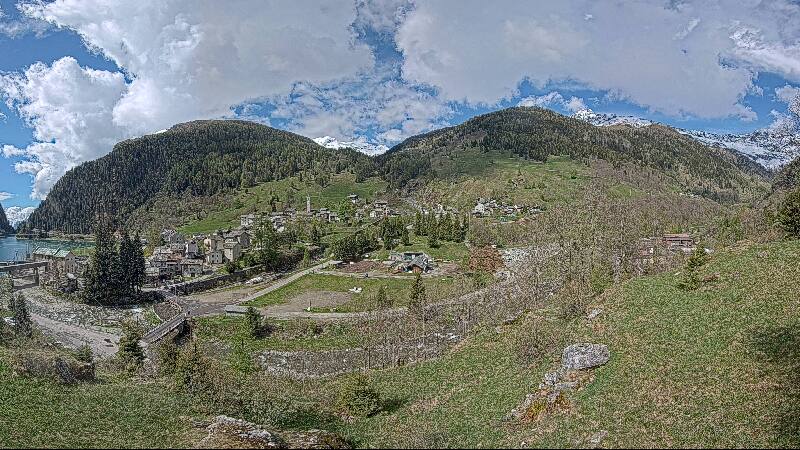
Mountains in Switzerland
See it in 3DLorenzhorn
3,048 m10,000 ft
Mountain · Adula Group · Switzerland
The Lorenzhorn is a mountain of the Lepontine Alps, located west of Hinterrhein in the canton of Graubünden. It lies on the range between the valleys of Vals and Hinterrhein. On its north side lies a glacier named Fanellgletscher.
From Wikipedia, CC BY-SA · Read the article
At the summit · forecast for 6:00 AM
-4 °CClear · wind 4 km/h from the NE
Weather at the summit of Lorenzhorn, 3,048 m
- 6:00 AM-4 °CNE 4 km/h–
- 9:00 AM1 °CNE 4 km/h–
- 12:00 PM5 °CNW 5 km/h–
- 3:00 PM5 °CN 7 km/h–
- 6:00 PM0 °CNE 4 km/h–
- 9:00 PM-1 °CNE 4 km/h–
- 12:00 AM-3 °CNE 5 km/h–
- 3:00 AM-3 °CNE 6 km/h–
| Day | Sky | High / low | Rain | Wind up to |
|---|---|---|---|---|
| Today | Clear | 5 °C / -4 °C | – | 7 km/h |
| Wed, Oct 28 | Partly cloudy | 1 °C / -5 °C | – | 10 km/h |
| Thu, Oct 29 | Clear | 0 °C / -8 °C | – | 6 km/h |
| Fri, Oct 30 | Clear | -0 °C / -6 °C | – | 2 km/h |
| Sat, Oct 31 | Clear | -1 °C / -6 °C | – | 4 km/h |
| Sun, Nov 1 | Clear | 2 °C / -5 °C | – | 4 km/h |
| Mon, Nov 2 | Clear | 1 °C / -7 °C | – | 7 km/h |
Forecast by MET Norway (CC BY 4.0), updated 02:17 AM GMT+1. Times are local.
Facts
- What it is
- Mountain
- Height above sea level
- 3,048 m (10,000 ft)
- Prominence
- 179 m (587 ft)
- Range
- Adula Group
- Parent peak
- Fanellhorn
- Country
- Switzerland
- Coordinates
- 46.527°N 9.128°E
- Source
- Wikidata, CC0
Peaks near Lorenzhorn
- Rheinwaldhorn3,402 m · 7.7 km awayOn the map
- Alperschällihorn3,036 m · 15 km awayOn the map
- Bruschghorn3,056 m · 18 km awayOn the map
- Piz Medel3,210 m · 19 km awayOn the map
- Piz Beverin2,998 m · 22 km awayOn the map
- Scopi3,190 m · 23 km awayOn the map
- Pizzo Campo Tencia3,072 m · 33 km awayOn the map
- Bifertenstock3,421 m · 33 km awayOn the map
- Piz Platta3,392 m · 33 km awayOn the map
- Tödi3,612 m · 36 km awayOn the map
Parent peak
The nearest higher peak its prominence is measured to.
- Fanellhorn3,124 mOn the map
Highest in the Adula Group
- Rheinwaldhorn3,402 mOn the map
- Güferhorn3,379 mOn the map
- Vogelberg3,218 mOn the map
- Fanellhorn3,124 mOn the map
- Lorenzhorn3,048 mOn the map
- Torent Alto2,952 mOn the map
- Pizzo del Ramulazz2,939 mOn the map
- Cima di Gana Bianca2,842 mOn the map
- Cima de Gagela2,805 mOn the map
Highest mountains in Switzerland
- Dufourspitze4,634 mOn the map
- Dom4,546 mOn the map
- Lyskamm4,532 mOn the map
- Weisshorn4,505 mOn the map
- Matterhorn4,478 mOn the map
- Dent Blanche4,357 mOn the map
- Grand Combin4,309 mOn the map
- Finsteraarhorn4,274 mOn the map
- Zinalrothorn4,221 mOn the map
- Alphubel4,206 mOn the map