Maleens Knoll
16 m52 ft
Hill · Germany
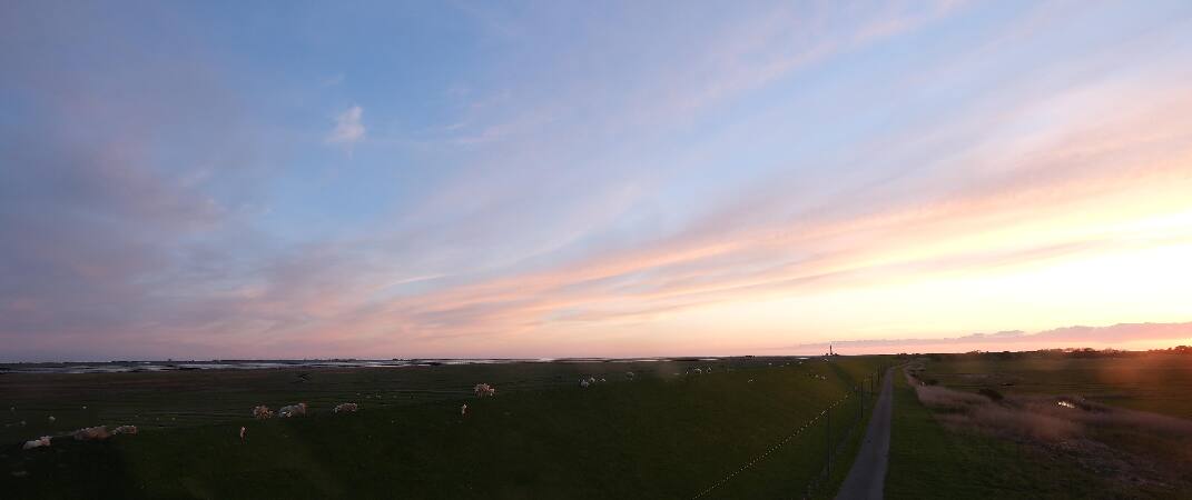
Maleens Knoll oder auch Magdalenenspitze ist eine 16,6 m ü. NHN hohe Düne in Sankt Peter-Ording in Schleswig-Holstein. Sie gilt als höchste natürliche Erhebung im Gemeindegebiet. Auf dem höchsten Punkt wurde eine hölzerne Aussichtsplattform errichtet, die im Herbst 2015 erneuert und erhöht wurde.
From German Wikipedia, CC BY-SA · Read the article
At the summit · forecast for 6:00 PM
12 °CCloudy · wind 22 km/h from the SW
 See it in 3D
Weather at the summit of Maleens Knoll, 16 m
- 6:00 PM12 °CSW 22 km/h–
- 9:00 PM12 °CSW 26 km/h–
- 12:00 AM12 °CSW 27 km/h–
- 3:00 AM12 °CSW 24 km/h–
- 6:00 AM12 °CNW 12 km/h–
- 9:00 AM12 °CSW 5 km/h–
- 12:00 PM14 °CW 8 km/h–
- 3:00 PM13 °CW 5 km/h–
| Day | Sky | High / low | Rain | Wind up to |
|---|---|---|---|---|
| Thu, Oct 29 | Cloudy | 14 °C / 11 °C | – | 27 km/h |
| Fri, Oct 30 | Cloudy | 13 °C / 11 °C | – | 11 km/h |
| Sat, Oct 31 | Partly cloudy | 11 °C / 11 °C | – | 9 km/h |
| Sun, Nov 1 | Cloudy | 11 °C / 10 °C | – | 12 km/h |
| Mon, Nov 2 | Cloudy | 10 °C / 9 °C | – | 18 km/h |
| Tue, Nov 3 | Partly cloudy | 10 °C / 8 °C | – | 14 km/h |
| Wed, Nov 4 | Partly cloudy | 9 °C / 7 °C | – | 13 km/h |
Forecast by MET Norway (CC BY 4.0), updated 09:29 AM GMT+1. Times are local.
Facts
- What it is
- Hill
- Height above sea level
- 16 m (52 ft)
- Country
- Germany
- Coordinates
- 54.320°N 8.606°E
- Source
- Wikidata, CC0
Maleens Knoll
Düne in Sankt Peter-Ording
Maleens Knoll oder auch Magdalenenspitze ist eine 16,6 m ü. NHN hohe Düne in Sankt Peter-Ording in Schleswig-Holstein. Sie gilt als höchste natürliche Erhebung im Gemeindegebiet. Auf dem höchsten Punkt wurde eine hölzerne Aussichtsplattform errichtet, die im Herbst 2015 erneuert und erhöht wurde. Sie bietet einen Rundblick auf die Dünenlandschaft in der näheren Umgebung, Gebäude von St.
From German Wikipedia, CC BY-SA · Read the article
Peaks near Maleens Knoll
- Stollberg43 m · 42 km awayOn the map
- SimonsbergMountain · 27 km awayOn the map
- DusenddüwelswarfHill · 36 km awayOn the map
- hill-104034156Hill · 44 km awayOn the map
- Sandesberg54 m · 45 km awayOn the map
- Pinneberg61 m · 50 km awayOn the map
- BudersandHill · 53 km awayOn the map
- Rantzauhöhe45 m · 53 km awayOn the map
- Hohe LiethHill · 59 km awayOn the map
Highest mountains in Germany
- Zugspitze2,962 mOn the map
- Hochwanner2,744 mOn the map
- Dreitorspitze2,682 mOn the map
- Hochkalter2,607 mOn the map
- Biberkopf2,599 mOn the map
- Großer Hundstod2,594 mOn the map
- Hochvogel2,592 mOn the map
- Östliche Karwendelspitze2,538 mOn the map
- Hocheisspitze2,523 mOn the map
- Hoher Göll2,522 mOn the map