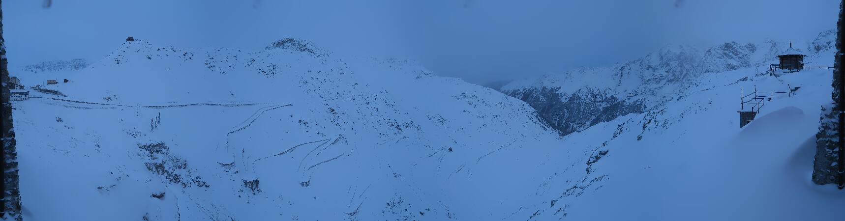
Piz da las Trais Linguas
2,843 m9,327 ft
Mountain · Umbrailgruppe · Italy · Switzerland
Piz da las Trais Linguas, is a minor summit of the Ortler Alps, located on the border between Switzerland and Italy. The summit is the tripoint between the Italian regions of Lombardy and South Tyrol and the Swiss canton of Graubünden.
From Wikipedia, CC BY-SA · Read the article
At the summit · forecast for 11:00 PM
-4 °CFog · wind 5 km/h from the N
 See it in 3D
Weather at the summit of Piz da las Trais Linguas, 2,843 m
- 11:00 PM-4 °CN 5 km/h–
- 2:00 AM-5 °CN 6 km/h–
- 5:00 AM-6 °CNE 6 km/h–
- 8:00 AM-5 °CNE 6 km/h–
- 11:00 AM1 °CN 5 km/h–
- 2:00 PM3 °CN 7 km/h–
- 5:00 PM-2 °CN 4 km/h–
- 8:00 PM-4 °CNE 1 km/h–
| Day | Sky | High / low | Rain | Wind up to |
|---|---|---|---|---|
| Thu, Oct 29 | Clear | 3 °C / -7 °C | – | 8 km/h |
| Fri, Oct 30 | Clear | 2 °C / -8 °C | – | 8 km/h |
| Sat, Oct 31 | Clear | 2 °C / -9 °C | – | 6 km/h |
| Sun, Nov 1 | Clear | -4 °C / -12 °C | 0.6 mm | 8 km/h |
| Mon, Nov 2 | Partly cloudy | -4 °C / -13 °C | – | 7 km/h |
| Tue, Nov 3 | Clear | -0 °C / -10 °C | – | 6 km/h |
| Wed, Nov 4 | Partly cloudy | 1 °C / -9 °C | 0.3 mm | 5 km/h |
Forecast by MET Norway (CC BY 4.0), updated 02:17 PM GMT+1. Times are local.
Facts
- What it is
- Mountain
- Height above sea level
- 2,843 m (9,327 ft)
- Range
- Umbrailgruppe
- Parent peak
- Punta Rosa
- Countries
- Italy, Switzerland
- Coordinates
- 46.531°N 10.453°E
- Source
- Wikidata, CC0
Piz da las Trais Linguas
Mountain in Switzerland
Piz da las Trais Linguas, is a minor summit of the Ortler Alps, located on the border between Switzerland and Italy. The summit is the tripoint between the Italian regions of Lombardy and South Tyrol and the Swiss canton of Graubünden. Before World War I it was the international tripoint of Switzerland, the Kingdom of Italy and Austria-Hungary.
From Wikipedia, CC BY-SA · Read the article
Peaks near Piz da las Trais Linguas
- Ortler3,905 m · 7.5 km awayOn the map
- Königspitze3,851 m · 11 km awayOn the map
- Monte Cevedale3,769 m · 16 km awayOn the map
- Piz Sesvenna3,204 m · 20 km awayOn the map
- Scima da Saoseo3,264 m · 28 km awayOn the map
- Saldurspitze3,433 m · 32 km awayOn the map
- Schwemser Spitze3,459 m · 35 km awayOn the map
- Äußerer Bärenbartkogel3,473 m · 35 km awayOn the map
- Piz Lad2,808 m · 35 km awayOn the map
- Weißkugel3,738 m · 36 km awayOn the map
Parent peak
The nearest higher peak its prominence is measured to.
- Punta Rosa3,026 mOn the map
Highest in the Umbrailgruppe
- Piz Murtaröl3,180 mOn the map
- Piz Tea Fondada3,144 mOn the map
- Monte Cassa del Ferro3,140 mOn the map
- Piz Schumbraida3,125 mOn the map
- Piz Daint2,968 mOn the map
- Piz Turettas2,963 mOn the map
- Piz Val Gronda2,878 mOn the map
- Piz da las Trais Linguas2,843 mOn the map
- Cima del Serraglio2,685 mOn the map
Highest mountains in Italy
- Mont Blanc4,806 mOn the map
- Lyskamm4,532 mOn the map
- Matterhorn4,478 mOn the map
- Pointe Walker4,208 mOn the map
- Grandes Jorasses4,208 mOn the map
- Dent d'Hérens4,173 mOn the map
- Breithorn4,160 mOn the map
- Piz da las Trais Linguas2,843 mOn the map