Platte
651 m2,136 ft
Mountain · Eastern Graz Highlands · Austria
Die Platte ist eine 651 m ü. A. hohe Erhebung im Grazer Stadtgebiet. Den Gipfel bildet ein etwa 1 ha großes Plateau, in dessen Mitte die Stephanienwarte, eine ehemalige Wetterstation, steht. Heute befindet sich am Turm eine moderne Umwelt- und Luftgüte-Überwachungsanlage.
From German Wikipedia, CC BY-SA · Read the article
At the summit · forecast for 5:00 PM
6 °CClear · wind 3 km/h from the S
 See it in 3D
Weather at the summit of Platte, 651 m
- 5:00 PM6 °CS 3 km/h–
- 8:00 PM5 °CN 3 km/h–
- 11:00 PM3 °CNW 4 km/h–
- 2:00 AM1 °CNW 7 km/h–
- 5:00 AM-0 °CN 10 km/h–
- 8:00 AM4 °CNW 12 km/h–
- 11:00 AM7 °CW 7 km/h–
- 2:00 PM8 °CSE 6 km/h–
| Day | Sky | High / low | Rain | Wind up to |
|---|---|---|---|---|
| Wed, Oct 28 | Cloudy | 9 °C / -1 °C | – | 12 km/h |
| Thu, Oct 29 | Partly cloudy | 12 °C / 5 °C | – | 16 km/h |
| Fri, Oct 30 | Clear | 12 °C / 3 °C | – | 14 km/h |
| Sat, Oct 31 | Clear | 11 °C / 3 °C | – | 5 km/h |
| Sun, Nov 1 | Partly cloudy | 9 °C / 4 °C | – | 17 km/h |
| Mon, Nov 2 | Partly cloudy | 6 °C / 2 °C | 0.2 mm | 9 km/h |
| Tue, Nov 3 | Cloudy | 7 °C / 3 °C | 0.9 mm | 16 km/h |
Forecast by MET Norway (CC BY 4.0), updated 02:17 PM GMT+1. Times are local.
Facts
- What it is
- Mountain
- Height above sea level
- 651 m (2,136 ft)
- Prominence
- 103 m (338 ft)
- Isolation
- 1.5 km to higher ground
- Range
- Eastern Graz Highlands
- Country
- Austria
- Coordinates
- 47.113°N 15.469°E
- Source
- Wikidata, CC0
Platte (Graz)
Berg im Grazer Bergland in der Steiermark
Die Platte ist eine 651 m ü. A. hohe Erhebung im Grazer Stadtgebiet. Den Gipfel bildet ein etwa 1 ha großes Plateau, in dessen Mitte die Stephanienwarte, eine ehemalige Wetterstation, steht. Heute befindet sich am Turm eine moderne Umwelt- und Luftgüte-Überwachungsanlage. Die Erhebung ist touristisch erschlossen und bietet ein Graz-Panorama von der Stephanienwarte.
From German Wikipedia, CC BY-SA · Read the article
Peaks near Platte
- Lineckberg702 m · 1.7 km awayOn the map
- Hauenstein650 m · 1.8 km awayOn the map
- Reinerkogel500 m · 3.4 km awayOn the map
- Schlossberg474 m · 4.8 km awayOn the map
- Admonter Kogel566 m · 5.5 km awayOn the map
- Hohenberg1,048 m · 6 km awayOn the map
- Hubertushöhe562 m · 6.2 km awayOn the map
- Göstinger Ruinenberg696 m · 6.4 km awayOn the map
- Kanzelkogel608 m · 6.5 km awayOn the map
- Fürstenstand754 m · 6.8 km awayOn the map
Highest in the Eastern Graz Highlands
- Hochlantsch1,720 mOn the map
- Osser1,548 mOn the map
- Plankogel1,531 mOn the map
- Rote Wand1,505 mOn the map
- Schöckl1,445 mOn the map
- Pommesberg1,287 mOn the map
- Zetz1,274 mOn the map
- Patschaberg1,271 mOn the map
- Platte651 mOn the map
Highest mountains in Austria
- Grossglockner3,798 mOn the map
- Wildspitze3,768 mOn the map
- Weißkugel3,738 mOn the map
- Großvenediger3,657 mOn the map
- Hintere Schwärze3,624 mOn the map
- Großes Wiesbachhorn3,564 mOn the map
- Ramolkogel3,549 mOn the map
- Schalfkogel3,537 mOn the map
- Watzespitze3,532 mOn the map
- Fineilspitze3,514 mOn the map
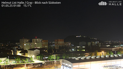
Webcams near Platte
History around Platte
Towns near Platte
- Graz5.5 km away
- Wolfsberg56 km away
- Eisenzicken62 km away
- Maribor63 km away