Mountains in Austria
Reinerkogel
500 m1,640 ft
Hill · Eastern Graz Highlands · Austria
Der Reinerkogel ist ein 500 m ü. A. hoher Hügel im Grazer Bergland im österreichischen Bundesland Steiermark. Er befindet sich in der Landeshauptstadt Graz nördlich des Zentrums am linken Murufer und war mit der 1957 abgerissenen Reinerkogelwarte vor allem in der Vergangenheit ein beliebtes Naherholungsgebiet.
From German Wikipedia, CC BY-SA · Read the article
At the summit · forecast for 11:00 PM
4 °CClear · wind 3 km/h from the N
 See it in 3D
Weather at the summit of Reinerkogel, 500 m
- 11:00 PM4 °CN 3 km/h–
- 2:00 AM2 °CN 7 km/h–
- 5:00 AM1 °CN 10 km/h–
- 8:00 AM5 °CN 11 km/h–
- 11:00 AM8 °CNW 8 km/h–
- 2:00 PM10 °CSE 6 km/h–
- 5:00 PM6 °CNE 6 km/h–
- 8:00 PM7 °CNE 5 km/h–
| Day | Sky | High / low | Rain | Wind up to |
|---|---|---|---|---|
| Wed, Oct 28 | Cloudy | 10 °C / 1 °C | – | 11 km/h |
| Thu, Oct 29 | Partly cloudy | 14 °C / 6 °C | – | 17 km/h |
| Fri, Oct 30 | Clear | 13 °C / 4 °C | – | 14 km/h |
| Sat, Oct 31 | Clear | 13 °C / 4 °C | – | 6 km/h |
| Sun, Nov 1 | Partly cloudy | 11 °C / 5 °C | – | 16 km/h |
| Mon, Nov 2 | Partly cloudy | 8 °C / 2 °C | 0.2 mm | 8 km/h |
| Tue, Nov 3 | Cloudy | 9 °C / 5 °C | 0.7 mm | 15 km/h |
Forecast by MET Norway (CC BY 4.0), updated 08:17 PM GMT+1. Times are local.
Facts
- What it is
- Hill
- Height above sea level
- 500 m (1,640 ft)
- Range
- Eastern Graz Highlands
- Country
- Austria
- Coordinates
- 47.094°N 15.433°E
- Source
- Wikidata, CC0
Peaks near Reinerkogel
- Schlossberg474 m · 2.1 km awayOn the map
- Hubertushöhe562 m · 2.8 km awayOn the map
- Platte651 m · 3.4 km awayOn the map
- Admonter Kogel566 m · 3.5 km awayOn the map
- Fürstenstand754 m · 3.7 km awayOn the map
- Plabutsch754 m · 3.7 km awayOn the map
- Göstinger Ruinenberg696 m · 3.8 km awayOn the map
- Kanzelkogel608 m · 4.5 km awayOn the map
- Frauenkogel561 m · 4.7 km awayOn the map
- Steinkogel742 m · 5.8 km awayOn the map
Highest in the Eastern Graz Highlands
- Hochlantsch1,720 mOn the map
- Osser1,548 mOn the map
- Plankogel1,531 mOn the map
- Rote Wand1,505 mOn the map
- Schöckl1,445 mOn the map
- Pommesberg1,287 mOn the map
- Zetz1,274 mOn the map
- Patschaberg1,271 mOn the map
- Reinerkogel500 mOn the map
Highest mountains in Austria
- Grossglockner3,798 mOn the map
- Wildspitze3,768 mOn the map
- Weißkugel3,738 mOn the map
- Großvenediger3,657 mOn the map
- Hintere Schwärze3,624 mOn the map
- Großes Wiesbachhorn3,564 mOn the map
- Ramolkogel3,549 mOn the map
- Schalfkogel3,537 mOn the map
- Watzespitze3,532 mOn the map
- Fineilspitze3,514 mOn the map
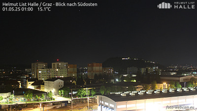
Webcams near Reinerkogel
History around Reinerkogel
Towns near Reinerkogel
- Graz3.1 km away
- Wolfsberg53 km away
- Maribor62 km away
- Eisenzicken66 km away