Facts
- What it is
- Mountain
- Height above sea level
- 1,071 m (3,514 ft)
- Range
- Bohemian Forest
- Country
- Czechia
- Coordinates
- 49.235°N 13.212°E
- Source
- Wikidata, CC0
Peaks near Prenet
- Zwercheck1,334 m · 7.6 km awayOn the map
- Osser1,293 m · 8.6 km awayOn the map
- Hindenburgkanzel1,062 m · 11 km awayOn the map
- Hochberg943 m · 14 km awayOn the map
- Schwarzeck1,236 m · 15 km awayOn the map
- Großer Arber1,456 m · 15 km awayOn the map
- Kleiner Arber1,384 m · 15 km awayOn the map
- Enzian1,285 m · 16 km awayOn the map
- Heugstatt1,262 m · 16 km awayOn the map
- Ödriegel1,156 m · 16 km awayOn the map
Highest in the Bohemian Forest
- Großer Arber1,456 mOn the map
- Plechý / Plöckenstein1,379 mOn the map
- Boubín1,362 mOn the map
- Hochficht1,338 mOn the map
- Černá hora1,316 mOn the map
- mountain-1177099971,290 mOn the map
- Tetřev1,258 mOn the map
- Knížecí stolec1,236 mOn the map
- Prenet1,071 mOn the map
Highest mountains in Czechia
- Sněžka1,603 mOn the map
- Wielki Szyszak1,510 mOn the map
- Praděd1,491 mOn the map
- Smogornia1,490 mOn the map
- Mały Szyszak1,440 mOn the map
- Keprník1,423 mOn the map
- Králický Sněžník1,423 mOn the map
- Plechý / Plöckenstein1,379 mOn the map
- Bayerischer Plöckenstein1,362 mOn the map
- Boubín1,362 mOn the map
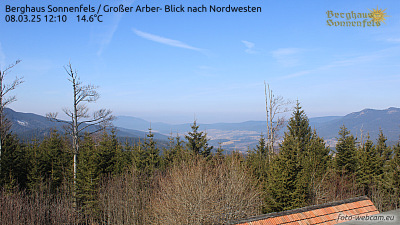
Webcams near Prenet


History around Prenet
- Battle of Nýrsk1467
Towns near Prenet
- Klatovy19 km away
- Cham40 km away
- Deggendorf47 km away
- Strakonice50 km away
- Pilsen58 km away
- Straubing61 km away