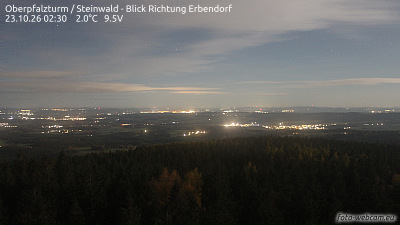
Mountains in Germany
See it in 3DRosskopf
725 m2,379 ft
Mountain · Fichtel Mountains · Germany
At the summit · forecast for 7:00 AM
4 °CPartly cloudy · wind 11 km/h from the S
Weather at the summit of Rosskopf, 725 m
- 7:00 AM4 °CS 11 km/h–
- 10:00 AM7 °CS 9 km/h–
- 1:00 PM11 °CS 11 km/h–
- 4:00 PM10 °CS 8 km/h–
- 7:00 PM6 °CS 12 km/h–
- 10:00 PM5 °CS 11 km/h–
- 1:00 AM4 °CSW 11 km/h–
- 4:00 AM3 °CSW 8 km/h–
| Day | Sky | High / low | Rain | Wind up to |
|---|---|---|---|---|
| Today | Partly cloudy | 11 °C / 4 °C | – | 12 km/h |
| Wed, Oct 28 | Cloudy | 9 °C / 3 °C | 3.1 mm | 15 km/h |
| Thu, Oct 29 | Mostly clear | 9 °C / 2 °C | – | 9 km/h |
| Fri, Oct 30 | Partly cloudy | 8 °C / -1 °C | – | 10 km/h |
| Sat, Oct 31 | Partly cloudy | 9 °C / 1 °C | – | 10 km/h |
| Sun, Nov 1 | Partly cloudy | 10 °C / 0 °C | – | 8 km/h |
| Mon, Nov 2 | Partly cloudy | 6 °C / 3 °C | 0.2 mm | 13 km/h |
Forecast by MET Norway (CC BY 4.0), updated 06:20 AM GMT+1. Times are local.
Facts
- What it is
- Mountain
- Height above sea level
- 725 m (2,379 ft)
- Range
- Fichtel Mountains
- Country
- Germany
- Coordinates
- 49.960°N 12.120°E
- Source
- Wikidata, CC0
Peaks near Rosskopf
- Platte946 m · 7.3 km awayOn the map
- Kösseine939 m · 10 km awayOn the map
- Landschaftsgarten685 m · 11 km awayOn the map
- Wartberg628 m · 11 km awayOn the map
- Katharinenberg bei Wunsiedel618 m · 11 km awayOn the map
- Hohe Matze813 m · 14 km awayOn the map
- Armesberg731 m · 15 km awayOn the map
- Platte885 m · 18 km awayOn the map
- Seehügel953 m · 19 km awayOn the map
- Nußhardt972 m · 20 km awayOn the map
Highest in the Fichtel Mountains
- Schneeberg1,051 mOn the map
- Kösseine939 mOn the map
- Großer Waldstein877 mOn the map
- Rudolfstein866 mOn the map
- Bergkopf857 mOn the map
- Großer Kornberg827 mOn the map
- Epprechtstein797 mOn the map
- Rosskopf725 mOn the map
- Rabenberg719 mOn the map
Highest mountains in Germany
- Zugspitze2,962 mOn the map
- Hochwanner2,744 mOn the map
- Dreitorspitze2,682 mOn the map
- Hochkalter2,607 mOn the map
- Biberkopf2,599 mOn the map
- Großer Hundstod2,594 mOn the map
- Hochvogel2,592 mOn the map
- Östliche Karwendelspitze2,538 mOn the map
- Hocheisspitze2,523 mOn the map
- Hoher Göll2,522 mOn the map