Schachen
1,870 m6,135 ft
Mountain · Wetterstein · Germany
Der Schachen ist ein Aussichtspunkt im Wettersteingebirge in der Nähe von Garmisch-Partenkirchen und Elmau. Er ist 1870 m ü. NHN hoch und liegt in unmittelbarer Nähe der Dreitorspitze und der Meilerhütte über dem Reintal.
From German Wikipedia, CC BY-SA · Read the article
At the summit · forecast for 12:00 AM
-1 °CClear · wind 8 km/h from the SE
 See it in 3D
Weather at the summit of Schachen, 1,870 m
- 12:00 AM-1 °CSE 8 km/h–
- 3:00 AM-0 °CS 6 km/h–
- 6:00 AM-1 °CSE 6 km/h–
- 9:00 AM4 °CS 8 km/h–
- 12:00 PM11 °CSE 3 km/h–
- 3:00 PM13 °CE 4 km/h–
- 6:00 PM7 °CN 1 km/h–
- 9:00 PM3 °CW 2 km/h–
| Day | Sky | High / low | Rain | Wind up to |
|---|---|---|---|---|
| Today | Clear | 13 °C / -2 °C | – | 8 km/h |
| Wed, Oct 28 | Rain | 5 °C / -1 °C | 4 mm | 8 km/h |
| Thu, Oct 29 | Clear | 6 °C / -0 °C | – | 7 km/h |
| Fri, Oct 30 | Clear | 9 °C / -5 °C | – | 4 km/h |
| Sat, Oct 31 | Clear | 8 °C / -4 °C | – | 6 km/h |
| Sun, Nov 1 | Partly cloudy | 7 °C / -6 °C | – | 6 km/h |
| Mon, Nov 2 | Cloudy | 2 °C / -2 °C | 0.6 mm | 5 km/h |
Forecast by MET Norway (CC BY 4.0), updated 08:17 PM GMT+1. Times are local.
Facts
- What it is
- Mountain
- Height above sea level
- 1,870 m (6,135 ft)
- Range
- Wetterstein
- Country
- Germany
- Coordinates
- 47.419°N 11.113°E
- Source
- Wikidata, CC0
Schachen (Wetterstein)
Berg in den Alpen
Der Schachen ist ein Aussichtspunkt im Wettersteingebirge in der Nähe von Garmisch-Partenkirchen und Elmau. Er ist 1870 m ü. NHN hoch und liegt in unmittelbarer Nähe der Dreitorspitze und der Meilerhütte über dem Reintal. Er liegt im 1970 gegründeten 39,65 Quadratkilometer großen Naturschutzgebiet Schachen und Reintal, das nach der Fauna-Flora-Habitat-Richtlinie der Europäischen Union geschützt ist.
From German Wikipedia, CC BY-SA · Read the article
Peaks near Schachen
- Dreitorspitze2,682 m · 2.3 km awayOn the map
- Alpspitze2,628 m · 5 km awayOn the map
- Hochwanner2,744 m · 5 km awayOn the map
- Zugspitze2,962 m · 9.5 km awayOn the map
- Schneefernerkopf2,874 m · 11 km awayOn the map
- Daniel2,340 m · 18 km awayOn the map
- Nordkette2,637 m · 22 km awayOn the map
- Birkkarspitze2,749 m · 24 km awayOn the map
- Bergisel746 m · 29 km awayOn the map
- Thaneller2,341 m · 29 km awayOn the map
Highest in the Wetterstein
- Zugspitze2,962 mOn the map
- Hochwanner2,744 mOn the map
- Dreitorspitze2,682 mOn the map
- Hohe Munde2,662 mOn the map
- Wannig2,493 mOn the map
- Tschirgant2,370 mOn the map
- Schachen1,870 mOn the map
Highest mountains in Germany
- Zugspitze2,962 mOn the map
- Hochwanner2,744 mOn the map
- Dreitorspitze2,682 mOn the map
- Hochkalter2,607 mOn the map
- Biberkopf2,599 mOn the map
- Großer Hundstod2,594 mOn the map
- Hochvogel2,592 mOn the map
- Östliche Karwendelspitze2,538 mOn the map
- Hocheisspitze2,523 mOn the map
- Hoher Göll2,522 mOn the map
Webcams near Schachen
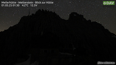 Meilerhütte - Wetterstein - Blick zur Hütte1.4 km from the summit
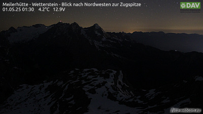 Meilerhütte - Wetterstein - Blick nach Nordwesten zur Zugspitze1.4 km from the summit
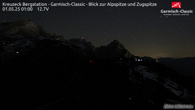 Kreuzeck Bergstation - Garmisch-Classic - Blick zur Alpspitze und Zugspitze4.7 km from the summit
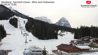 Hausberg - Garmisch-Classic - Blick nach Südwesten5.1 km from the summit