Schrandele
3,393 m11,132 ft
Mountain · Stubai Alps · Austria
Das Schrandele ist ein 3392 m ü. A. hoher Berg in den Alpeiner Bergen, einer Untergruppe der Stubaier Alpen im österreichischen Bundesland Tirol. Der Berg hat die Form einer steilen Pyramide, die aus der Umgebung deutlich hervorragt.
From German Wikipedia, CC BY-SA · Read the article
At the summit · forecast for 12:00 AM
-5 °CMostly clear · wind 4 km/h from the W
 See it in 3D
Weather at the summit of Schrandele, 3,393 m
- 12:00 AM-5 °CW 4 km/h–
- 3:00 AM-4 °CW 5 km/h–
- 6:00 AM-6 °CW 3 km/h–
- 9:00 AM-3 °CW 3 km/h–
- 12:00 PM-0 °CNW 4 km/h–
- 3:00 PM-0 °CNW 4 km/h–
- 6:00 PM-4 °CW 4 km/h–
- 9:00 PM-5 °CNW 4 km/h–
| Day | Sky | High / low | Rain | Wind up to |
|---|---|---|---|---|
| Today | Clear | -0 °C / -7 °C | – | 5 km/h |
| Wed, Oct 28 | Cloudy | -4 °C / -8 °C | 0.8 mm | 6 km/h |
| Thu, Oct 29 | Mostly clear | -4 °C / -13 °C | – | 4 km/h |
| Fri, Oct 30 | Clear | -3 °C / -10 °C | – | 5 km/h |
| Sat, Oct 31 | Mostly clear | -4 °C / -10 °C | – | 7 km/h |
| Sun, Nov 1 | Mostly clear | -4 °C / -10 °C | 0.2 mm | 7 km/h |
| Mon, Nov 2 | Light snow | -8 °C / -10 °C | 2.8 mm | 7 km/h |
Forecast by MET Norway (CC BY 4.0), updated 08:16 PM GMT+1. Times are local.
Facts
- What it is
- Mountain
- Height above sea level
- 3,393 m (11,132 ft)
- Isolation
- 1.4 km to higher ground
- Range
- Stubai Alps
- Country
- Austria
- First ascent
- 1870
- Coordinates
- 47.055°N 11.111°E
- Source
- Wikidata, CC0
Schrandele
Berg in Tirol
Das Schrandele ist ein 3392 m ü. A. hoher Berg in den Alpeiner Bergen, einer Untergruppe der Stubaier Alpen im österreichischen Bundesland Tirol. Der Berg hat die Form einer steilen Pyramide, die aus der Umgebung deutlich hervorragt. Das Schrandele sendet nach allen vier Himmelsrichtungen rechtwinklig ausgeprägte Grate aus, die aus der Vogelperspektive eine Kreuzform ergeben.
From German Wikipedia, CC BY-SA · Read the article
Peaks near Schrandele
- Zuckerhütl3,507 m · 11 km awayOn the map
- Wildspitze3,768 m · 26 km awayOn the map
- Bergisel746 m · 31 km awayOn the map
- Patscherkofel2,246 m · 32 km awayOn the map
- Nordkette2,637 m · 33 km awayOn the map
- Hintere Schwärze3,624 m · 35 km awayOn the map
- Similaun3,597 m · 37 km awayOn the map
- Hochwanner2,744 m · 38 km awayOn the map
- Schneefernerkopf2,874 m · 41 km awayOn the map
- Weißkugel3,738 m · 41 km awayOn the map
Highest in the Stubai Alps
- Zuckerhütl3,507 mOn the map
- Schrankogel3,497 mOn the map
- Ruderhofspitze3,474 mOn the map
- Schrandele3,393 mOn the map
- Wilde Leck3,359 mOn the map
- Strahlkogel3,288 mOn the map
- Habicht3,277 mOn the map
- Östlicher Feuerstein3,268 mOn the map
- Botzer3,250 mOn the map
Highest mountains in Austria
- Grossglockner3,798 mOn the map
- Wildspitze3,768 mOn the map
- Weißkugel3,738 mOn the map
- Großvenediger3,657 mOn the map
- Hintere Schwärze3,624 mOn the map
- Großes Wiesbachhorn3,564 mOn the map
- Ramolkogel3,549 mOn the map
- Schalfkogel3,537 mOn the map
- Watzespitze3,532 mOn the map
- Fineilspitze3,514 mOn the map
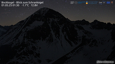
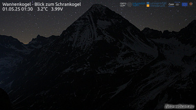
Webcams near Schrandele

History around Schrandele
Towns near Schrandele
- Telfs28 km away
- Innsbruck32 km away
- Merano43 km away
- Garmisch-Partenkirchen49 km away
- Bressanone56 km away
- Bolzano65 km away