Mountains in United States
Silvertip Peak
6,138 ft1,871 m
Mountain · North Cascades · United States
Silvertip Peak is a 6,140-foot (1,870-metre) mountain summit located in the North Cascades, in Snohomish County of Washington state. It is situated 3.5 miles south of Barlow Pass along the Mountain Loop Highway, in the Henry M. Jackson Wilderness, on land managed by Mount Baker-Snoqualmie National Forest.
From Wikipedia, CC BY-SA · Read the article
At the summit · forecast for 10:00 PM
26 °FSnow · wind 8 mph from the SW
 See it in 3D
Weather at the summit of Silvertip Peak, 6,138 ft
- 10:00 PM26 °FSW 8 mph0.26 in
- 1:00 AM25 °FS 5 mph0.29 in
- 4:00 AM24 °FS 5 mph0.24 in
- 7:00 AM22 °FS 5 mph0.26 in
- 10:00 AM25 °FS 4 mph0.2 in
- 1:00 PM26 °FS 5 mph0.06 in
- 4:00 PM26 °FS 5 mph0.03 in
- 7:00 PM23 °FSE 3 mph0.03 in
| Day | Sky | High / low | Rain | Wind up to |
|---|---|---|---|---|
| Wed, Oct 28 | Snow | 26 °F / 22 °F | 1.25 in | 6 mph |
| Thu, Oct 29 | Partly cloudy | 31 °F / 14 °F | – | 10 mph |
| Fri, Oct 30 | Snow | 26 °F / 10 °F | 0.23 in | 7 mph |
| Sat, Oct 31 | Mostly clear | 31 °F / 12 °F | – | 2 mph |
| Sun, Nov 1 | Mostly clear | 30 °F / 18 °F | – | 2 mph |
| Mon, Nov 2 | Cloudy | 38 °F / 24 °F | – | 6 mph |
| Tue, Nov 3 | Partly cloudy | 39 °F / 27 °F | – | 2 mph |
Forecast by MET Norway (CC BY 4.0), updated 06:17 PM PDT. Times are local.
Facts
- What it is
- Mountain
- Height above sea level
- 6,138 ft (1,871 m)
- Range
- North Cascades
- Country
- United States
- Coordinates
- 47.975°N 121.420°W
- Source
- Wikidata, CC0
Peaks near Silvertip Peak
- Wilmans Peaks6,883 ft · 4.1 km awayOn the map
- Columbia Peak7,172 ft · 4.6 km awayOn the map
- Cadet Peak7,185 ft · 5.4 km awayOn the map
- Sheep Mountain6,166 ft · 5.5 km awayOn the map
- Monte Cristo Peak7,136 ft · 5.9 km awayOn the map
- Sperry Peak6,119 ft · 7.6 km awayOn the map
- Vesper Peak6,221 ft · 8.4 km awayOn the map
- Sloan Peak7,835 ft · 9.5 km awayOn the map
- Big Four Mountain6,181 ft · 11 km awayOn the map
- Mount Dickerman5,722 ft · 11 km awayOn the map
Highest in the North Cascades
- Glacier Peak10,541 ftOn the map
- Bonanza Peak9,516 ftOn the map
- Goode Mountain9,206 ftOn the map
- Buckner Mountain9,114 ftOn the map
- Mount Logan9,087 ftOn the map
- Eldorado Peak8,868 ftOn the map
- Forbidden Peak8,815 ftOn the map
- Clark Mountain8,602 ftOn the map
- Silvertip Peak6,138 ftOn the map
Highest mountains in United States
- Denali20,308 ftOn the map
- Mount Saint Elias18,009 ftOn the map
- Mount Foraker17,402 ftOn the map
- Mount Bona16,535 ftOn the map
- Mount Blackburn16,390 ftOn the map
- Mount Sanford16,237 ftOn the map
- Mount Vancouver15,787 ftOn the map
- Mount Churchill15,636 ftOn the map
- Mount Fairweather15,325 ftOn the map
- Mount Hubbard14,951 ftOn the map
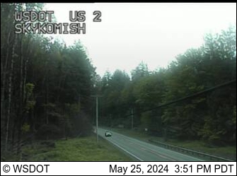
Webcams near Silvertip Peak

Towns near Silvertip Peak
- Sultan31 km away
- Granite Falls43 km away
- Monroe43 km away
- Lake Stevens48 km away
- Snohomish50 km away
- West Lake Stevens51 km away