Steamboat Springs, Nevada
4,642 ft1,415 m
Mountain · United States
Steamboat Springs is a small volcanic field of rhyolitic lava domes and flows in western Nevada, located south of Reno. There is extensive geothermal activity in the area, including numerous hot springs, steam vents, and fumaroles.
From Wikipedia, CC BY-SA · Read the article
At the summit · forecast for 3:00 PM
57 °FClear · wind 4 mph from the E
 See it in 3D
Weather at the summit of Steamboat Springs, Nevada, 4,642 ft
- 3:00 PM57 °FE 4 mph–
- 6:00 PM52 °FN 3 mph–
- 9:00 PM46 °FS 3 mph–
- 12:00 AM42 °FS 3 mph–
- 3:00 AM40 °FS 1 mph–
- 6:00 AM40 °FS 1 mph–
- 9:00 AM44 °FSE 1 mph–
- 12:00 PM54 °FSE 3 mph–
| Day | Sky | High / low | Rain | Wind up to |
|---|---|---|---|---|
| Thu, Oct 29 | Cloudy | 59 °F / 40 °F | 0 in | 9 mph |
| Fri, Oct 30 | Light rain | 56 °F / 42 °F | 0.04 in | 11 mph |
| Sat, Oct 31 | Light rain | 52 °F / 39 °F | 0.57 in | 3 mph |
| Sun, Nov 1 | Partly cloudy | 44 °F / 36 °F | 0.04 in | 7 mph |
| Mon, Nov 2 | Mostly clear | 50 °F / 33 °F | – | 4 mph |
| Tue, Nov 3 | Partly cloudy | 57 °F / 35 °F | – | 4 mph |
| Wed, Nov 4 | Cloudy | 58 °F / 41 °F | – | 3 mph |
Forecast by MET Norway (CC BY 4.0), updated 12:18 PM PDT. Times are local.
Facts
- What it is
- Mountain
- Height above sea level
- 4,642 ft (1,415 m)
- Country
- United States
- Coordinates
- 39.375°N 119.720°W
- Volcano number
- 326801 at the Global Volcanism Program
- Source
- Wikidata, CC0
Steamboat Springs (Nevada)
Geothermal area in Nevada, United States
Steamboat Springs is a small volcanic field of rhyolitic lava domes and flows in western Nevada, located south of Reno. There is extensive geothermal activity in the area, including numerous hot springs, steam vents, and fumaroles. The residential portions of this area, located mostly east of Steamboat Creek and south of modern-day SR 341, are now known simply as Steamboat.
From Wikipedia, CC BY-SA · Read the article
Peaks near Steamboat Springs, Nevada
- Mount Davidson7,868 ft · 8.9 km awayOn the map
- Slide Mountain9,702 ft · 16 km awayOn the map
- Mount Rose10,785 ft · 17 km awayOn the map
- Mount Baldy9,275 ft · 26 km awayOn the map
- Snow Valley Peak9,218 ft · 28 km awayOn the map
- Peavine Peak8,269 ft · 30 km awayOn the map
- Crystal Peak8,107 ft · 38 km awayOn the map
- Mount Pluto, California8,617 ft · 39 km awayOn the map
- Tinker Knob8,950 ft · 51 km awayOn the map
- East Peak9,595 ft · 51 km awayOn the map
Highest mountains in United States
- Denali20,308 ftOn the map
- Mount Saint Elias18,009 ftOn the map
- Mount Foraker17,402 ftOn the map
- Mount Bona16,535 ftOn the map
- Mount Blackburn16,390 ftOn the map
- Mount Sanford16,237 ftOn the map
- Mount Vancouver15,787 ftOn the map
- Mount Churchill15,636 ftOn the map
- Mount Fairweather15,325 ftOn the map
- Mount Hubbard14,951 ftOn the map
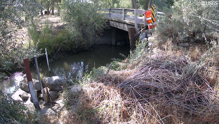
Webcams near Steamboat Springs, Nevada
History around Steamboat Springs, Nevada
- Grand Sierra Resort shooting2025
- Galaxy Airlines Flight 2031985
- Perry Fire2018
- A false alarm leads to Republican presidential nominee Donald Trump being rushed off stage by United States Secret Service agents at a campaign rally in Reno2016
- Little Valley Fire2016
- Caughlin Fire2011
- Pine Middle School shooting2006
- Reno U-Haul murders1994
Towns near Steamboat Springs, Nevada
- Sparks18 km away
- Reno19 km away
- Carson City24 km away
- Sun Valley25 km away
- Spanish Springs30 km away
- Truckee40 km away