Mountains in Germany
Toter Mann
1,039 m3,409 ft
Mountain · Lattengebirge · Germany
Der Tote Mann ist ein 1392 m ü. NHN hoher Berg in den Berchtesgadener Alpen, am südlichen Ende des Lattenbergmassivs. Er liegt auf der Gemeindegrenze zwischen Ramsau bei Berchtesgaden und Bischofswiesen.
From German Wikipedia, CC BY-SA · Read the article
 See it in 3D
Facts
- What it is
- Mountain
- Height above sea level
- 1,039 m (3,409 ft)
- Range
- Lattengebirge
- Country
- Germany
- Coordinates
- 47.631°N 12.924°E
- Source
- Wikidata, CC0
Peaks near Toter Mann
- Karkopf1,738 m · 6.6 km awayOn the map
- Schottmalhorn1,982 m · 7.3 km awayOn the map
- Hochkalter2,607 m · 8.1 km awayOn the map
- Berchtesgadener Hochthron1,972 m · 8.4 km awayOn the map
- Stadelhorn2,286 m · 11 km awayOn the map
- Hoher Göll2,522 m · 11 km awayOn the map
- Großer Hundstod2,594 m · 13 km awayOn the map
- Hochstaufen1,771 m · 15 km awayOn the map
- Grießkogel2,543 m · 18 km awayOn the map
- Sonntagshorn1,961 m · 18 km awayOn the map
Highest in the Lattengebirge
- Karkopf1,738 mOn the map
- Schlafende Hexe1,460 mOn the map
- Toter Mann1,039 mOn the map
Highest mountains in Germany
- Zugspitze2,962 mOn the map
- Hochwanner2,744 mOn the map
- Dreitorspitze2,682 mOn the map
- Hochkalter2,607 mOn the map
- Biberkopf2,599 mOn the map
- Großer Hundstod2,594 mOn the map
- Hochvogel2,592 mOn the map
- Östliche Karwendelspitze2,538 mOn the map
- Hocheisspitze2,523 mOn the map
- Hoher Göll2,522 mOn the map
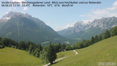
Webcams near Toter Mann


History around Toter Mann
Towns near Toter Mann
- Bad Reichenhall11 km away
- Salzburg21 km away
- Saalfelden am Steinernen Meer23 km away
- Freilassing24 km away
- Traunstein34 km away
- Traunreut44 km away