Larchetkarspitze
2.541 m8.337 pés
Montanha · Hinterautal-Vomper Chain · Áustria
Die Larchetkarspitze ist ein 2541 m ü. A. hoher Berg zwischen der Pleisenspitze im Westen und der Großen Riedlkarspitze im Osten in der Hinterautal-Vomper-Kette. Sie wird im Winter und Frühjahr gerne als Skitour gemacht und dient als lohnendes Ausweichziel zur Pleisenspitze.
Da Wikipédia em alemão, CC BY-SA · Ler o artigo
No cume · previsão para 10:00
2 °CNublado · vento de 7 km/h de NO
 Ver em 3D
Clima no cume de Larchetkarspitze, 2.541 m
- 10:002 °CNO 7 km/h1,6 mm
- 13:000 °CN 9 km/h1,7 mm
- 16:00-1 °CN 8 km/h0,1 mm
- 19:00-2 °CN 7 km/h0,3 mm
- 22:00-3 °CN 6 km/h–
- 1:00-4 °CN 4 km/h–
- 4:00-4 °CNE 3 km/h–
- 7:00-4 °CL 4 km/h–
| Dia | Céu | Máx. / mín. | Chuva | Vento até |
|---|---|---|---|---|
| Hoje | Neve forte | 2 °C / -3 °C | 3,7 mm | 9 km/h |
| qui., 29 de out. | Poucas nuvens | 1 °C / -7 °C | – | 8 km/h |
| sex., 30 de out. | Céu limpo | 1 °C / -8 °C | – | 9 km/h |
| sáb., 31 de out. | Céu limpo | 2 °C / -9 °C | – | 8 km/h |
| dom., 1 de nov. | Parcialmente nublado | -3 °C / -7 °C | – | 7 km/h |
| seg., 2 de nov. | Neve | -6 °C / -9 °C | 13,1 mm | 8 km/h |
| ter., 3 de nov. | Neve fraca | -7 °C / -10 °C | 3,2 mm | 7 km/h |
Previsão: MET Norway (CC BY 4.0), atualizada às 02:17 GMT+1. Horários locais.
Ficha técnica
- Tipo
- Montanha
- Altitude acima do nível do mar
- 2.541 m (8.337 pés)
- Isolamento
- a 0,8 km de um terreno mais alto
- Cordilheira
- Hinterautal-Vomper Chain
- País
- Áustria
- Primeira ascensão
- 3 de agosto de 1870
- Coordenadas
- 47.411°N 11.354°E
- Fonte
- Wikidata, CC0
Larchetkarspitze
Berg in Tirol
Die Larchetkarspitze ist ein 2541 m ü. A. hoher Berg zwischen der Pleisenspitze im Westen und der Großen Riedlkarspitze im Osten in der Hinterautal-Vomper-Kette. Sie wird im Winter und Frühjahr gerne als Skitour gemacht und dient als lohnendes Ausweichziel zur Pleisenspitze. Von der Pleisenhütte quert man entlang des Sommerweges hinein in das Mitterkar. Die Gipfelflanke ist ca.
Da Wikipédia em alemão, CC BY-SA · Ler o artigo
Picos perto de Larchetkarspitze
- Birkkarspitze2.749 m · a 6,3 kmNo mapa
- Kaltwasserkarspitze2.733 m · a 7,5 kmNo mapa
- Hafelekarspitze2.334 m · a 11 kmNo mapa
- Nordkette2.637 m · a 12 kmNo mapa
- Dreitorspitze2.682 m · a 17 kmNo mapa
- Bergisel746 m · a 19 kmNo mapa
- Wank1.780 m · a 19 kmNo mapa
- Krotenkopf2.086 m · a 19 kmNo mapa
- Hohe Munde2.662 m · a 22 kmNo mapa
- Hochwanner2.744 m · a 23 kmNo mapa
Os mais altos de Hinterautal-Vomper Chain
- Große Seekarspitze2.677 mNo mapa
- Pleisenspitze2.569 mNo mapa
- Hochnissl2.547 mNo mapa
- Larchetkarspitze2.541 mNo mapa
Montanhas mais altas de Áustria
- Grossglockner3.798 mNo mapa
- Wildspitze3.768 mNo mapa
- Weißkugel3.738 mNo mapa
- Großvenediger3.657 mNo mapa
- Hintere Schwärze3.624 mNo mapa
- Großes Wiesbachhorn3.564 mNo mapa
- Ramolkogel3.549 mNo mapa
- Schalfkogel3.537 mNo mapa
- Watzespitze3.532 mNo mapa
- Fineilspitze3.514 mNo mapa
Webcams perto de Larchetkarspitze
 IR night vision | Tunnel Porta Claudia Nord Rchtg. Seefeld B177 km 21.0a 6,8 km do cume
B177, B177: km 21,00: Tunnel Porta Claudia Nord: Richtg. Seefeld, Blickrichtung Seefelda 6,8 km do cume
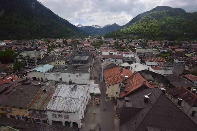 Alpenwelt Karwendel - Mittenwald Kirchea 7,9 km do cume
B177, Tunnel Porta Claudia Süd Rchtg. Seefeld, Blickrichtung Seefelda 8 km do cume
História ao redor de Larchetkarspitze
- The 1964 Winter Olympics are held in Innsbruck, Austria1964
- G7 leaders gather for a summit in Germany to discuss the situation in Ukraine2022
- Battles of Bergisel1809
- Fourth Battle of Bergisel1809
- Third Battle of Bergisel1809
- Second Battle of Bergisel1809
- First Battle of Bergisel1809
- Battle of Innsbruck1809