Larchetkarspitze
2,541 m8,337 ft
Mountain · Hinterautal-Vomper Chain · Austria
Die Larchetkarspitze ist ein 2541 m ü. A. hoher Berg zwischen der Pleisenspitze im Westen und der Großen Riedlkarspitze im Osten in der Hinterautal-Vomper-Kette. Sie wird im Winter und Frühjahr gerne als Skitour gemacht und dient als lohnendes Ausweichziel zur Pleisenspitze.
From German Wikipedia, CC BY-SA · Read the article
At the summit · forecast for 12:00 AM
0 °CPartly cloudy · wind 5 km/h from the N
 See it in 3D
Weather at the summit of Larchetkarspitze, 2,541 m
- 12:00 AM0 °CN 5 km/h–
- 3:00 AM-1 °CN 7 km/h–
- 6:00 AM-2 °CN 5 km/h–
- 9:00 AM1 °CNE 4 km/h–
- 12:00 PM4 °CNW 8 km/h4.5 mm
- 3:00 PM-0 °CN 9 km/h1.4 mm
- 6:00 PM-2 °CN 8 km/h0.8 mm
- 9:00 PM-2 °CN 6 km/h0.2 mm
| Day | Sky | High / low | Rain | Wind up to |
|---|---|---|---|---|
| Wed, Oct 28 | Sleet | 4 °C / -3 °C | 6.9 mm | 9 km/h |
| Thu, Oct 29 | Clear | 1 °C / -6 °C | – | 8 km/h |
| Fri, Oct 30 | Clear | 1 °C / -8 °C | – | 8 km/h |
| Sat, Oct 31 | Clear | 3 °C / -8 °C | – | 6 km/h |
| Sun, Nov 1 | Clear | 1 °C / -8 °C | – | 5 km/h |
| Mon, Nov 2 | Mostly clear | -3 °C / -8 °C | 0.7 mm | 7 km/h |
| Tue, Nov 3 | Partly cloudy | -4 °C / -8 °C | 4.3 mm | 8 km/h |
Forecast by MET Norway (CC BY 4.0), updated 08:17 PM GMT+1. Times are local.
Facts
- What it is
- Mountain
- Height above sea level
- 2,541 m (8,337 ft)
- Isolation
- 0.8 km to higher ground
- Range
- Hinterautal-Vomper Chain
- Country
- Austria
- First ascent
- August 3, 1870
- Coordinates
- 47.411°N 11.354°E
- Source
- Wikidata, CC0
Larchetkarspitze
Berg in Tirol
Die Larchetkarspitze ist ein 2541 m ü. A. hoher Berg zwischen der Pleisenspitze im Westen und der Großen Riedlkarspitze im Osten in der Hinterautal-Vomper-Kette. Sie wird im Winter und Frühjahr gerne als Skitour gemacht und dient als lohnendes Ausweichziel zur Pleisenspitze. Von der Pleisenhütte quert man entlang des Sommerweges hinein in das Mitterkar. Die Gipfelflanke ist ca.
From German Wikipedia, CC BY-SA · Read the article
Peaks near Larchetkarspitze
- Birkkarspitze2,749 m · 6.3 km awayOn the map
- Kaltwasserkarspitze2,733 m · 7.5 km awayOn the map
- Hafelekarspitze2,334 m · 11 km awayOn the map
- Nordkette2,637 m · 12 km awayOn the map
- Dreitorspitze2,682 m · 17 km awayOn the map
- Bergisel746 m · 19 km awayOn the map
- Wank1,780 m · 19 km awayOn the map
- Krottenkopf2,086 m · 19 km awayOn the map
- Hohe Munde2,662 m · 22 km awayOn the map
- Hochwanner2,744 m · 23 km awayOn the map
Highest in the Hinterautal-Vomper Chain
- Große Seekarspitze2,677 mOn the map
- Pleisenspitze2,569 mOn the map
- Hochnissl2,547 mOn the map
- Larchetkarspitze2,541 mOn the map
Highest mountains in Austria
- Grossglockner3,798 mOn the map
- Wildspitze3,768 mOn the map
- Weißkugel3,738 mOn the map
- Großvenediger3,657 mOn the map
- Hintere Schwärze3,624 mOn the map
- Großes Wiesbachhorn3,564 mOn the map
- Ramolkogel3,549 mOn the map
- Schalfkogel3,537 mOn the map
- Watzespitze3,532 mOn the map
- Fineilspitze3,514 mOn the map
Webcams near Larchetkarspitze
 IR night vision | Tunnel Porta Claudia Nord Rchtg. Seefeld B177 km 21.06.8 km from the summit
B177, B177: km 21,00: Tunnel Porta Claudia Nord: Richtg. Seefeld, Blickrichtung Seefeld6.8 km from the summit
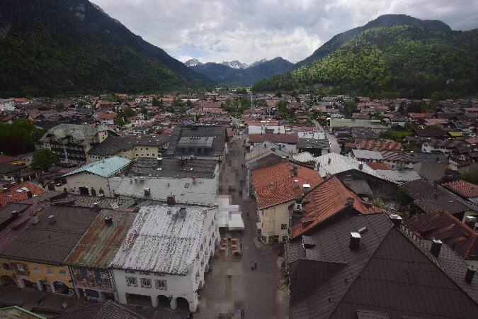 Alpenwelt Karwendel - Mittenwald Kirche7.9 km from the summit
B177, Tunnel Porta Claudia Süd Rchtg. Seefeld, Blickrichtung Seefeld8 km from the summit
History around Larchetkarspitze
- The 1964 Winter Olympics are held in Innsbruck, Austria1964
- G7 leaders gather for a summit in Germany to discuss the situation in Ukraine2022
- Battles of Bergisel1809
- Fourth Battle of Bergisel1809
- Third Battle of Bergisel1809
- Second Battle of Bergisel1809
- First Battle of Bergisel1809
- Battle of Innsbruck1809