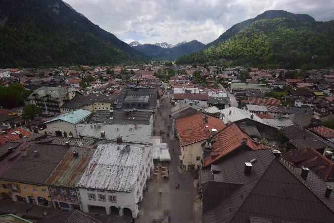
Wörner
2.474 m8.117 pés
Montanha · Northern Karwendel Chain · Alemanha · Áustria
The Wörner is a 2,476 m high mountain in the Karwendel on the border between Bavaria and Tyrol. It is part of the Northern Karwendel Chain that initially runs northwards to the Wörner and then swings east.
Da Wikipedia, CC BY-SA · Ler o artigo
No cume · previsão para 2:00
-4 °CParcialmente nublado · vento de 6 km/h de S
 Ver em 3D
Clima no cume de Wörner, 2.474 m
- 2:00-4 °CS 6 km/h–
- 5:00-2 °CS 6 km/h–
- 8:00-1 °CS 8 km/h–
- 11:008 °CS 4 km/h–
- 14:009 °CN 6 km/h–
- 17:004 °CSE 1 km/h–
- 20:001 °CS 3 km/h–
- 23:001 °CS 3 km/h–
| Dia | Céu | Máx. / mín. | Chuva | Vento até |
|---|---|---|---|---|
| Hoje | Céu limpo | 9 °C / -4 °C | – | 8 km/h |
| qua., 28 de out. | Neve | 2 °C / -3 °C | 3,3 mm | 9 km/h |
| qui., 29 de out. | Parcialmente nublado | 2 °C / -4 °C | – | 9 km/h |
| sex., 30 de out. | Céu limpo | 1 °C / -7 °C | – | 6 km/h |
| sáb., 31 de out. | Céu limpo | 4 °C / -7 °C | – | 6 km/h |
| dom., 1 de nov. | Céu limpo | 4 °C / -7 °C | – | 5 km/h |
| seg., 2 de nov. | Céu limpo | 1 °C / -7 °C | – | 5 km/h |
Previsão: MET Norway (CC BY 4.0), atualizada às 00:19 GMT+1. Horários locais.
Ficha técnica
- Tipo
- Montanha
- Altitude acima do nível do mar
- 2.474 m (8.117 pés)
- Isolamento
- a 0,9 km de um terreno mais alto
- Cordilheira
- Northern Karwendel Chain
- Coordenadas
- 47.450°N 11.339°E
- Fonte
- Wikidata, CC0
Wörner (Alps)
Mountain on the border of Austria and Germany
The Wörner is a 2,476 m high mountain in the Karwendel on the border between Bavaria and Tyrol. It is part of the Northern Karwendel Chain that initially runs northwards to the Wörner and then swings east. The northwest ridge (Nordwestgrat) of the Wörner is very striking and easy to make out from many other peaks in the region.
Da Wikipedia, CC BY-SA · Ler o artigo
Picos perto de Wörner
- Birkkarspitze2.749 m · a 8,6 kmNo mapa
- Kaltwasserkarspitze2.733 m · a 10 kmNo mapa
- Hafelekarspitze2.334 m · a 15 kmNo mapa
- Krotenkopf2.086 m · a 15 kmNo mapa
- Wank1.780 m · a 16 kmNo mapa
- Nordkette2.637 m · a 17 kmNo mapa
- Dreitorspitze2.682 m · a 17 kmNo mapa
- Herzogstand1.731 m · a 18 kmNo mapa
- Alpspitze2.628 m · a 22 kmNo mapa
- Hochwanner2.744 m · a 22 kmNo mapa
Os mais altos de Northern Karwendel Chain
- Östliche Karwendelspitze2.538 mNo mapa
- Wörner2.474 mNo mapa
- Westliche Karwendelspitze2.385 mNo mapa
Montanhas mais altas de Alemanha
- Zugspitze2.962 mNo mapa
- Hochwanner2.744 mNo mapa
- Dreitorspitze2.682 mNo mapa
- Hochkalter2.607 mNo mapa
- Biberkopf2.599 mNo mapa
- Grosser Hundstod2.594 mNo mapa
- Hochvogel2.592 mNo mapa
- Östliche Karwendelspitze2.538 mNo mapa
- Hocheisspitze2.523 mNo mapa
- Hoher Göll2.522 mNo mapa