Hochries
1569 m5148 ft
Montaña · Alpes del Chiemgau · Alemania
Hochries is a mountain in Bavaria, Germany. It is 1569 m high, and is located in the north-western part of the Chiemgauer Alpen. The summit can be reached by cable car from Grainbach. Starting from the village, a chairlift takes you to the middle station at 920 m above sea level.
De Wikipedia, CC BY-SA · Leer el artículo
En la cumbre · pronóstico para las 17:00
4 °CLluvia · viento de 13 km/h del NO
 Verla en 3D
Clima en la cumbre de Hochries, 1569 m
- 17:004 °CNO 13 km/h2,1 mm
- 20:003 °CO 12 km/h1,3 mm
- 23:003 °CNO 6 km/h0,6 mm
- 2:002 °CNO 5 km/h–
- 5:001 °CNO 4 km/h–
- 8:001 °CN 3 km/h–
- 11:003 °CN 5 km/h–
- 14:004 °CNE 9 km/h–
| Día | Cielo | Máx. / mín. | Lluvia | Viento hasta |
|---|---|---|---|---|
| jue, 29 oct | Nublado | 5 °C / -0 °C | 0,4 mm | 10 km/h |
| vie, 30 oct | Despejado | 4 °C / -2 °C | – | 15 km/h |
| sáb, 31 oct | Despejado | 3 °C / -4 °C | – | 6 km/h |
| dom, 1 nov | Nublado | 2 °C / -2 °C | 0,4 mm | 6 km/h |
| lun, 2 nov | Nieve fuerte | -1 °C / -2 °C | 16,2 mm | 7 km/h |
| mar, 3 nov | Nieve | -1 °C / -2 °C | 9,4 mm | 5 km/h |
| mié, 4 nov | Parcialmente nublado | -0 °C / -4 °C | – | 5 km/h |
Pronóstico de MET Norway (CC BY 4.0), actualizado a las 00:17 CET. Horas locales.
Ficha técnica
- Tipo
- Montaña
- Altitud sobre el nivel del mar
- 1569 m (5148 ft)
- Aislamiento
- a 4 km de un terreno más alto
- Cordillera
- Alpes del Chiemgau
- País
- Alemania
- Coordenadas
- 47.747°N 12.249°E
- Fuente
- Wikidata, CC0
Hochries
Hochries is a mountain in Bavaria, Germany. It is 1569 m high, and is located in the north-western part of the Chiemgauer Alpen. The summit can be reached by cable car from Grainbach. Starting from the village, a chairlift takes you to the middle station at 920 m above sea level. From there, a cable car leads to the summit.
De Wikipedia, CC BY-SA · Leer el artículo
Picos cerca de Hochries
- Kampenwand1669 m · a 8,7 kmEn el mapa
- Petersköpfl1745 m · a 15 kmEn el mapa
- Naunspitze1633 m · a 15 kmEn el mapa
- Pyramidenspitze1997 m · a 15 kmEn el mapa
- Feldberg1813 m · a 18 kmEn el mapa
- Wendelstein1838 m · a 18 kmEn el mapa
- Totenkirchl2190 m · a 20 kmEn el mapa
- Predigtstuhl2116 m · a 20 kmEn el mapa
- Fleischbank2186 m · a 20 kmEn el mapa
- Hackenköpfe2126 m · a 21 kmEn el mapa
Los más altos de Alpes del Chiemgau
- Sonntagshorn1961 mEn el mapa
- Steinplatte1869 mEn el mapa
- Geigelstein1808 mEn el mapa
- Dürrnbachhorn1776 mEn el mapa
- Fellhorn1764 mEn el mapa
- Hochgern1748 mEn el mapa
- Gurnwandkopf1691 mEn el mapa
- Hochfelln1674 mEn el mapa
- Hochries1569 mEn el mapa
Montañas más altas de Alemania
- Zugspitze2962 mEn el mapa
- Hochwanner2744 mEn el mapa
- Dreitorspitze2682 mEn el mapa
- Hochkalter2607 mEn el mapa
- Biberkopf2599 mEn el mapa
- Großer Hundstod2594 mEn el mapa
- Hochvogel2592 mEn el mapa
- Östliche Karwendelspitze2538 mEn el mapa
- Hocheisspitze2523 mEn el mapa
- Hoher Göll2522 mEn el mapa
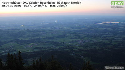
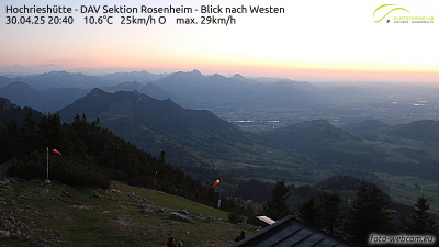
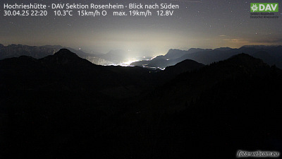
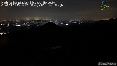
Cámaras web cerca de Hochries

Historia alrededor de Hochries
Ciudades cerca de Hochries
- Rosenheima 15 km
- Kolbermoora 18 km
- Bad Aiblinga 22 km
- Bruckmühla 29 km
- Traunsteina 32 km
- Traunreuta 35 km