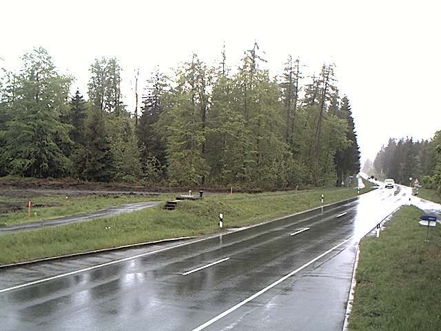
Kulm
482 m1 581 ft
Colline · Saale-Elster-Sandsteinplatte · Allemagne
The Kulm is a hill, 481.9 m above sea level (NHN), near Saalfeld in the German state of Thuringia. It lies east of the Saale valley at the western tip of the Saale 'Knee' and is the local hill of the towns of Saalfeld and Rudolstadt.
Source : Wikipedia, CC BY-SA · Lire l’article
Le point culminant de Saale-Elster-Sandsteinplatte
Au sommet · prévision pour 20:00
5 °CPlutôt dégagé · vent 7 km/h du O
 Voir en 3D
Météo au sommet : Kulm, 482 m
- 20:005 °CO 7 km/h–
- 23:003 °CO 6 km/h–
- 2:002 °CO 5 km/h–
- 5:001 °CSO 4 km/h–
- 8:001 °CSO 5 km/h–
- 11:009 °CO 3 km/h–
- 14:0011 °CN 7 km/h–
- 17:008 °CN 4 km/h–
| Jour | Ciel | Max. / min. | Pluie | Vent jusqu’à |
|---|---|---|---|---|
| jeu. 29 oct. | Nuageux | 11 °C / 0 °C | – | 8 km/h |
| ven. 30 oct. | Nuageux | 10 °C / 4 °C | – | 9 km/h |
| sam. 31 oct. | Nuageux | 8 °C / 5 °C | 0,5 mm | 9 km/h |
| dim. 1 nov. | Nuageux | 7 °C / 3 °C | 0,5 mm | 11 km/h |
| lun. 2 nov. | Nuageux | 5 °C / 1 °C | 0,1 mm | 6 km/h |
| mar. 3 nov. | Nuageux | 6 °C / 1 °C | 0,3 mm | 9 km/h |
| mer. 4 nov. | Nuageux | 5 °C / 3 °C | 0,2 mm | 9 km/h |
Prévisions de MET Norway (CC BY 4.0), mises à jour à 18:20 UTC+1. Heures locales.
Fiche technique
- Type
- Colline
- Altitude
- 482 m (1 581 ft)
- Proéminence
- 195 m (640 ft)
- Massif
- Saale-Elster-Sandsteinplatte
- Pays
- Allemagne
- Point culminant de
- Saale-Elster-Sandsteinplatte
- Coordonnées
- 50.683°N 11.369°E
- Source
- Wikidata, CC0
Kulm (Saalfeld)
Hill in Thuringia, Germany
The Kulm is a hill, 481.9 m above sea level (NHN), near Saalfeld in the German state of Thuringia. It lies east of the Saale valley at the western tip of the Saale 'Knee' and is the local hill of the towns of Saalfeld and Rudolstadt. From the Kulm there is a panoramic view over the valleys of the Saale and Rinne, the Orla Basin, the Thuringian Highland and the Ilm-Saale Plateau.
Source : Wikipedia, CC BY-SA · Lire l’article
Sommets près de Kulm
- Aßberg703 m · à 17 kmSur la carte
- Walpersberg311 m · à 18 kmSur la carte
- Rauhhügel802 m · à 19 kmSur la carte
- Spitzer Berg790 m · à 19 kmSur la carte
- Mutzenberg770 m · à 20 kmSur la carte
- Hahnberg686 m · à 21 kmSur la carte
- Sauhügel720 m · à 21 kmSur la carte
- Hettstädt808 m · à 22 kmSur la carte
- Mittelberg804 m · à 23 kmSur la carte
- Rückersbiel756 m · à 23 kmSur la carte
Les plus hauts : Saale-Elster-Sandsteinplatte
- Kulm482 mSur la carte
- Dohlenstein366 mSur la carte
Plus hautes montagnes : Allemagne
- Zugspitze2 962 mSur la carte
- Hochwanner2 744 mSur la carte
- Dreitorspitze2 682 mSur la carte
- Hochkalter2 607 mSur la carte
- Biberkopf2 599 mSur la carte
- Grosser Hundstod2 594 mSur la carte
- Hochvogel2 592 mSur la carte
- Östliche Karwendelspitze2 538 mSur la carte
- Hocheisspitze2 523 mSur la carte
- Hoher Göll2 522 mSur la carte