Kulm
482 m1.581 pés
Colina · Saale-Elster-Sandsteinplatte · Alemanha
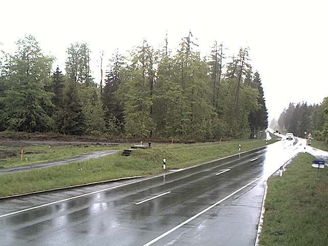
The Kulm is a hill, 481.9 m above sea level (NHN), near Saalfeld in the German state of Thuringia. It lies east of the Saale valley at the western tip of the Saale 'Knee' and is the local hill of the towns of Saalfeld and Rudolstadt.
Da Wikipedia, CC BY-SA · Ler o artigo
O ponto mais alto de Saale-Elster-Sandsteinplatte
No cume · previsão para 22:00
4 °CPoucas nuvens · vento de 6 km/h de O
 Ver em 3D
Clima no cume de Kulm, 482 m
- 22:004 °CO 6 km/h–
- 1:003 °CO 6 km/h–
- 4:002 °CSO 5 km/h–
- 7:002 °CSO 4 km/h–
- 10:008 °CS 3 km/h–
- 13:0011 °CN 6 km/h–
- 16:0010 °CN 8 km/h–
- 19:006 °CN 4 km/h–
| Dia | Céu | Máx. / mín. | Chuva | Vento até |
|---|---|---|---|---|
| qui., 29 de out. | Nublado | 11 °C / 2 °C | – | 8 km/h |
| sex., 30 de out. | Parcialmente nublado | 11 °C / 3 °C | – | 9 km/h |
| sáb., 31 de out. | Nublado | 8 °C / 4 °C | 0,3 mm | 12 km/h |
| dom., 1 de nov. | Nublado | 7 °C / 3 °C | 0,5 mm | 11 km/h |
| seg., 2 de nov. | Nublado | 5 °C / 1 °C | 0,1 mm | 6 km/h |
| ter., 3 de nov. | Nublado | 6 °C / 1 °C | 0,3 mm | 9 km/h |
| qua., 4 de nov. | Nublado | 5 °C / 3 °C | 0,2 mm | 9 km/h |
Previsão: MET Norway (CC BY 4.0), atualizada às 20:20 GMT+1. Horários locais.
Ficha técnica
- Tipo
- Colina
- Altitude acima do nível do mar
- 482 m (1.581 pés)
- Proeminência
- 195 m (640 pés)
- Cordilheira
- Saale-Elster-Sandsteinplatte
- País
- Alemanha
- Ponto mais alto de
- Saale-Elster-Sandsteinplatte
- Coordenadas
- 50.683°N 11.369°E
- Fonte
- Wikidata, CC0
Kulm (Saalfeld)
Hill in Thuringia, Germany
The Kulm is a hill, 481.9 m above sea level (NHN), near Saalfeld in the German state of Thuringia. It lies east of the Saale valley at the western tip of the Saale 'Knee' and is the local hill of the towns of Saalfeld and Rudolstadt. From the Kulm there is a panoramic view over the valleys of the Saale and Rinne, the Orla Basin, the Thuringian Highland and the Ilm-Saale Plateau.
Da Wikipedia, CC BY-SA · Ler o artigo
Picos perto de Kulm
- Aßberg703 m · a 17 kmNo mapa
- Walpersberg311 m · a 18 kmNo mapa
- Rauhhügel802 m · a 19 kmNo mapa
- Spitzer Berg790 m · a 19 kmNo mapa
- Mutzenberg770 m · a 20 kmNo mapa
- Hahnberg686 m · a 21 kmNo mapa
- Sauhügel720 m · a 21 kmNo mapa
- Hettstädt808 m · a 22 kmNo mapa
- Mittelberg804 m · a 23 kmNo mapa
- Rückersbiel756 m · a 23 kmNo mapa
Os mais altos de Saale-Elster-Sandsteinplatte
- Kulm482 mNo mapa
- Dohlenstein366 mNo mapa
Montanhas mais altas de Alemanha
- Zugspitze2.962 mNo mapa
- Hochwanner2.744 mNo mapa
- Dreitorspitze2.682 mNo mapa
- Hochkalter2.607 mNo mapa
- Biberkopf2.599 mNo mapa
- Grosser Hundstod2.594 mNo mapa
- Hochvogel2.592 mNo mapa
- Östliche Karwendelspitze2.538 mNo mapa
- Hocheisspitze2.523 mNo mapa
- Hoher Göll2.522 mNo mapa