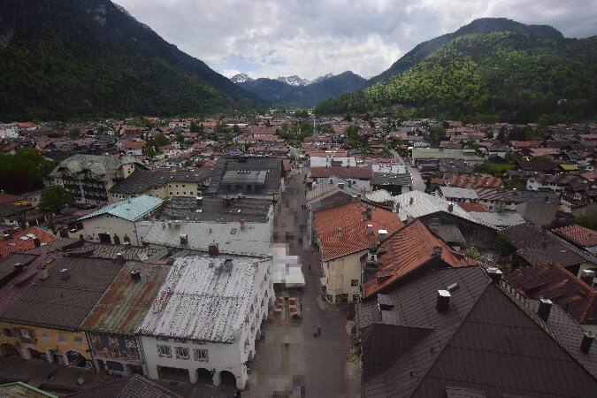
Hochkarspitze
2,482 m8,143 ft
山 · Northern Karwendel Chain · ドイツ · オーストリア
The Hochkarspitze is a 2,484 m high mountain in the Karwendel on the border between Bavaria and Tyrol. It is part of the Northern Karwendel Chain, which runs initially northwards before swinging east at the Wörner.
出典: Wikipedia、CC BY-SA · 記事を読む
山頂 · 8:00 の予報
1 °C曇り · 西の風 5 km/h
 3D で見る
Hochkarspitze 山頂の天気(2,482 m)
- 8:001 °C西 5 km/h–
- 11:003 °C北西 7 km/h3.4 mm
- 14:000 °C北西 8 km/h3.5 mm
- 17:00-1 °C北西 9 km/h1 mm
- 20:00-2 °C北西 6 km/h0.5 mm
- 23:00-2 °C北西 4 km/h0.2 mm
- 2:00-3 °C北 4 km/h–
- 5:00-3 °C北東 3 km/h–
| 日付 | 天気 | 最高 / 最低 | 雨 | 最大風速 |
|---|---|---|---|---|
| 今日 | 大雪 | 3 °C / -2 °C | 8.6 mm | 9 km/h |
| 10月29日(木) | 晴れ | 2 °C / -4 °C | – | 10 km/h |
| 10月30日(金) | 快晴 | 1 °C / -7 °C | – | 9 km/h |
| 10月31日(土) | 快晴 | 2 °C / -6 °C | – | 8 km/h |
| 11月1日(日) | 晴れ | 0 °C / -6 °C | – | 7 km/h |
| 11月2日(月) | 晴れ時々曇り | -3 °C / -7 °C | 1.8 mm | 8 km/h |
| 11月3日(火) | 雪 | -4 °C / -7 °C | 7.1 mm | 8 km/h |
MET Norway(CC BY 4.0)による予報。20:17 GMT+1 更新。時刻は現地時間です。
基本データ
- 種類
- 山
- 標高
- 2,482 m (8,143 ft)
- 孤立度
- より高い地点まで 4 km
- 山脈
- Northern Karwendel Chain
- 座標
- 47.447°N 11.350°E
Hochkarspitze
Mountain on the border between Germany and Austria
The Hochkarspitze is a 2,484 m high mountain in the Karwendel on the border between Bavaria and Tyrol. It is part of the Northern Karwendel Chain, which runs initially northwards before swinging east at the Wörner. The Hochkarspitze lies east of the Wörner summit and is the highest point of the massif that it forms jointly with the Wörner.
出典: Wikipedia、CC BY-SA · 記事を読む
Hochkarspitze周辺の山
- Birkkarspitze2,749 m · 7.7 km先地図上
- Kaltwasserkarspitze2,733 m · 9.2 km先地図上
- Hafelekarspitze2,334 m · 15 km先地図上
- Krottenkopf2,086 m · 16 km先地図上
- ノルトケッテ2,637 m · 16 km先地図上
- Wank1,780 m · 17 km先地図上
- Dreitorspitze2,682 m · 18 km先地図上
- Herzogstand1,731 m · 19 km先地図上
- ベルクイーゼル746 m · 23 km先地図上
- Alpspitze2,628 m · 23 km先地図上
Northern Karwendel Chainの最高峰
- Östliche Karwendelspitze2,538 m地図上
- Hochkarspitze2,482 m地図上
- Westliche Karwendelspitze2,385 m地図上
ドイツの高い山
- ツークシュピッツェ2,962 m地図上
- Hochwanner2,744 m地図上
- Dreitorspitze2,682 m地図上
- ホッホカルター2,607 m地図上
- Biberkopf2,599 m地図上
- Großer Hundstod2,594 m地図上
- Hochvogel2,592 m地図上
- Östliche Karwendelspitze2,538 m地図上
- Hocheisspitze2,523 m地図上
- Hoher Göll2,522 m地図上