Mountains in Germany
Asberg
430 m1,411 ft
Mountain · Westerwald · Germany
The Asberg is a hill, 441 m above sea level (NHN), on the Rheinwesterwald Volcanic Ridge on the northern edge of the Linz Heights. Until the 1970s it was the site of a basalt quarry.
From Wikipedia, CC BY-SA · Read the article
At the summit · forecast for 12:00 AM
10 °CPartly cloudy · wind 16 km/h from the S
 See it in 3D
Weather at the summit of Asberg, 430 m
- 12:00 AM10 °CS 16 km/h–
- 3:00 AM8 °CSE 12 km/h–
- 6:00 AM9 °CSE 15 km/h–
- 9:00 AM11 °CSE 17 km/h–
- 12:00 PM12 °CS 19 km/h–
- 3:00 PM14 °CS 17 km/h–
- 6:00 PM11 °CS 14 km/h–
- 9:00 PM11 °CS 11 km/h1.3 mm
| Day | Sky | High / low | Rain | Wind up to |
|---|---|---|---|---|
| Today | Partly cloudy | 14 °C / 8 °C | 1.3 mm | 19 km/h |
| Wed, Oct 28 | Mostly clear | 12 °C / 4 °C | 0.2 mm | 13 km/h |
| Thu, Oct 29 | Clear | 11 °C / 2 °C | – | 9 km/h |
| Fri, Oct 30 | Clear | 11 °C / 3 °C | – | 9 km/h |
| Sat, Oct 31 | Clear | 10 °C / 3 °C | – | 10 km/h |
| Sun, Nov 1 | Partly cloudy | 10 °C / 2 °C | 0.1 mm | 10 km/h |
| Mon, Nov 2 | Cloudy | 9 °C / 5 °C | – | 9 km/h |
Forecast by MET Norway (CC BY 4.0), updated 12:19 AM GMT+1. Times are local.
Facts
- What it is
- Mountain
- Height above sea level
- 430 m (1,411 ft)
- Range
- Westerwald
- Country
- Germany
- Coordinates
- 50.626°N 7.296°E
- Source
- Wikidata, CC0
Peaks near Asberg
- Himmerich367 m · 2.5 km awayOn the map
- Großer Ölberg461 m · 7.1 km awayOn the map
- Rodderberg195 m · 7.1 km awayOn the map
- Drachenfels321 m · 7.5 km awayOn the map
- Petersberg336 m · 9 km awayOn the map
- Landskrone272 m · 12 km awayOn the map
- Bausen-Berg340 m · 18 km awayOn the map
- Häuschen507 m · 21 km awayOn the map
- Veitskopf428 m · 22 km awayOn the map
- Hochstein563 m · 29 km awayOn the map
Highest in the Westerwald
- Stegskopf654 mOn the map
- Salzburger Kopf654 mOn the map
- Höllberg643 mOn the map
- Bartenstein614 mOn the map
- Knoten605 mOn the map
- Hirschbergkoppe539 mOn the map
- Gräbersberg513 mOn the map
- Helleberg491 mOn the map
- Asberg430 mOn the map
Highest mountains in Germany
- Zugspitze2,962 mOn the map
- Hochwanner2,744 mOn the map
- Dreitorspitze2,682 mOn the map
- Hochkalter2,607 mOn the map
- Biberkopf2,599 mOn the map
- Großer Hundstod2,594 mOn the map
- Hochvogel2,592 mOn the map
- Östliche Karwendelspitze2,538 mOn the map
- Hocheisspitze2,523 mOn the map
- Hoher Göll2,522 mOn the map
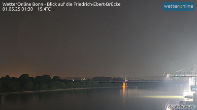
Webcams near Asberg

History around Asberg
- Treaty of Bonn921
- West Germany hosts the UEFA Euro 1988 football tournament, which is won by the Netherlands1988
- The 2017 United Nations Climate Change Conference in November in Bonn, Germany, was led by Fiji2017
- Battle of Kircheib1796
- Siege of Bonn in 16731673
- Killing of Niklas Pöhler2016
- Bonn Agreement2001
- Friedensdemonstration in Bonn 19821982
Towns near Asberg
- Bad Honnef5.2 km away
- Remagen7.2 km away
- Königswinter9.2 km away
- Sinzig9.8 km away
- Wachtberg14 km away
- Bad Neuenahr-Ahrweiler16 km away