Mountains in Germany
Drachenfels
321 m1,052 ft
Mountain · Siebengebirge · Germany
The Drachenfels is a hill in the Siebengebirge uplands between Königswinter and Bad Honnef in Germany. The hill was formed by rising magma that could not break through to the surface, and then cooled and became solid underneath. It is the subject of much tourism and romanticism in the North Rhine-Westphalia area.
From Wikipedia, CC BY-SA · Read the article
At the summit · forecast for 12:00 AM
11 °CPartly cloudy · wind 15 km/h from the S
 See it in 3D
Weather at the summit of Drachenfels, 321 m
- 12:00 AM11 °CS 15 km/h–
- 3:00 AM9 °CSE 12 km/h–
- 6:00 AM10 °CSE 14 km/h–
- 9:00 AM12 °CSE 16 km/h–
- 12:00 PM14 °CS 18 km/h–
- 3:00 PM15 °CS 17 km/h–
- 6:00 PM12 °CSE 14 km/h0.3 mm
- 9:00 PM12 °CSW 13 km/h1 mm
| Day | Sky | High / low | Rain | Wind up to |
|---|---|---|---|---|
| Tue, Oct 27 | Partly cloudy | 15 °C / 9 °C | 1.3 mm | 18 km/h |
| Wed, Oct 28 | Mostly clear | 12 °C / 5 °C | 0.1 mm | 13 km/h |
| Thu, Oct 29 | Mostly clear | 12 °C / 3 °C | – | 9 km/h |
| Fri, Oct 30 | Clear | 11 °C / 4 °C | – | 8 km/h |
| Sat, Oct 31 | Mostly clear | 10 °C / 3 °C | – | 9 km/h |
| Sun, Nov 1 | Cloudy | 9 °C / 4 °C | – | 10 km/h |
| Mon, Nov 2 | Partly cloudy | 10 °C / 6 °C | 2 mm | 13 km/h |
Forecast by MET Norway (CC BY 4.0), updated 08:16 PM GMT+1. Times are local.
Facts
- What it is
- Mountain
- Height above sea level
- 321 m (1,052 ft)
- Range
- Siebengebirge
- Country
- Germany
- Coordinates
- 50.665°N 7.210°E
- Source
- Wikidata, CC0
Peaks near Drachenfels
- Petersberg336 m · 2.3 km awayOn the map
- Rodderberg195 m · 2.7 km awayOn the map
- Großer Ölberg461 m · 3.3 km awayOn the map
- Himmerich367 m · 5.1 km awayOn the map
- Asberg430 m · 7.5 km awayOn the map
- Landskrone272 m · 13 km awayOn the map
- Häuschen507 m · 20 km awayOn the map
- Bausen-Berg340 m · 22 km awayOn the map
- Hochthürmerberg500 m · 26 km awayOn the map
- Veitskopf428 m · 26 km awayOn the map
Highest in the Siebengebirge
- Petersberg336 mOn the map
- Drachenfels321 mOn the map
Highest mountains in Germany
- Zugspitze2,962 mOn the map
- Hochwanner2,744 mOn the map
- Dreitorspitze2,682 mOn the map
- Hochkalter2,607 mOn the map
- Biberkopf2,599 mOn the map
- Großer Hundstod2,594 mOn the map
- Hochvogel2,592 mOn the map
- Östliche Karwendelspitze2,538 mOn the map
- Hocheisspitze2,523 mOn the map
- Hoher Göll2,522 mOn the map
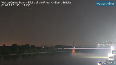
Webcams near Drachenfels

History around Drachenfels
- Treaty of Bonn921
- West Germany hosts the UEFA Euro 1988 football tournament, which is won by the Netherlands1988
- The 2017 United Nations Climate Change Conference in November in Bonn, Germany, was led by Fiji2017
- Battle of Kircheib1796
- Siege of Bonn in 16731673
- Killing of Niklas Pöhler2016
- Bonn Agreement2001
- Friedensdemonstration in Bonn 19821982
Towns near Drachenfels
- Königswinter1.8 km away
- Bad Honnef2.7 km away
- Wachtberg8.5 km away
- Remagen9.7 km away
- Bonn11 km away
- Sankt Augustin12 km away