Mountains in Ireland
Bencorr
711 m2,333 ft
Mountain · Twelve Bens · Ireland
Bencorr at 711 metres (2,333 ft), is the 82nd–highest peak in Ireland on the Arderin scale, and the 102nd–highest peak on the Vandeleur-Lynam scale. Bencorr is situated near the centre of the core massif of the Twelve Bens mountain range in the Connemara National Park in County Galway, Ireland.
From Wikipedia, CC BY-SA · Read the article
At the summit · forecast for 11:00 PM
6 °CLight rain · wind 41 km/h from the SW
 See it in 3D
Weather at the summit of Bencorr, 711 m
- 11:00 PM6 °CSW 41 km/h0.8 mm
- 2:00 AM5 °CSW 47 km/h3.9 mm
- 5:00 AM5 °CW 41 km/h0.9 mm
- 8:00 AM6 °CW 36 km/h1.5 mm
- 11:00 AM5 °CW 36 km/h1.8 mm
- 2:00 PM6 °CW 38 km/h0.9 mm
- 5:00 PM5 °CW 33 km/h2.3 mm
- 8:00 PM6 °CSW 35 km/h1.6 mm
| Day | Sky | High / low | Rain | Wind up to |
|---|---|---|---|---|
| Tue, Oct 27 | Light rain | 7 °C / 4 °C | 13.9 mm | 47 km/h |
| Wed, Oct 28 | Rain | 9 °C / 7 °C | 6.7 mm | 39 km/h |
| Thu, Oct 29 | Light rain | 9 °C / 7 °C | 8.8 mm | 35 km/h |
| Fri, Oct 30 | Clear | 9 °C / 4 °C | 3.1 mm | 23 km/h |
| Sat, Oct 31 | Mostly clear | 6 °C / 1 °C | 0.1 mm | 5 km/h |
| Sun, Nov 1 | Cloudy | 6 °C / 3 °C | – | 9 km/h |
| Mon, Nov 2 | Mostly clear | 5 °C / 1 °C | – | 16 km/h |
Forecast by MET Norway (CC BY 4.0), updated 07:16 PM GMT. Times are local.
Facts
- What it is
- Mountain
- Height above sea level
- 711 m (2,333 ft)
- Prominence
- 306 m (1,004 ft)
- Range
- Twelve Bens
- Country
- Ireland
- Coordinates
- 53.500°N 9.800°W
- Source
- Wikidata, CC0
Peaks near Bencorr
- Bencollaghduff696 m · 1.7 km awayOn the map
- Benbaun729 m · 3.1 km awayOn the map
- Letterbreckaun667 m · 6.2 km awayOn the map
- Knocknahillion607 m · 6.8 km awayOn the map
- Binn idir an dá Log702 m · 8.3 km awayOn the map
- Binn Chaonaigh633 m · 9.4 km awayOn the map
- Diamond Hill442 m · 9.5 km awayOn the map
- Leenaun Hill618 m · 10 km awayOn the map
- Binn Mhór661 m · 11 km awayOn the map
- Mullach Glas622 m · 13 km awayOn the map
Highest in the Twelve Bens
- Benbaun729 mOn the map
- Bencorr711 mOn the map
- Tully Mountain356 mOn the map
Highest mountains in Ireland
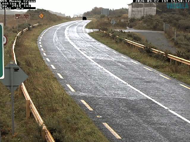
Webcams near Bencorr
History around Bencorr
Towns near Bencorr
- Galway56 km away