Mountains in Austria
See it in 3DHohe Pressing
2,370 m7,776 ft
Mountain · Northern Nock Mountains · Austria
At the summit · forecast for 2:00 AM
-7 °CClear · wind 3 km/h from the E
Weather at the summit of Hohe Pressing, 2,370 m
- 2:00 AM-7 °CE 3 km/h–
- 5:00 AM-7 °CNE 3 km/h–
- 8:00 AM-2 °CNE 3 km/h–
- 11:00 AM3 °CN 3 km/h–
- 2:00 PM4 °CNW 5 km/h–
- 5:00 PM-1 °CE 2 km/h–
- 8:00 PM-2 °CSE 2 km/h–
- 11:00 PM-2 °CNE 3 km/h–
| Day | Sky | High / low | Rain | Wind up to |
|---|---|---|---|---|
| Today | Clear | 4 °C / -7 °C | – | 5 km/h |
| Wed, Oct 28 | Cloudy | 4 °C / -4 °C | 0.5 mm | 12 km/h |
| Thu, Oct 29 | Partly cloudy | 1 °C / -6 °C | – | 10 km/h |
| Fri, Oct 30 | Clear | 3 °C / -7 °C | – | 7 km/h |
| Sat, Oct 31 | Mostly clear | 3 °C / -7 °C | – | 5 km/h |
| Sun, Nov 1 | Clear | 4 °C / -5 °C | – | 5 km/h |
| Mon, Nov 2 | Clear | 1 °C / -7 °C | – | 12 km/h |
Forecast by MET Norway (CC BY 4.0), updated 12:20 AM GMT+1. Times are local.
Facts
- What it is
- Mountain
- Height above sea level
- 2,370 m (7,776 ft)
- Range
- Northern Nock Mountains
- Country
- Austria
- Coordinates
- 46.938°N 13.692°E
- Source
- Wikidata, CC0
Peaks near Hohe Pressing
- Großer Rosennock2,440 m · 7 km awayOn the map
- Eisenhut2,441 m · 18 km awayOn the map
- Reißeck2,965 m · 25 km awayOn the map
- Grosser Hafner3,076 m · 27 km awayOn the map
- Goldeck2,142 m · 27 km awayOn the map
- Hochalmspitze3,360 m · 29 km awayOn the map
- Gerlitzen1,909 m · 32 km awayOn the map
- Weißeck2,711 m · 34 km awayOn the map
- Kasereck2,740 m · 34 km awayOn the map
- Preber2,740 m · 34 km awayOn the map
Highest in the Northern Nock Mountains
- Eisenhut2,441 mOn the map
- Großer Rosennock2,440 mOn the map
- Hohe Pressing2,370 mOn the map
- Rinsennock2,334 mOn the map
- Klomnock2,331 mOn the map
- Pfannnock2,254 mOn the map
- Schwarzwand2,214 mOn the map
- Schoberriegel2,208 mOn the map
Highest mountains in Austria
- Grossglockner3,798 mOn the map
- Wildspitze3,768 mOn the map
- Weißkugel3,738 mOn the map
- Großvenediger3,657 mOn the map
- Hintere Schwärze3,624 mOn the map
- Großes Wiesbachhorn3,564 mOn the map
- Ramolkogel3,549 mOn the map
- Schalfkogel3,537 mOn the map
- Watzespitze3,532 mOn the map
- Fineilspitze3,514 mOn the map
Webcams near Hohe Pressing
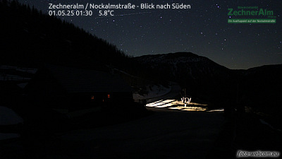 Zechneralm / Nockalmstraße - Blick nach Süden4.4 km from the summit
 Nockalmstraße - Eisentalhöhe5 km from the summit
A10, zwischen Rennweg-Katschberg und Raststation Eisentratten, Blickrichtung Villach - Km 119,706.2 km from the summit
A10, bei Pressingberg , Blickrichtung Villach - Km 122,806.4 km from the summit
Towns near Hohe Pressing
- Villach38 km away
- Klagenfurt am Wörthersee58 km away