Pfannnock
2,254 m7,395 ft
Mountain · Northern Nock Mountains · Austria
Der Pfannnock ist ein 2254 m ü. A. hoher Berg in den Nockbergen, einem Teil der Gurktaler Alpen in Kärnten. Er liegt vollständig in der Kernzone („Naturzone“) des Biosphärenparks Nockberge.
From German Wikipedia, CC BY-SA · Read the article
At the summit · forecast for 1:00 AM
-6 °CClear · wind 4 km/h from the E
 See it in 3D
Weather at the summit of Pfannnock, 2,254 m
- 1:00 AM-6 °CE 4 km/h–
- 4:00 AM-6 °CNE 3 km/h–
- 7:00 AM-2 °CNE 4 km/h–
- 10:00 AM3 °CNW 4 km/h–
- 1:00 PM5 °CNW 5 km/h–
- 4:00 PM2 °CN 3 km/h–
- 7:00 PM-1 °CE 1 km/h–
- 10:00 PM-2 °CSW 4 km/h–
| Day | Sky | High / low | Rain | Wind up to |
|---|---|---|---|---|
| Today | Clear | 5 °C / -6 °C | – | 5 km/h |
| Wed, Oct 28 | Cloudy | 4 °C / -3 °C | 0.5 mm | 13 km/h |
| Thu, Oct 29 | Cloudy | 1 °C / -5 °C | – | 11 km/h |
| Fri, Oct 30 | Clear | 3 °C / -6 °C | – | 5 km/h |
| Sat, Oct 31 | Mostly clear | 4 °C / -5 °C | – | 4 km/h |
| Sun, Nov 1 | Clear | 5 °C / -4 °C | – | 4 km/h |
| Mon, Nov 2 | Mostly clear | 1 °C / -6 °C | – | 13 km/h |
Forecast by MET Norway (CC BY 4.0), updated 12:19 AM GMT+1. Times are local.
Facts
- What it is
- Mountain
- Height above sea level
- 2,254 m (7,395 ft)
- Range
- Northern Nock Mountains
- Country
- Austria
- Coordinates
- 46.888°N 13.754°E
- Source
- Wikidata, CC0
Pfannnock
Berg in den Nockbergen in Kärnten
Der Pfannnock ist ein 2254 m ü. A. hoher Berg in den Nockbergen, einem Teil der Gurktaler Alpen in Kärnten. Er liegt vollständig in der Kernzone („Naturzone“) des Biosphärenparks Nockberge. Der geologisch komplexe Berg ist namensgebend für die Pfannock-Einheit, eine Besonderheit im Deckensystem der Nockberge bzw. der Alpen insgesamt.
From German Wikipedia, CC BY-SA · Read the article
Peaks near Pfannnock
- Großer Rosennock2,440 m · 3.4 km awayOn the map
- Rinsennock2,334 m · 7.7 km awayOn the map
- Eisenhut2,441 m · 15 km awayOn the map
- Gerlitzen1,909 m · 25 km awayOn the map
- Goldeck2,142 m · 27 km awayOn the map
- Reißeck2,965 m · 30 km awayOn the map
- Dobratsch2,166 m · 32 km awayOn the map
- Grosser Hafner3,076 m · 34 km awayOn the map
- Hochalmspitze3,360 m · 36 km awayOn the map
- Preber2,740 m · 38 km awayOn the map
Highest in the Northern Nock Mountains
- Eisenhut2,441 mOn the map
- Großer Rosennock2,440 mOn the map
- Hohe Pressing2,370 mOn the map
- Rinsennock2,334 mOn the map
- Klomnock2,331 mOn the map
- Pfannnock2,254 mOn the map
- Schwarzwand2,214 mOn the map
- Schoberriegel2,208 mOn the map
Highest mountains in Austria
- Grossglockner3,798 mOn the map
- Wildspitze3,768 mOn the map
- Weißkugel3,738 mOn the map
- Großvenediger3,657 mOn the map
- Hintere Schwärze3,624 mOn the map
- Großes Wiesbachhorn3,564 mOn the map
- Ramolkogel3,549 mOn the map
- Schalfkogel3,537 mOn the map
- Watzespitze3,532 mOn the map
- Fineilspitze3,514 mOn the map
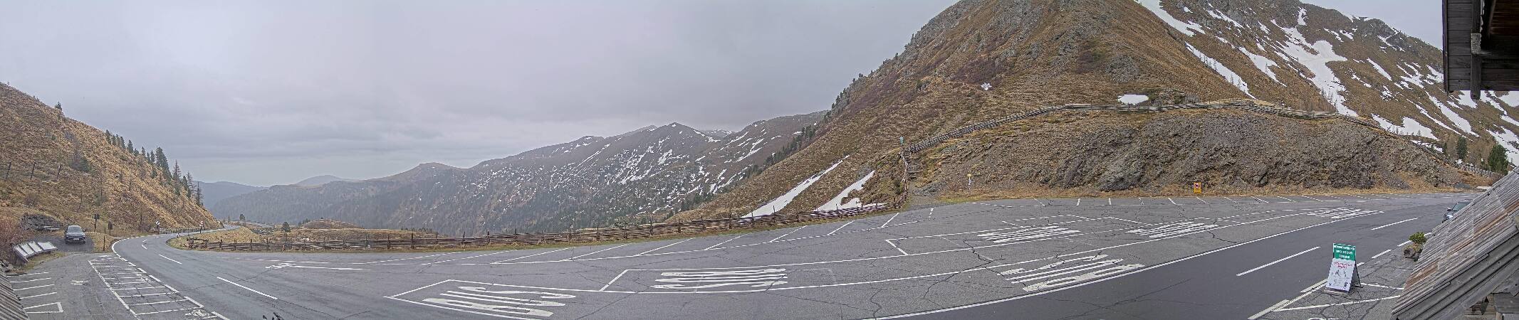
Webcams near Pfannnock
Towns near Pfannnock
- Villach32 km away
- Klagenfurt am Wörthersee51 km away