Mountains in Austria
Hoher Sonnblick
3,106 m10,190 ft
Mountain · Goldberg Group · Austria
The Hoher Sonnblick is a glaciated mountain, 3,106 m (AA) high, on the main Alpine chain in the Goldberg Group on the border between the Austrian states of Carinthia and Salzburg. At its summit is the Sonnblick Observatory and the Alpine refuge hut of Zittelhaus.
From Wikipedia, CC BY-SA · Read the article
At the summit · forecast for 12:00 PM
-3 °CCloudy · wind 9 km/h from the N
 See it in 3D
Weather at the summit of Hoher Sonnblick, 3,106 m
- 12:00 PM-3 °CN 9 km/h0.1 mm
- 3:00 PM-3 °CN 8 km/h2 mm
- 6:00 PM-5 °CN 7 km/h1.2 mm
- 9:00 PM-6 °CN 7 km/h0.3 mm
- 12:00 AM-7 °CN 9 km/h–
- 3:00 AM-8 °CN 9 km/h–
- 6:00 AM-9 °CN 8 km/h–
- 9:00 AM-8 °CNW 8 km/h–
| Day | Sky | High / low | Rain | Wind up to |
|---|---|---|---|---|
| Thu, Oct 29 | Cloudy | -6 °C / -11 °C | – | 9 km/h |
| Fri, Oct 30 | Mostly clear | -5 °C / -13 °C | – | 8 km/h |
| Sat, Oct 31 | Clear | -4 °C / -13 °C | 0.3 mm | 6 km/h |
| Sun, Nov 1 | Cloudy | -8 °C / -12 °C | 2.6 mm | 11 km/h |
| Mon, Nov 2 | Snow | -11 °C / -13 °C | 6.1 mm | 12 km/h |
| Tue, Nov 3 | Light snow | -10 °C / -12 °C | 4 mm | 12 km/h |
| Wed, Nov 4 | Partly cloudy | -8 °C / -15 °C | 0.2 mm | 10 km/h |
Forecast by MET Norway (CC BY 4.0), updated 10:22 AM GMT+1. Times are local.
Facts
- What it is
- Mountain
- Height above sea level
- 3,106 m (10,190 ft)
- Isolation
- 2.4 km to higher ground
- Range
- Goldberg Group
- Country
- Austria
- Coordinates
- 47.054°N 12.957°E
- Source
- Wikidata, CC0
Peaks near Hoher Sonnblick
- Hocharn3,254 m · 2.9 km awayOn the map
- Petzeck3,283 m · 17 km awayOn the map
- Großes Wiesbachhorn3,564 m · 19 km awayOn the map
- Grossglockner3,798 m · 20 km awayOn the map
- Glocknerwand3,721 m · 21 km awayOn the map
- Hoher Tenn3,368 m · 21 km awayOn the map
- Ankogel3,252 m · 22 km awayOn the map
- Johannisberg3,453 m · 22 km awayOn the map
- Kitzsteinhorn3,203 m · 25 km awayOn the map
- Hochalmspitze3,360 m · 28 km awayOn the map
Highest in the Goldberg Group
- Hocharn3,254 mOn the map
- Schareck3,123 mOn the map
- Hoher Sonnblick3,106 mOn the map
- Krumlkeeskopf3,101 mOn the map
- Sandkopf3,090 mOn the map
- Ritterkopf3,006 mOn the map
- Vorderer Geißlkopf2,974 mOn the map
- Alteck2,942 mOn the map
- Stellkopf2,852 mOn the map
Highest mountains in Austria
- Grossglockner3,798 mOn the map
- Wildspitze3,768 mOn the map
- Weißkugel3,738 mOn the map
- Großvenediger3,657 mOn the map
- Hintere Schwärze3,624 mOn the map
- Großes Wiesbachhorn3,564 mOn the map
- Ramolkogel3,549 mOn the map
- Schalfkogel3,537 mOn the map
- Watzespitze3,532 mOn the map
- Fineilspitze3,514 mOn the map
Webcams near Hoher Sonnblick
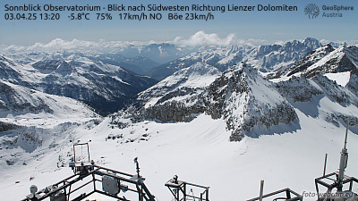 Sonnblick Observatorium - Blick nach Südwesten Richtung Lienzer Dolomiten0 km from the summit
 Goldbergkees - Blick nach Südosten0.6 km from the summit
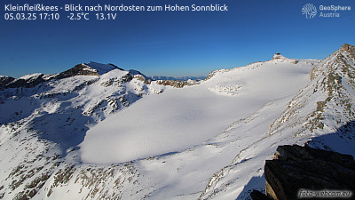 Kleinfleißkees - Blick nach Nordosten zum Hohen Sonnblick1.4 km from the summit
 Goldbergkees 2 / Blick nach Nordwesten zum Hohen Sonnblick1.9 km from the summit
History around Hoher Sonnblick
Towns near Hoher Sonnblick
- Saalfelden am Steinernen Meer42 km away
- Bad Reichenhall75 km away