Mountains in Germany
Jenner
1,874 m6,148 ft
Mountain · Göll · Germany
The Jenner is a mountain in Bavaria, Germany. It is part of the Göll massif within the Berchtesgaden Alps. Its summit, accessible from Schönau by cable car (Jennerbahn) since 1953, offers panoramic views to the Watzmann range and the Königssee below.
From Wikipedia, CC BY-SA · Read the article
At the summit · forecast for 12:00 AM
-2 °CClear · wind 6 km/h from the S
 See it in 3D
Weather at the summit of Jenner, 1,874 m
- 12:00 AM-2 °CS 6 km/h–
- 3:00 AM1 °CS 6 km/h–
- 6:00 AM3 °CSW 4 km/h–
- 9:00 AM6 °CS 5 km/h–
- 12:00 PM10 °CN 4 km/h–
- 3:00 PM10 °CNE 4 km/h–
- 6:00 PM4 °CS 3 km/h–
- 9:00 PM2 °CS 5 km/h–
| Day | Sky | High / low | Rain | Wind up to |
|---|---|---|---|---|
| Tue, Oct 27 | Clear | 10 °C / -2 °C | – | 6 km/h |
| Wed, Oct 28 | Heavy rain | 7 °C / 1 °C | 11.5 mm | 9 km/h |
| Thu, Oct 29 | Partly cloudy | 3 °C / -2 °C | 0.3 mm | 6 km/h |
| Fri, Oct 30 | Clear | 5 °C / -2 °C | – | 5 km/h |
| Sat, Oct 31 | Mostly clear | 3 °C / -2 °C | – | 6 km/h |
| Sun, Nov 1 | Mostly clear | 2 °C / -5 °C | – | 6 km/h |
| Mon, Nov 2 | Cloudy | -1 °C / -4 °C | – | 4 km/h |
Forecast by MET Norway (CC BY 4.0), updated 08:17 PM GMT+1. Times are local.
Facts
- What it is
- Mountain
- Height above sea level
- 1,874 m (6,148 ft)
- Isolation
- 1.6 km to higher ground
- Range
- Göll
- Country
- Germany
- Coordinates
- 47.576°N 13.021°E
- Source
- Wikidata, CC0
Peaks near Jenner
- Hoher Göll2,522 m · 4 km awayOn the map
- Hochkalter2,607 m · 12 km awayOn the map
- Grießkogel2,543 m · 12 km awayOn the map
- Großer Hundstod2,594 m · 12 km awayOn the map
- Berchtesgadener Hochthron1,972 m · 13 km awayOn the map
- Schönfeldspitze2,653 m · 14 km awayOn the map
- Schottmalhorn1,982 m · 15 km awayOn the map
- Karkopf1,738 m · 16 km awayOn the map
- Breithorn2,504 m · 16 km awayOn the map
- Persailhorn2,347 m · 16 km awayOn the map
Highest in the Göll
- Hoher Göll2,522 mOn the map
- Hinteres Freieck2,308 mOn the map
- Kehlstein1,881 mOn the map
- Jenner1,874 mOn the map
Highest mountains in Germany
- Zugspitze2,962 mOn the map
- Hochwanner2,744 mOn the map
- Dreitorspitze2,682 mOn the map
- Hochkalter2,607 mOn the map
- Biberkopf2,599 mOn the map
- Großer Hundstod2,594 mOn the map
- Hochvogel2,592 mOn the map
- Östliche Karwendelspitze2,538 mOn the map
- Hocheisspitze2,523 mOn the map
- Hoher Göll2,522 mOn the map
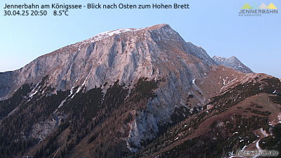
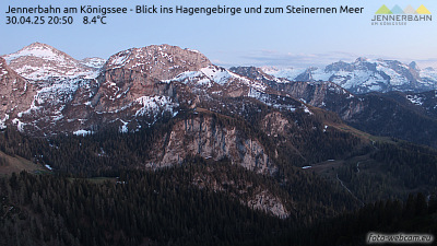
Webcams near Jenner


History around Jenner
Towns near Jenner
- Bad Reichenhall20 km away
- Saalfelden am Steinernen Meer21 km away
- Salzburg25 km away
- Freilassing30 km away
- Traunstein43 km away
- Traunreut54 km away