Kehlstein
1,881 m6,171 ft
Mountain · Göll · Germany
The Kehlstein is a 1,881 m (6,171 ft) subpeak of the Göll massif, a 2,522 m (8,274 ft) mountain in the Berchtesgaden Alps. The rocky promontory is located west of the Hoher Göll main summit, high above the Obersalzberg mountain retreat near Berchtesgaden.
From Wikipedia, CC BY-SA · Read the article
At the summit · forecast for 4:00 AM
0 °CCloudy · wind 10 km/h from the S
 See it in 3D
Weather at the summit of Kehlstein, 1,881 m
- 4:00 AM0 °CS 10 km/h–
- 7:00 AM2 °CS 8 km/h–
- 10:00 AM6 °CSE 8 km/h–
- 1:00 PM10 °CNE 5 km/h–
- 4:00 PM8 °CNE 3 km/h–
- 7:00 PM2 °CS 6 km/h–
- 10:00 PM2 °CS 6 km/h–
- 1:00 AM3 °CSW 3 km/h–
| Day | Sky | High / low | Rain | Wind up to |
|---|---|---|---|---|
| Today | Clear | 10 °C / 0 °C | – | 10 km/h |
| Wed, Oct 28 | Rain | 7 °C / 0 °C | 9.8 mm | 12 km/h |
| Thu, Oct 29 | Cloudy | 3 °C / -2 °C | 0.2 mm | 5 km/h |
| Fri, Oct 30 | Clear | 4 °C / -4 °C | – | 6 km/h |
| Sat, Oct 31 | Clear | 6 °C / -3 °C | – | 6 km/h |
| Sun, Nov 1 | Clear | 7 °C / -2 °C | – | 5 km/h |
| Mon, Nov 2 | Mostly clear | 3 °C / -4 °C | – | 5 km/h |
Forecast by MET Norway (CC BY 4.0), updated 12:19 AM GMT+1. Times are local.
Facts
- What it is
- Mountain
- Height above sea level
- 1,881 m (6,171 ft)
- Range
- Göll
- Country
- Germany
- Coordinates
- 47.610°N 13.046°E
- Source
- Wikidata, CC0
Kehlstein
Mountain in the Berchtesgaden Alps, near the Austrian-German border
The Kehlstein is a 1,881 m (6,171 ft) subpeak of the Göll massif, a 2,522 m (8,274 ft) mountain in the Berchtesgaden Alps. The rocky promontory is located west of the Hoher Göll main summit, high above the Obersalzberg mountain retreat near Berchtesgaden. It is chiefly known for the Kehlsteinhaus mountain inn built in 1937–1938, which today is a major tourist destination.
From Wikipedia, CC BY-SA · Read the article
Peaks near Kehlstein
- Hoher Göll2,522 m · 2.3 km awayOn the map
- Berchtesgadener Hochthron1,972 m · 10 km awayOn the map
- Hochkalter2,607 m · 14 km awayOn the map
- Karkopf1,738 m · 14 km awayOn the map
- Grießkogel2,543 m · 16 km awayOn the map
- Großer Hundstod2,594 m · 16 km awayOn the map
- Schottmalhorn1,982 m · 16 km awayOn the map
- Raucheck2,430 m · 18 km awayOn the map
- Schönfeldspitze2,653 m · 19 km awayOn the map
- Stadelhorn2,286 m · 19 km awayOn the map
Highest in the Göll
- Hoher Göll2,522 mOn the map
- Hinteres Freieck2,308 mOn the map
- Kehlstein1,881 mOn the map
- Jenner1,874 mOn the map
Highest mountains in Germany
- Zugspitze2,962 mOn the map
- Hochwanner2,744 mOn the map
- Dreitorspitze2,682 mOn the map
- Hochkalter2,607 mOn the map
- Biberkopf2,599 mOn the map
- Großer Hundstod2,594 mOn the map
- Hochvogel2,592 mOn the map
- Östliche Karwendelspitze2,538 mOn the map
- Hocheisspitze2,523 mOn the map
- Hoher Göll2,522 mOn the map
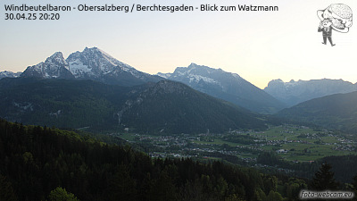
Webcams near Kehlstein



History around Kehlstein
Towns near Kehlstein
- Bad Reichenhall18 km away
- Salzburg21 km away
- Saalfelden am Steinernen Meer25 km away
- Freilassing26 km away
- Traunstein42 km away
- Traunreut52 km away