Kehlstein
1881 m6171 ft
Montaña · Göll · Alemania
The Kehlstein is a 1,881 m (6,171 ft) subpeak of the Göll massif, a 2,522 m (8,274 ft) mountain in the Berchtesgaden Alps. The rocky promontory is located west of the Hoher Göll main summit, high above the Obersalzberg mountain retreat near Berchtesgaden.
De Wikipedia, CC BY-SA · Leer el artículo
En la cumbre · pronóstico para las 2:00
-1 °CDespejado · viento de 10 km/h del S
 Verla en 3D
Clima en la cumbre de Kehlstein, 1881 m
- 2:00-1 °CS 10 km/h–
- 5:002 °CS 9 km/h–
- 8:003 °CS 8 km/h–
- 11:008 °CE 5 km/h–
- 14:0010 °CNE 5 km/h–
- 17:005 °CSO 1 km/h–
- 20:002 °CS 8 km/h–
- 23:002 °CS 5 km/h–
| Día | Cielo | Máx. / mín. | Lluvia | Viento hasta |
|---|---|---|---|---|
| Hoy | Despejado | 10 °C / -1 °C | – | 10 km/h |
| mié, 28 oct | Lluvia | 7 °C / 0 °C | 9,8 mm | 12 km/h |
| jue, 29 oct | Nublado | 3 °C / -2 °C | 0,2 mm | 5 km/h |
| vie, 30 oct | Despejado | 4 °C / -4 °C | – | 6 km/h |
| sáb, 31 oct | Despejado | 6 °C / -3 °C | – | 6 km/h |
| dom, 1 nov | Despejado | 7 °C / -2 °C | – | 5 km/h |
| lun, 2 nov | Mayormente despejado | 3 °C / -4 °C | – | 5 km/h |
Pronóstico de MET Norway (CC BY 4.0), actualizado a las 00:20 CET. Horas locales.
Ficha técnica
- Tipo
- Montaña
- Altitud sobre el nivel del mar
- 1881 m (6171 ft)
- Cordillera
- Göll
- País
- Alemania
- Coordenadas
- 47.610°N 13.046°E
- Fuente
- Wikidata, CC0
Kehlstein
Mountain in the Berchtesgaden Alps, near the Austrian-German border
The Kehlstein is a 1,881 m (6,171 ft) subpeak of the Göll massif, a 2,522 m (8,274 ft) mountain in the Berchtesgaden Alps. The rocky promontory is located west of the Hoher Göll main summit, high above the Obersalzberg mountain retreat near Berchtesgaden. It is chiefly known for the Kehlsteinhaus mountain inn built in 1937–1938, which today is a major tourist destination.
De Wikipedia, CC BY-SA · Leer el artículo
Picos cerca de Kehlstein
- Hoher Göll2522 m · a 2,3 kmEn el mapa
- Berchtesgadener Hochthron1972 m · a 10 kmEn el mapa
- Hochkalter2607 m · a 14 kmEn el mapa
- Karkopf1738 m · a 14 kmEn el mapa
- Grießkogel2543 m · a 16 kmEn el mapa
- Großer Hundstod2594 m · a 16 kmEn el mapa
- Schottmalhorn1982 m · a 16 kmEn el mapa
- Raucheck2430 m · a 18 kmEn el mapa
- Schönfeldspitze2653 m · a 19 kmEn el mapa
- Stadelhorn2286 m · a 19 kmEn el mapa
Los más altos de Göll
- Hoher Göll2522 mEn el mapa
- Hinteres Freieck2308 mEn el mapa
- Kehlstein1881 mEn el mapa
- Jenner1874 mEn el mapa
Montañas más altas de Alemania
- Zugspitze2962 mEn el mapa
- Hochwanner2744 mEn el mapa
- Dreitorspitze2682 mEn el mapa
- Hochkalter2607 mEn el mapa
- Biberkopf2599 mEn el mapa
- Großer Hundstod2594 mEn el mapa
- Hochvogel2592 mEn el mapa
- Östliche Karwendelspitze2538 mEn el mapa
- Hocheisspitze2523 mEn el mapa
- Hoher Göll2522 mEn el mapa
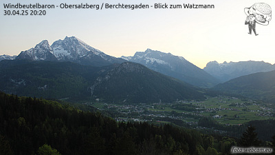
Cámaras web cerca de Kehlstein



Historia alrededor de Kehlstein
Ciudades cerca de Kehlstein
- Bad Reichenhalla 18 km
- Salzburga 21 km
- Saalfelden am Steinernen Meera 25 km
- Freilassinga 26 km
- Traunsteina 42 km
- Traunreuta 52 km