Mountains in Austria
See it in 3DKogelberg
533 m1,749 ft
Hill · Eastern Graz Highlands · Austria
At the summit · forecast for 12:00 AM
2 °CClear · wind 8 km/h from the N
Weather at the summit of Kogelberg, 533 m
- 12:00 AM2 °CN 8 km/h–
- 3:00 AM1 °CN 10 km/h–
- 6:00 AM1 °CN 12 km/h–
- 9:00 AM7 °CNE 6 km/h–
- 12:00 PM11 °CS 6 km/h–
- 3:00 PM11 °CSE 8 km/h–
- 6:00 PM7 °CE 4 km/h–
- 9:00 PM5 °CN 3 km/h–
| Day | Sky | High / low | Rain | Wind up to |
|---|---|---|---|---|
| Tue, Oct 27 | Clear | 12 °C / 1 °C | – | 13 km/h |
| Wed, Oct 28 | Cloudy | 13 °C / 2 °C | – | 14 km/h |
| Thu, Oct 29 | Partly cloudy | 13 °C / 7 °C | – | 16 km/h |
| Fri, Oct 30 | Clear | 13 °C / 3 °C | – | 8 km/h |
| Sat, Oct 31 | Partly cloudy | 10 °C / 2 °C | – | 14 km/h |
| Sun, Nov 1 | Partly cloudy | 10 °C / 3 °C | – | 10 km/h |
| Mon, Nov 2 | Clear | 11 °C / 1 °C | – | 11 km/h |
Forecast by MET Norway (CC BY 4.0), updated 08:16 PM GMT+1. Times are local.
Facts
- What it is
- Hill
- Height above sea level
- 533 m (1,749 ft)
- Range
- Eastern Graz Highlands
- Country
- Austria
- Coordinates
- 47.108°N 15.480°E
- Source
- Wikidata, CC0
Peaks near Kogelberg
- Platte651 m · 1 km awayOn the map
- Lineckberg702 m · 2.2 km awayOn the map
- Hauenstein650 m · 2.3 km awayOn the map
- Fuchsriegel501 m · 2.6 km awayOn the map
- Reinerkogel500 m · 3.8 km awayOn the map
- Schlossberg474 m · 4.8 km awayOn the map
- Admonter Kogel566 m · 6.3 km awayOn the map
- Hubertushöhe562 m · 6.7 km awayOn the map
- Hohenberg1,048 m · 6.7 km awayOn the map
- Göstinger Ruinenberg696 m · 7.2 km awayOn the map
Highest in the Eastern Graz Highlands
- Hochlantsch1,720 mOn the map
- Osser1,548 mOn the map
- Plankogel1,531 mOn the map
- Rote Wand1,505 mOn the map
- Schöckl1,445 mOn the map
- Pommesberg1,287 mOn the map
- Zetz1,274 mOn the map
- Patschaberg1,271 mOn the map
- Kogelberg533 mOn the map
Highest mountains in Austria
- Grossglockner3,798 mOn the map
- Wildspitze3,768 mOn the map
- Weißkugel3,738 mOn the map
- Großvenediger3,657 mOn the map
- Hintere Schwärze3,624 mOn the map
- Großes Wiesbachhorn3,564 mOn the map
- Ramolkogel3,549 mOn the map
- Schalfkogel3,537 mOn the map
- Watzespitze3,532 mOn the map
- Fineilspitze3,514 mOn the map
Webcams near Kogelberg
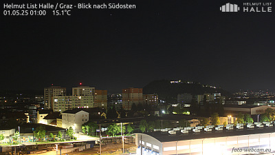 Helmut List Halle / Graz - Blick nach Südosten6 km from the summit
A02, bei Laßnitzhöhe, Blickrichtung Graz - Km 172,287.8 km from the summit
A02, bei Laßnitzhöhe, Blickrichtung Wien - Km 172,287.8 km from the summit
A02, zwischen Rastplatz Laßnitzhöhe Süd und Graz Ost, Blickrichtung Wien - Km 175,828 km from the summit
History around Kogelberg
Towns near Kogelberg
- Graz5.4 km away
- Wolfsberg57 km away
- Eisenzicken62 km away
- Maribor63 km away