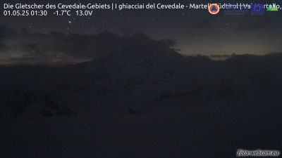
Madritschspitze
3,265 m10,712 ft
Mountain · Ortler Alps · Italy
Die Madritschspitze ist ein 3265 m hoher Berg in den Laaser Bergen der Ortler-Alpen in Südtirol. Sie erhebt sich zwischen dem vom inneren Martelltal abzweigenden Madritschtal und dem Suldental.
From German Wikipedia, CC BY-SA · Read the article
At the summit · forecast for 10:00 PM
-2 °CPartly cloudy · wind 4 km/h from the W
 See it in 3D
Weather at the summit of Madritschspitze, 3,265 m
- 10:00 PM-2 °CW 4 km/h–
- 1:00 AM-3 °CW 4 km/h–
- 4:00 AM-3 °CW 4 km/h–
- 7:00 AM-4 °CW 4 km/h0.1 mm
- 10:00 AM-2 °CNW 5 km/h–
- 1:00 PM0 °CN 7 km/h–
- 4:00 PM-0 °CN 8 km/h–
- 7:00 PM-5 °CNW 3 km/h–
| Day | Sky | High / low | Rain | Wind up to |
|---|---|---|---|---|
| Wed, Oct 28 | Clear | 0 °C / -6 °C | 0.1 mm | 8 km/h |
| Thu, Oct 29 | Clear | 0 °C / -8 °C | – | 7 km/h |
| Fri, Oct 30 | Clear | -2 °C / -8 °C | – | 6 km/h |
| Sat, Oct 31 | Clear | -1 °C / -9 °C | – | 4 km/h |
| Sun, Nov 1 | Clear | 0 °C / -8 °C | – | 7 km/h |
| Mon, Nov 2 | Clear | -3 °C / -9 °C | – | 11 km/h |
| Tue, Nov 3 | Partly cloudy | -4 °C / -13 °C | 0.1 mm | 9 km/h |
Forecast by MET Norway (CC BY 4.0), updated 08:17 PM GMT+1. Times are local.
Facts
- What it is
- Mountain
- Height above sea level
- 3,265 m (10,712 ft)
- Range
- Ortler Alps
- Country
- Italy
- Coordinates
- 46.492°N 10.629°E
- Source
- Wikidata, CC0
Madritschspitze
Berggipfel in Italien
Die Madritschspitze ist ein 3265 m hoher Berg in den Laaser Bergen der Ortler-Alpen in Südtirol. Sie erhebt sich zwischen dem vom inneren Martelltal abzweigenden Madritschtal und dem Suldental. Die nächstgelegenen Gipfel im weiteren Kammverlauf sind im Norden die Hintere Schöntaufspitze und im Südwesten die Butzenspitze. Die Madritschspitze ist Teil des Nationalparks Stilfserjoch.
From German Wikipedia, CC BY-SA · Read the article
Peaks near Madritschspitze
- Monte Cevedale3,769 m · 4.9 km awayOn the map
- Königspitze3,851 m · 4.9 km awayOn the map
- Ortler3,905 m · 6.7 km awayOn the map
- Thurwieserspitze3,652 m · 8 km awayOn the map
- Trafoier Eiswand3,565 m · 8.9 km awayOn the map
- Hohe Schneide3,434 m · 13 km awayOn the map
- Piz da las Trais Linguas2,843 m · 14 km awayOn the map
- Piz Chavalatsch2,763 m · 17 km awayOn the map
- Saldurspitze3,433 m · 29 km awayOn the map
- Piz Sesvenna3,204 m · 29 km awayOn the map
Highest in the Ortler Alps
- Ortler3,905 mOn the map
- Königspitze3,851 mOn the map
- Monte Cevedale3,769 mOn the map
- Punta San Matteo3,678 mOn the map
- Thurwieserspitze3,652 mOn the map
- Vertainspitze3,545 mOn the map
- Hintere Eggenspitze3,443 mOn the map
- Veneziaspitze3,386 mOn the map
- Madritschspitze3,265 mOn the map
Highest mountains in Italy
- Mont Blanc4,806 mOn the map
- Lyskamm4,532 mOn the map
- Matterhorn4,478 mOn the map
- Pointe Walker4,208 mOn the map
- Grandes Jorasses4,208 mOn the map
- Dent d'Hérens4,173 mOn the map
- Breithorn4,160 mOn the map
- Madritschspitze3,265 mOn the map